MyTopo
Bingham Canyon Utah US Topo Map
Couldn't load pickup availability
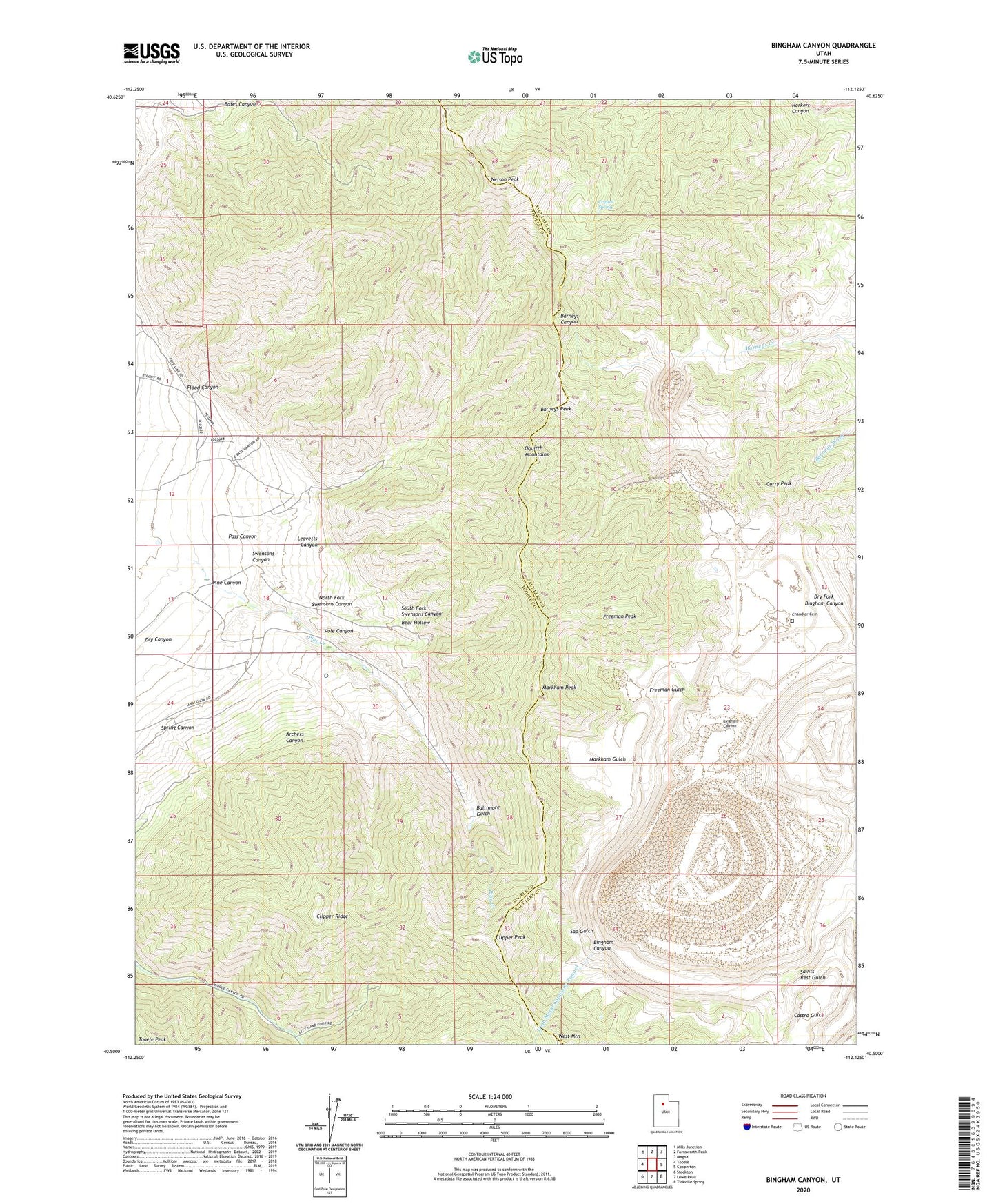
2020 topographic map quadrangle Bingham Canyon in the state of Utah. Scale: 1:24000. Based on the newly updated USGS 7.5' US Topo map series, this map is in the following counties: Tooele, Salt Lake. The map contains contour data, water features, and other items you are used to seeing on USGS maps, but also has updated roads and other features. This is the next generation of topographic maps. Printed on high-quality waterproof paper with UV fade-resistant inks.
Quads adjacent to this one:
West: Tooele
Northwest: Mills Junction
North: Farnsworth Peak
Northeast: Magna
East: Copperton
Southeast: Tickville Spring
South: Lowe Peak
Southwest: Stockton
Contains the following named places: Anaconda Reservoir, Anaconda Tailing Dam, Apex Shaft, Apex Tunnel, Archers Canyon, Armstrong Tunnel, Baltimore Gulch, Barneys Peak, Bear Hollow, Bingham Canyon, Bingham Copper Mine, Bingham West Dip Tunnel, Chandler Cemetery, Clipper Peak, Clipper Ridge, Crystal Spring, Curry Peak, Dry Canyon, Dry Fork Bingham Canyon, Flood Canyon, Freeman Gulch, Freeman Peak, Highland Tunnel, International, KALL-FM (Salt Lake City), KBYU-FM (Provo), KBYU-TV (Provo), KCPX-FM (Salt Lake City), KTVX-TV (Salt Lake City), KUED-TV (Salt Lake City), KUER-FM (Salt Lake City), KUTV-TV (Salt Lake City), Leavetts Canyon, Markham Gulch, Markham Peak, Nelson Peak, North Fork Swensons Canyon, Oquirrh Mountains, Pass Canyon, Pine Canyon, Pine Creek, Pole Canyon, Sap Gulch, South Fork Swensons Canyon, Spring Canyon, Swensons Canyon, Utah Metal Company Tunnel, West Mountain