MyTopo
Mills Junction Utah US Topo Map
Couldn't load pickup availability
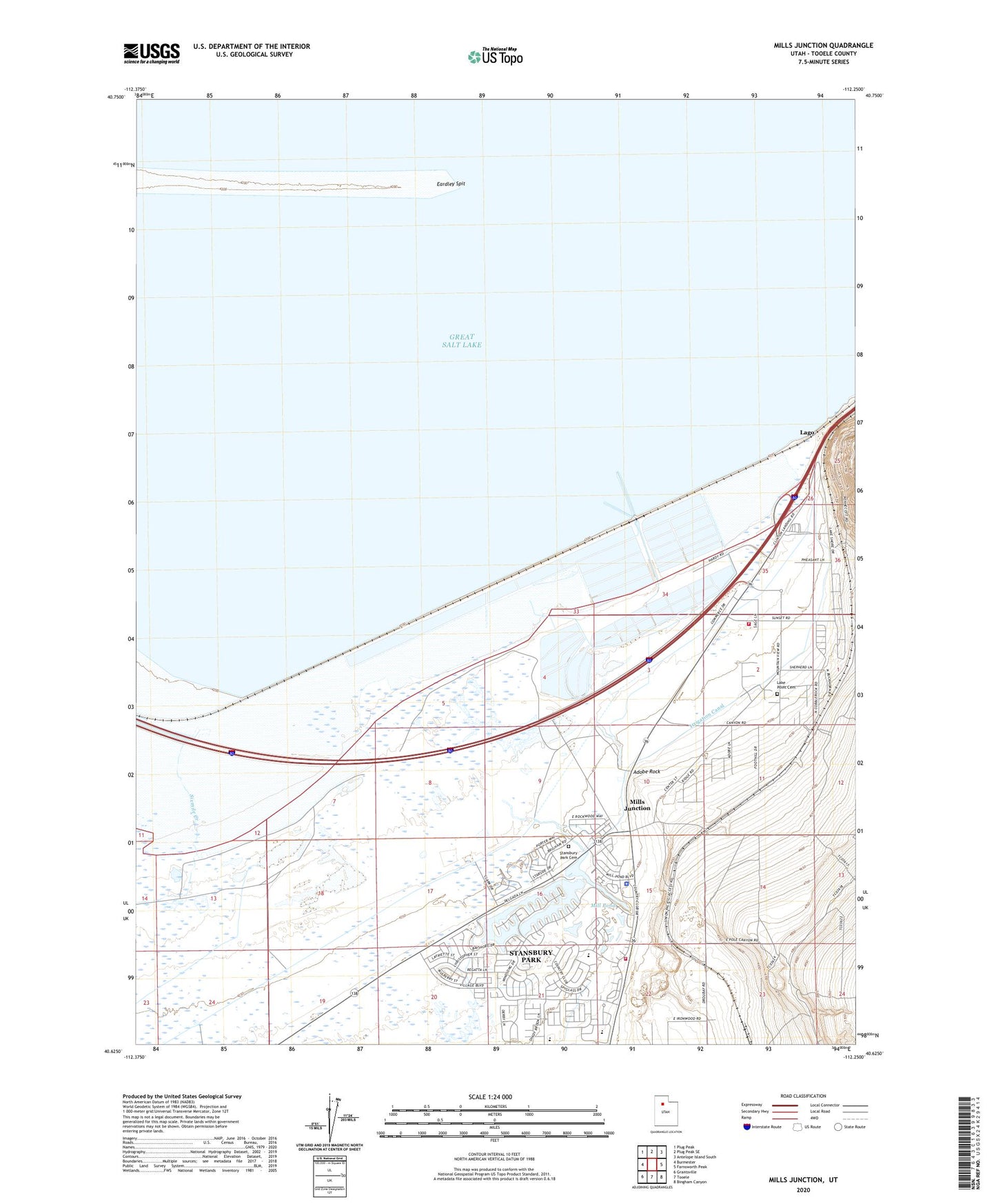
2023 topographic map quadrangle Mills Junction in the state of Utah. Scale: 1:24000. Based on the newly updated USGS 7.5' US Topo map series, this map is in the following counties: Tooele. The map contains contour data, water features, and other items you are used to seeing on USGS maps, but also has updated roads and other features. This is the next generation of topographic maps. Printed on high-quality waterproof paper with UV fade-resistant inks.
Quads adjacent to this one:
West: Burmester
Northwest: Plug Peak
North: Plug Peak SE
Northeast: Antelope Island South
East: Farnsworth Peak
Southeast: Bingham Canyon
South: Tooele
Southwest: Grantsville
This map covers the same area as the classic USGS quad with code o40112f3.
Contains the following named places: Adobe Rock, Eardley Spit, Irrigation Canal, Lago, Lake Point, Lake Point Cemetery, Mill Pond, Mill Pond Farm, Mills Junction, Mountain West Ambulance Stansbury Park, North Tooele County Fire Service District - Lake Point Station, North Tooele County Fire Service District - Stansbury Station, Sixmile Creek, Stansbury High School, Stansbury Lake, Stansbury park, Stansbury Park Cemetery, Stansbury Park Census Designated Place, The Church of Jesus Christ of Latter Day Saints