MyTopo
Lowe Peak Utah US Topo Map
Couldn't load pickup availability
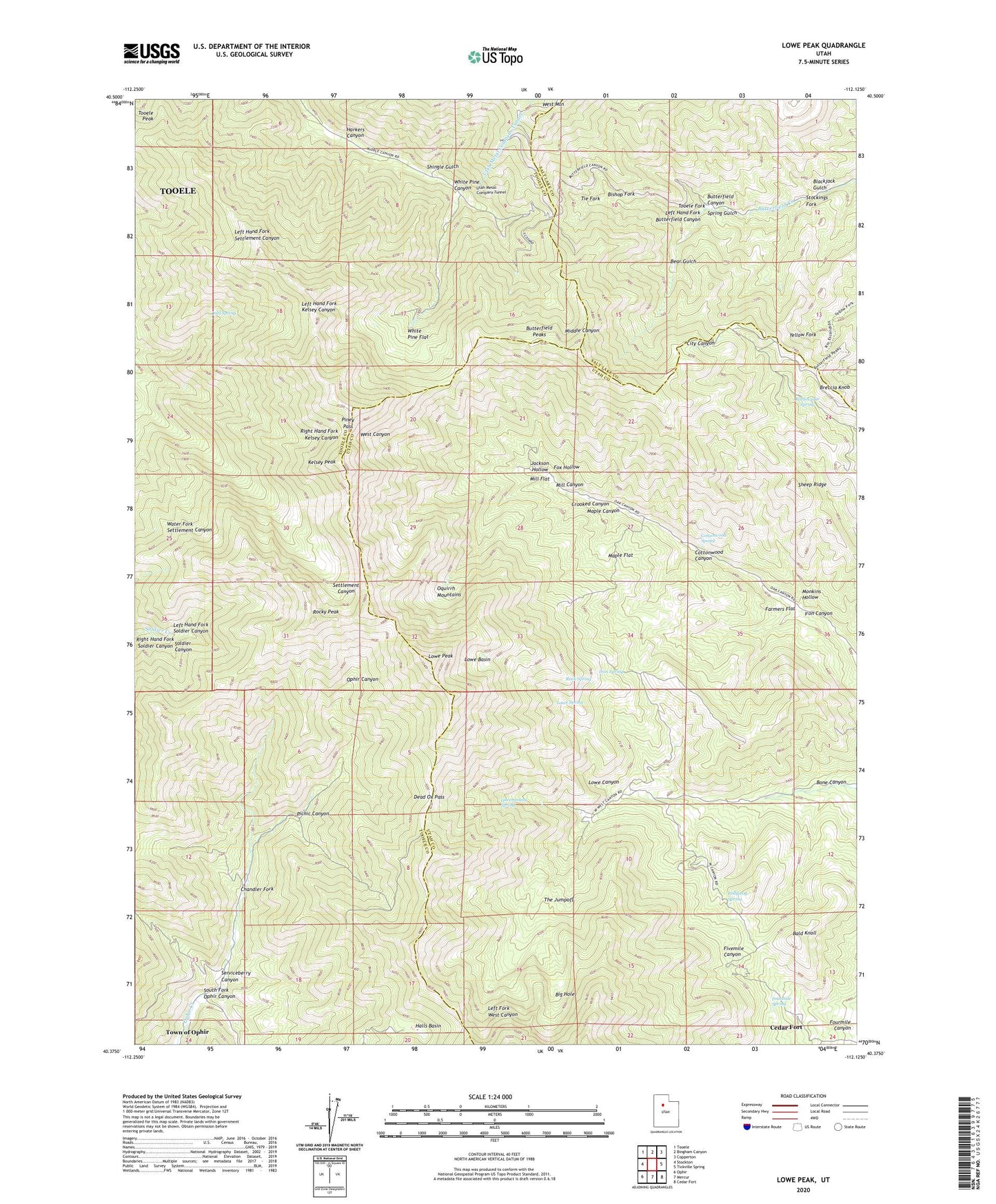
2023 topographic map quadrangle Lowe Peak in the state of Utah. Scale: 1:24000. Based on the newly updated USGS 7.5' US Topo map series, this map is in the following counties: Tooele, Utah, Salt Lake. The map contains contour data, water features, and other items you are used to seeing on USGS maps, but also has updated roads and other features. This is the next generation of topographic maps. Printed on high-quality waterproof paper with UV fade-resistant inks.
Quads adjacent to this one:
West: Stockton
Northwest: Tooele
North: Bingham Canyon
Northeast: Copperton
East: Tickville Spring
Southeast: Cedar Fort
South: Mercur
Southwest: Ophir
This map covers the same area as the classic USGS quad with code o40112d2.
Contains the following named places: Bald Knoll, Bear Gulch, Big Hole, Bishop Fork, Blackjack Gulch, Bone Canyon, Breccia Knob, Butterfield Peaks, Chandler Fork, Cold Spring, Cottonwood Canyon, Cottonwood Spring, Crooked Canyon, Dead Ox Pass, Farmers Flat, Fourmile Spring, Fox Hollow, Government Spring, Halls Basin, Harkers Canyon, Iron Canyon, Iron Spring, Jackson Hollow, Kelsey Peak, Left Hand Fork Butterfield Canyon, Left Hand Fork Soldier Canyon, Lowe Basin, Lowe Canyon, Lowe Peak, Lowe Spring, Maple Canyon, Maple Flat, Mill Canyon, Mill Flat, Monkins Hollow, Oak Grove, Old Mayflower Mine, Picnic Canyon, Piney Pass, Pollywog Spring, Queen Mine, Rattlesnake Spring, Right Hand Fork Soldier Canyon, Rock Spring, Rocky Peak, Serviceberry Canyon, Sheep Ridge, Shingle Gulch, South Fork Ophir Canyon, South Fork Ophir Creek, Spring Gulch, Stockings Fork, The Jumpoff, Tie Fork, Tooele Fork, White Pine Canyon, White Pine Flat