MyTopo
Bluff Utah US Topo Map
Couldn't load pickup availability
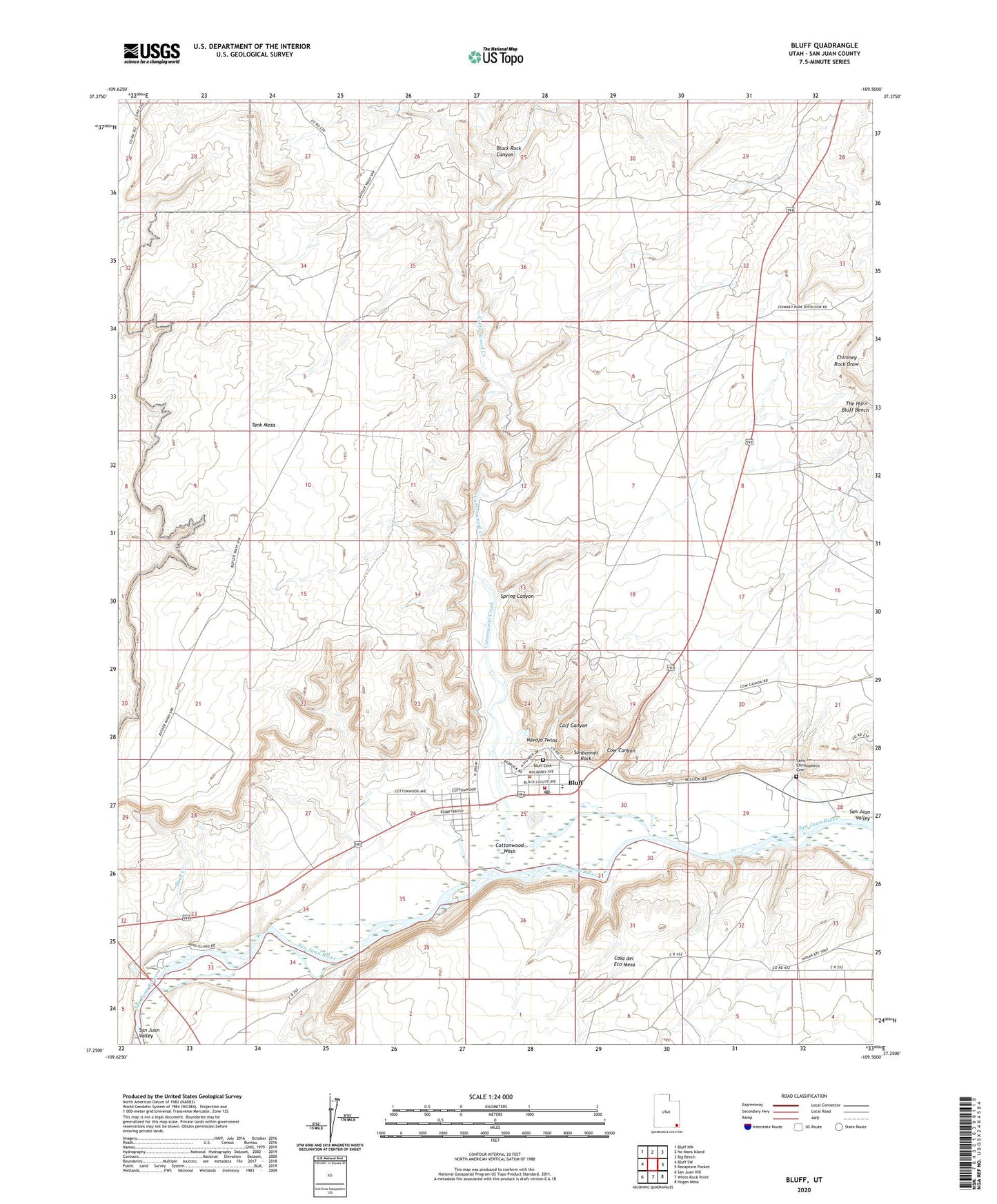
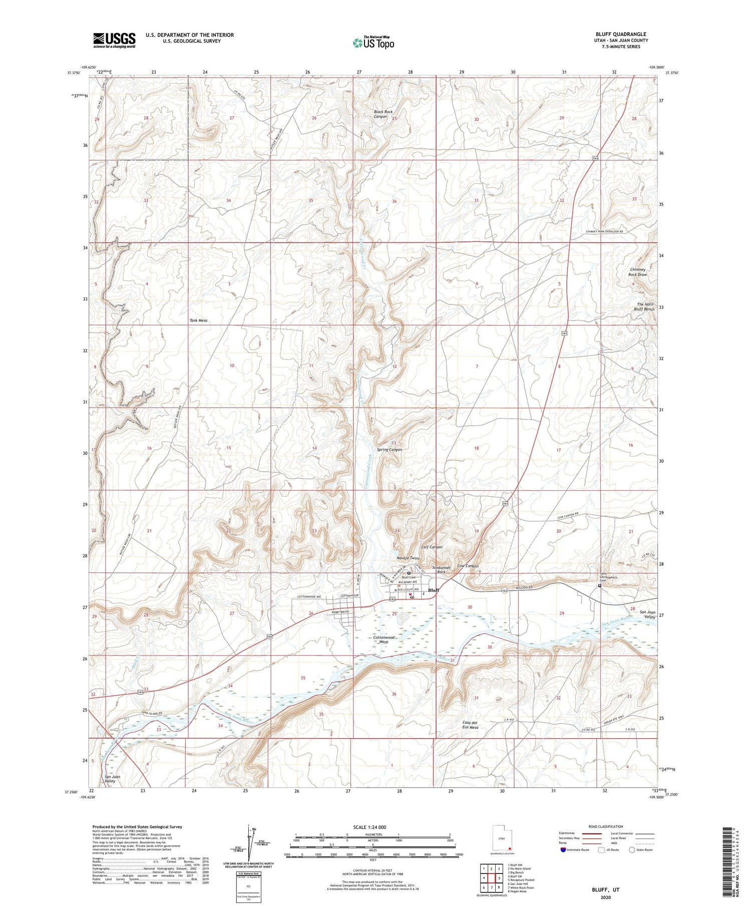
2020 topographic map quadrangle Bluff in the state of Utah. Scale: 1:24000. Based on the newly updated USGS 7.5' US Topo map series, this map is in the following counties: San Juan. The map contains contour data, water features, and other items you are used to seeing on USGS maps, but also has updated roads and other features. This is the next generation of topographic maps. Printed on high-quality waterproof paper with UV fade-resistant inks.
Quads adjacent to this one:
West: Bluff SW
Northwest: Bluff NW
North: No-Mans Island
Northeast: Big Bench
East: Recapture Pocket
Southeast: Hogan Mesa
South: White Rock Point
Southwest: San Juan Hill
Contains the following named places: Black Rock Canyon, Bluff, Bluff Bench, Bluff Cemetery, Bluff Census Designated Place, Bluff Elementary School, Bluff Post Office, Buck Creek, Calf Canyon, Cottonwood Wash, Cow Canyon, Hobbs Wash Historical Marker, Navajo Twins, Saint Christopher's Cemetery, Saint Christophers Mission, San Juan County Emergency Medical Services - Bluff, San Juan Fire Department - Bluff Station, Sand Island, Sand Island Boat Launch, Sand Island Campground, Spring Canyon, Sunbonnet Rock, Tank Mesa, Tank Point Well, The Church of Jesus Christ of Latter Day Saints, Town of Bluff, Turquoise RV Park