MyTopo
Recapture Pocket Utah US Topo Map
Couldn't load pickup availability
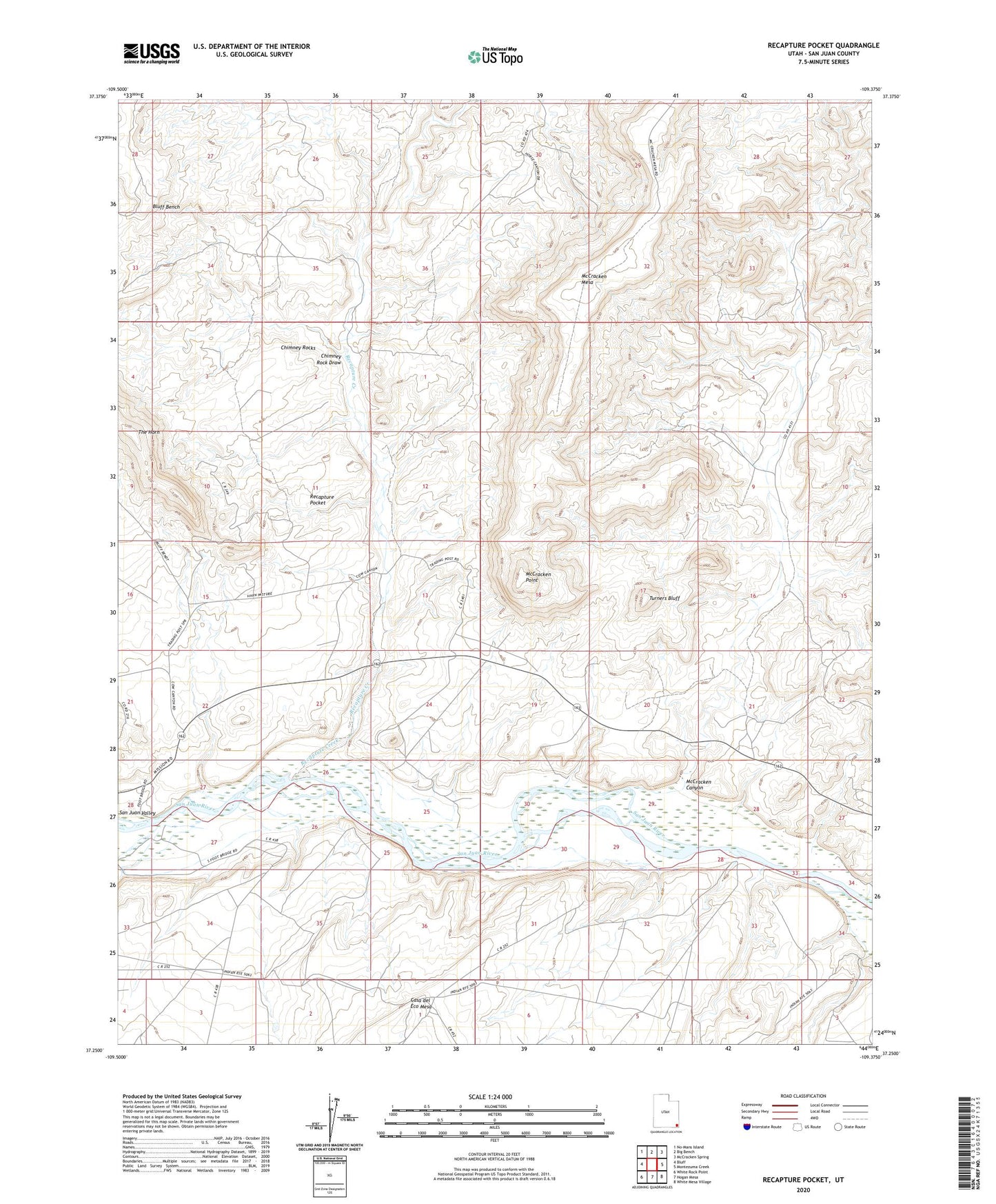
2023 topographic map quadrangle Recapture Pocket in the state of Utah. Scale: 1:24000. Based on the newly updated USGS 7.5' US Topo map series, this map is in the following counties: San Juan. The map contains contour data, water features, and other items you are used to seeing on USGS maps, but also has updated roads and other features. This is the next generation of topographic maps. Printed on high-quality waterproof paper with UV fade-resistant inks.
Quads adjacent to this one:
West: Bluff
Northwest: No-Mans Island
North: Big Bench
Northeast: McCracken Spring
East: Montezuma Creek
Southeast: White Mesa Village
South: Hogan Mesa
Southwest: White Rock Point
This map covers the same area as the classic USGS quad with code o37109c4.
Contains the following named places: Chimney Rock Draw, Chimney Rocks, McCracken Canyon, McCracken Point, Recapture Creek, Recapture Pocket, The Horn, Turners Bluff