MyTopo
Boulder Mountain Utah US Topo Map
Couldn't load pickup availability
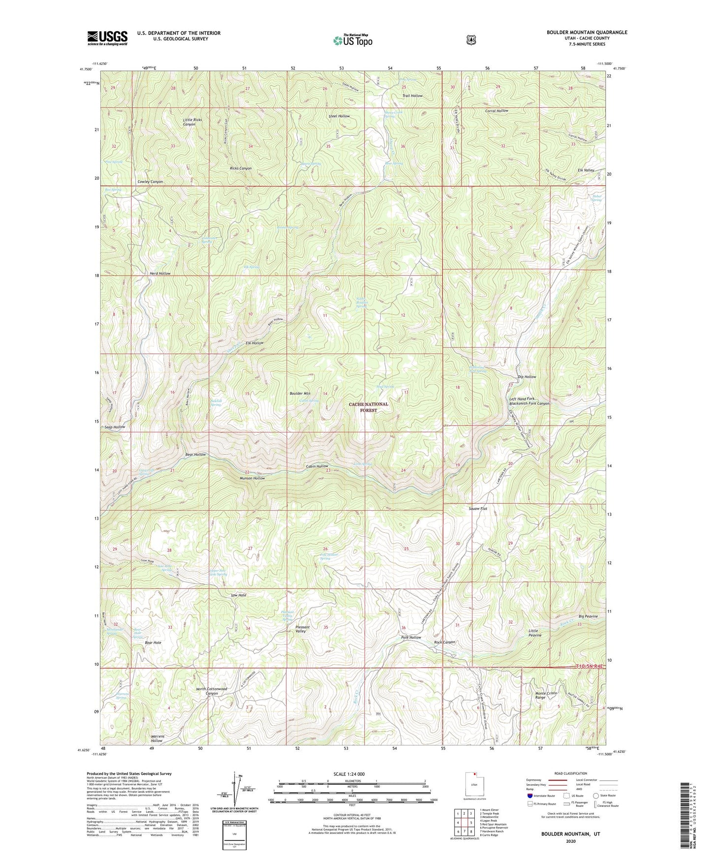
2020 topographic map quadrangle Boulder Mountain in the state of Utah. Scale: 1:24000. Based on the newly updated USGS 7.5' US Topo map series, this map is in the following counties: Cache. The map contains contour data, water features, and other items you are used to seeing on USGS maps, but also has updated roads and other features. This is the next generation of topographic maps. Printed on high-quality waterproof paper with UV fade-resistant inks.
Quads adjacent to this one:
West: Logan Peak
Northwest: Mount Elmer
North: Temple Peak
Northeast: Meadowville
East: Red Spur Mountain
Southeast: Curtis Ridge
South: Hardware Ranch
Southwest: Porcupine Reservoir
Contains the following named places: Bear Hollow, Bear Spring, Big Peavine, Boar Hole Spring, Boulder Mountain, Box Spring, Bronco Spring, Cabin Hollow, Cabin Spring, Coldwater Spring, Dip Hollow, Dog Spring, Elk Hollow, Elk Spring, Gray Cliff Spring, Heber Spring, Humming Bird Spring, Lime Spring, Little Peavine, Lucky Star Mine, Marie Spring, Mosslander Spring, Mud Spring, Munson Hollow, North Boulder Spring, Pine Spring, Pleasant Valley, Pleasant Valley Spring, Pole Hollow, Pole Hollow Spring, Saddle Creek, Seep Hollow, Sheep Creek, Sheep Creek Spring, Sidehill Spring, Sow Hole Spring, Squaw Flat, Upper Sow Hole Spring, Warrens Hollow, Warrens Spring