MyTopo
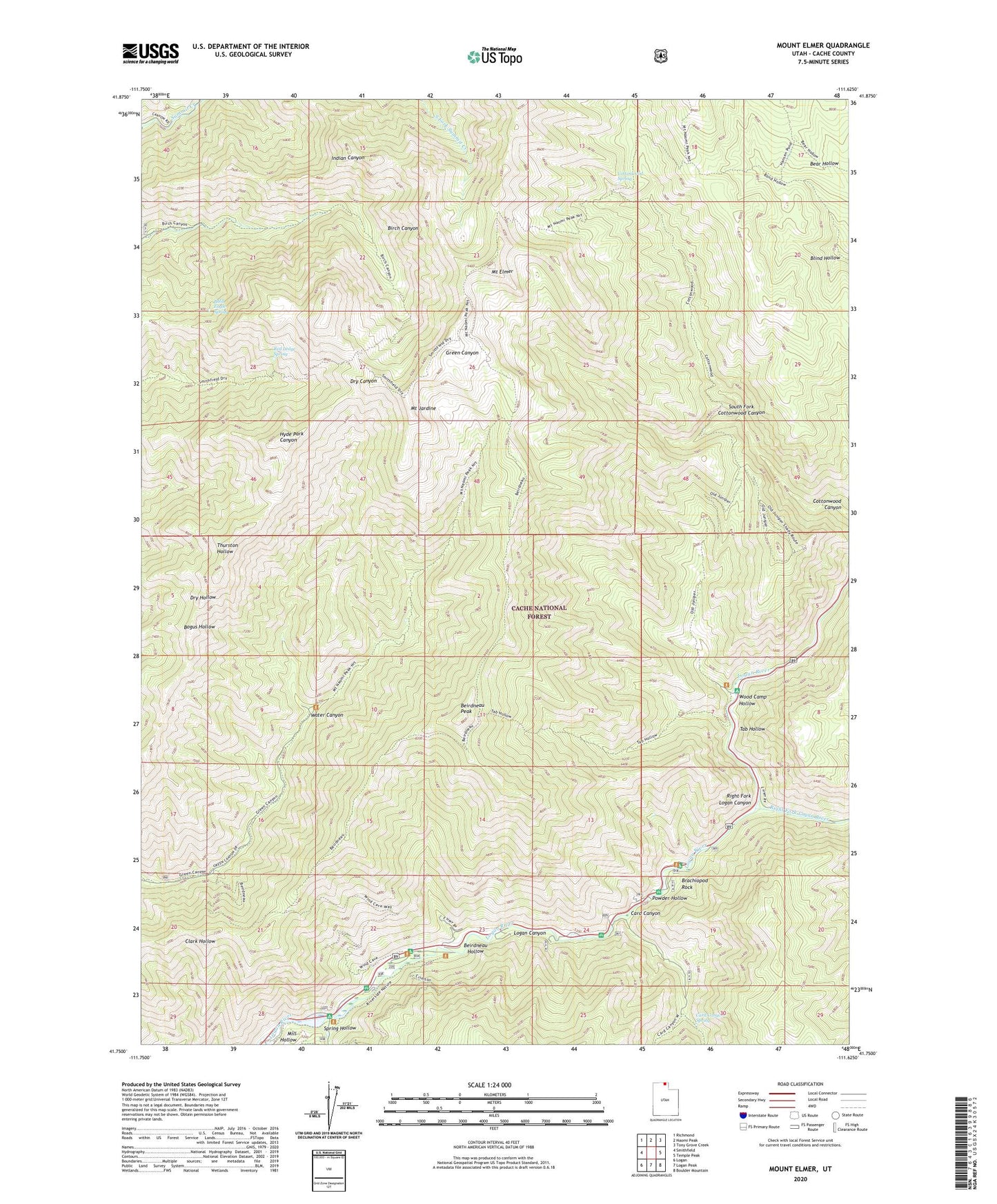
Mount Elmer Utah US Topo Map
Couldn't load pickup availability
Also explore the Mount Elmer Forest Service Topo of this same quad for updated USFS data
2023 topographic map quadrangle Mount Elmer in the state of Utah. Scale: 1:24000. Based on the newly updated USGS 7.5' US Topo map series, this map is in the following counties: Cache. The map contains contour data, water features, and other items you are used to seeing on USGS maps, but also has updated roads and other features. This is the next generation of topographic maps. Printed on high-quality waterproof paper with UV fade-resistant inks.
Quads adjacent to this one:
West: Smithfield
Northwest: Richmond
North: Naomi Peak
Northeast: Tony Grove Creek
East: Temple Peak
Southeast: Boulder Mountain
South: Logan Peak
Southwest: Logan
This map covers the same area as the classic USGS quad with code o41111g6.
Contains the following named places: Bald Eagle Spring, Beindneau Summer Home Area, Beirdneau Campground, Beirdneau Hollow, Beirdneau Peak, Brachiopod Rock, Browns Roll Off Campground, Card Campground, Card Canyon, Card Canyon Guard Station, Card Canyon Spring, China Row Campground, Chokecherry Campground, Chokecherry Summer Home Area, Cottonwood Spring, Dewitt Campground, Guinavah Amphitheater, Guinavah Campground, Hansen Pond, Malibu Campground, Middle Spring Hollow Picnic Area, Mill Hollow, Mount Elmer, Mount Jardine, Nook Campground, Old Jardine Juniper, Pine Bluffs Summer Home Area, Powder Hollow, Preston Valley Campground, Red Ledge Spring, Right Fork Logan Canyon, Right Fork Logan River, Smoky Rock Campground, South Fork Cottonwood Canyon, Spring Hollow, Spring Hollow Campground, Tab Hollow, Third Dam, Water Canyon, Wood Camp Campground, Wood Camp Hollow