MyTopo
Buck Knoll Utah US Topo Map
Couldn't load pickup availability
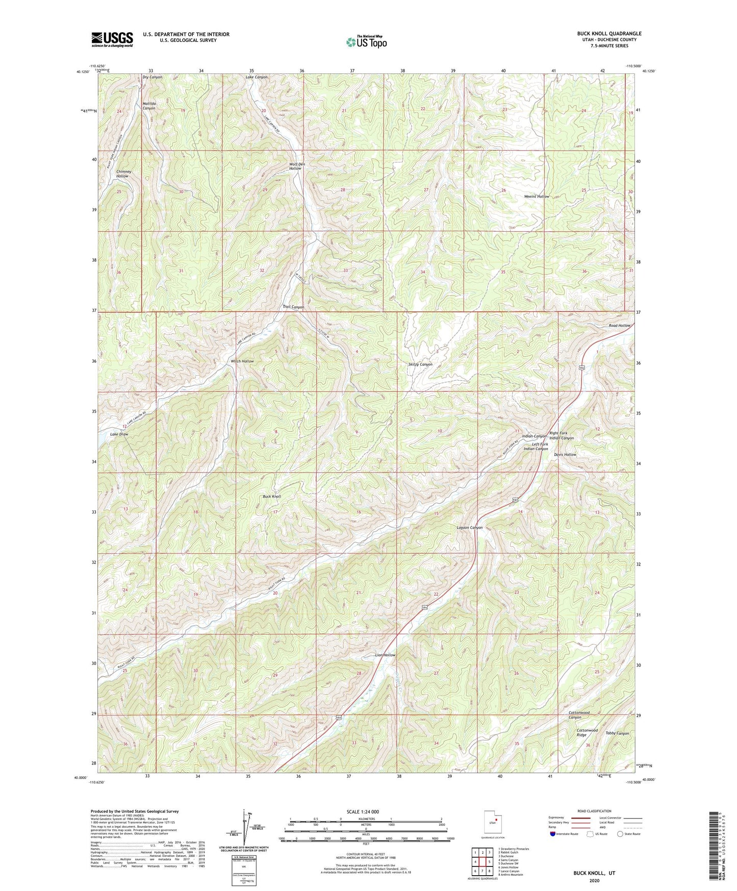
2020 topographic map quadrangle Buck Knoll in the state of Utah. Scale: 1:24000. Based on the newly updated USGS 7.5' US Topo map series, this map is in the following counties: Duchesne. The map contains contour data, water features, and other items you are used to seeing on USGS maps, but also has updated roads and other features. This is the next generation of topographic maps. Printed on high-quality waterproof paper with UV fade-resistant inks.
Quads adjacent to this one:
West: Sams Canyon
Northwest: Strawberry Pinnacles
North: Rabbit Gulch
Northeast: Duchesne
East: Duchesne SW
Southeast: Anthro Mountain
South: Lance Canyon
Southwest: Jones Hollow
Contains the following named places: Buck Knoll, Chimney Hollow, Cripple Creek, Davis Hollow, Lagoon Canyon, Lake Draw, Left Fork Indian Canyon, Lion Hollow, Matilda Canyon, Raven Mine, Right Fork Indian Canyon, Road Hollow, Skitzy Wildlife Management Area, Trail Canyon, Witch Hollow, Wolf Den Hollow, ZIP Code: 84021