MyTopo
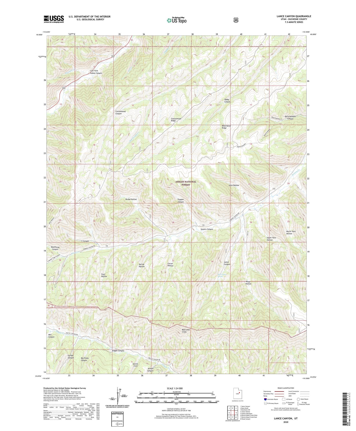
Lance Canyon Utah US Topo Map
Couldn't load pickup availability
Also explore the Lance Canyon Forest Service Topo of this same quad for updated USFS data
2023 topographic map quadrangle Lance Canyon in the state of Utah. Scale: 1:24000. Based on the newly updated USGS 7.5' US Topo map series, this map is in the following counties: Duchesne. The map contains contour data, water features, and other items you are used to seeing on USGS maps, but also has updated roads and other features. This is the next generation of topographic maps. Printed on high-quality waterproof paper with UV fade-resistant inks.
Quads adjacent to this one:
West: Jones Hollow
Northwest: Sams Canyon
North: Buck Knoll
Northeast: Duchesne SW
East: Anthro Mountain
Southeast: Wood Canyon
South: Minnie Maud Creek East
Southwest: Minnie Maud Creek West
This map covers the same area as the classic USGS quad with code o39110h5.
Contains the following named places: Big Piney Canyon, Big Trough Creek, Broad Hollow, Corral Hollow, Cottonwood Ridge, Deathtrap Canyon, Fivemile Creek, Garder Canyon, Jenson Canyon, Jolie Hollow, K P Creek, Lance Canyon, Mill Canyon, North Twin Hollow, Road Hollow, Sorens Cove, South Twin Hollow, Spring Hollow, Trail Hollow, Trapper Canyon, West Lance Spring, Wild Horse Ridge, Y Canyon