MyTopo
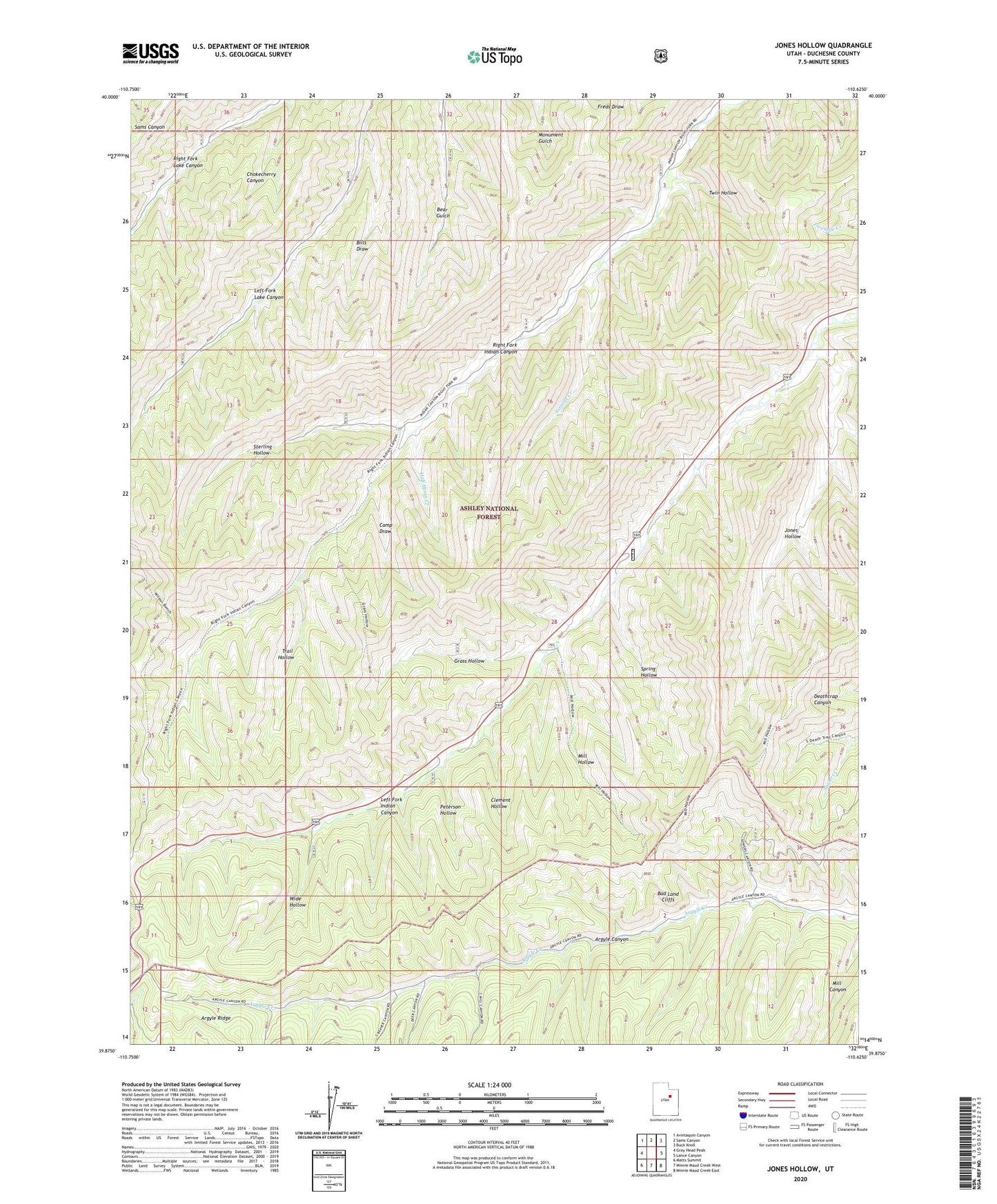
Jones Hollow Utah US Topo Map
Couldn't load pickup availability
Also explore the Jones Hollow Forest Service Topo of this same quad for updated USFS data
2023 topographic map quadrangle Jones Hollow in the state of Utah. Scale: 1:24000. Based on the newly updated USGS 7.5' US Topo map series, this map is in the following counties: Duchesne. The map contains contour data, water features, and other items you are used to seeing on USGS maps, but also has updated roads and other features. This is the next generation of topographic maps. Printed on high-quality waterproof paper with UV fade-resistant inks.
Quads adjacent to this one:
West: Gray Head Peak
Northwest: Avintaquin Canyon
North: Sams Canyon
Northeast: Buck Knoll
East: Lance Canyon
Southeast: Minnie Maud Creek East
South: Minnie Maud Creek West
Southwest: Matts Summit
This map covers the same area as the classic USGS quad with code o39110h6.
Contains the following named places: Bills Draw, Camp Draw, Chokecherry Canyon, Clement Hollow, Grass Hollow, Half Moon Creek, Indian Canyon Guard Station, Jones Hollow, Mill Hollow, Peterson Hollow, Sixmile Creek, Spring Hollow, Sterling Hollow, Trail Hollow, Twelvemile Creek, Twin Hollow, Wide Hollow