
MyTopo
Candland Spring Utah US Topo Map
Couldn't load pickup availability
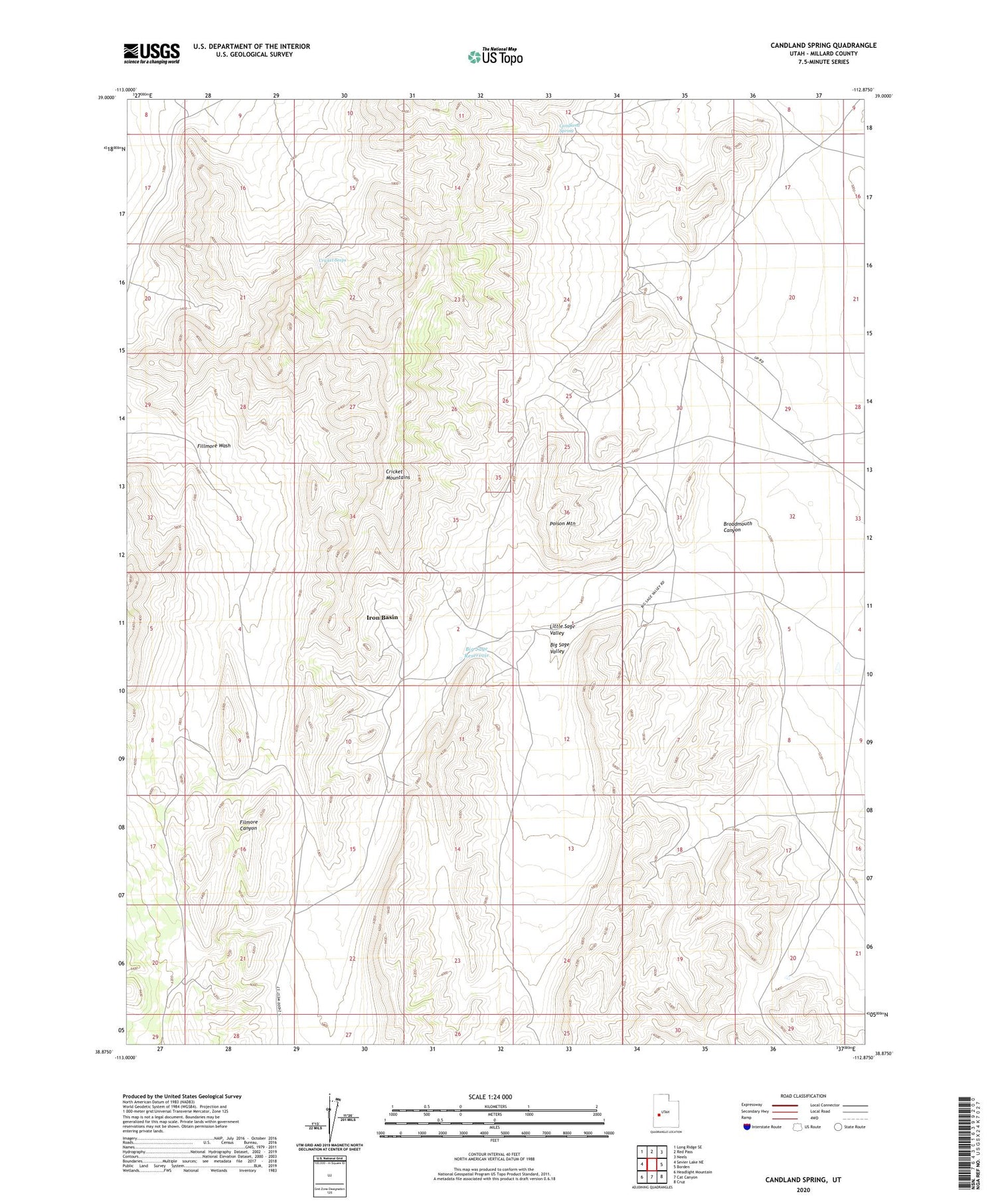
2020 topographic map quadrangle Candland Spring in the state of Utah. Scale: 1:24000. Based on the newly updated USGS 7.5' US Topo map series, this map is in the following counties: Millard. The map contains contour data, water features, and other items you are used to seeing on USGS maps, but also has updated roads and other features. This is the next generation of topographic maps. Printed on high-quality waterproof paper with UV fade-resistant inks.
Quads adjacent to this one:
West: Sevier Lake NE
Northwest: Long Ridge SE
North: Red Pass
Northeast: Neels
East: Borden
Southeast: Cruz
South: Cat Canyon
Southwest: Headlight Mountain
Contains the following named places: Big Sage Reservoir, Big Sage Valley, Broadmouth Canyon, Candland Spring, Cricket Seeps, Iron Basin, Little Sage Valley, Poison Mountain


