MyTopo
Cave Canyon Utah US Topo Map
Couldn't load pickup availability
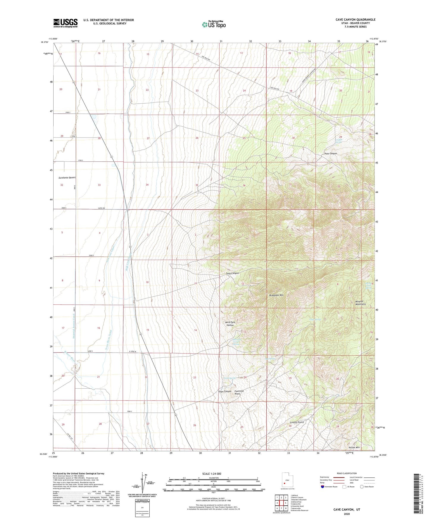
2020 topographic map quadrangle Cave Canyon in the state of Utah. Scale: 1:24000. Based on the newly updated USGS 7.5' US Topo map series, this map is in the following counties: Beaver. The map contains contour data, water features, and other items you are used to seeing on USGS maps, but also has updated roads and other features. This is the next generation of topographic maps. Printed on high-quality waterproof paper with UV fade-resistant inks.
Quads adjacent to this one:
West: Milford Flat
Northwest: Milford
North: Ranch Canyon
Northeast: Bearskin Mountain
East: Adamsville
Southeast: Minersville Reservoir
South: Minersville
Southwest: Ninemile Knoll
Contains the following named places: Bradshaw Mountain, Cave Canyon, Cave Mine, Creole Mine, Fourmile Knoll, Griffith Spring, Guyo Canyon, Guyo Spring, Harriet Mine, Hecla Mine, Herb Eyre Hollow, High Line Canal, Honey Bov Mine, Imperial Avenue Canal, Jimmy Jones Spring, Lincoln Gulch, Lincoln Mine, Low Line Canal, North Spring, Oak Spring, Pole Canyon, Shearing Corral Spring, The Iron Mine, Trans River Canal, Yellow Mountain