MyTopo
Milford Utah US Topo Map
Couldn't load pickup availability
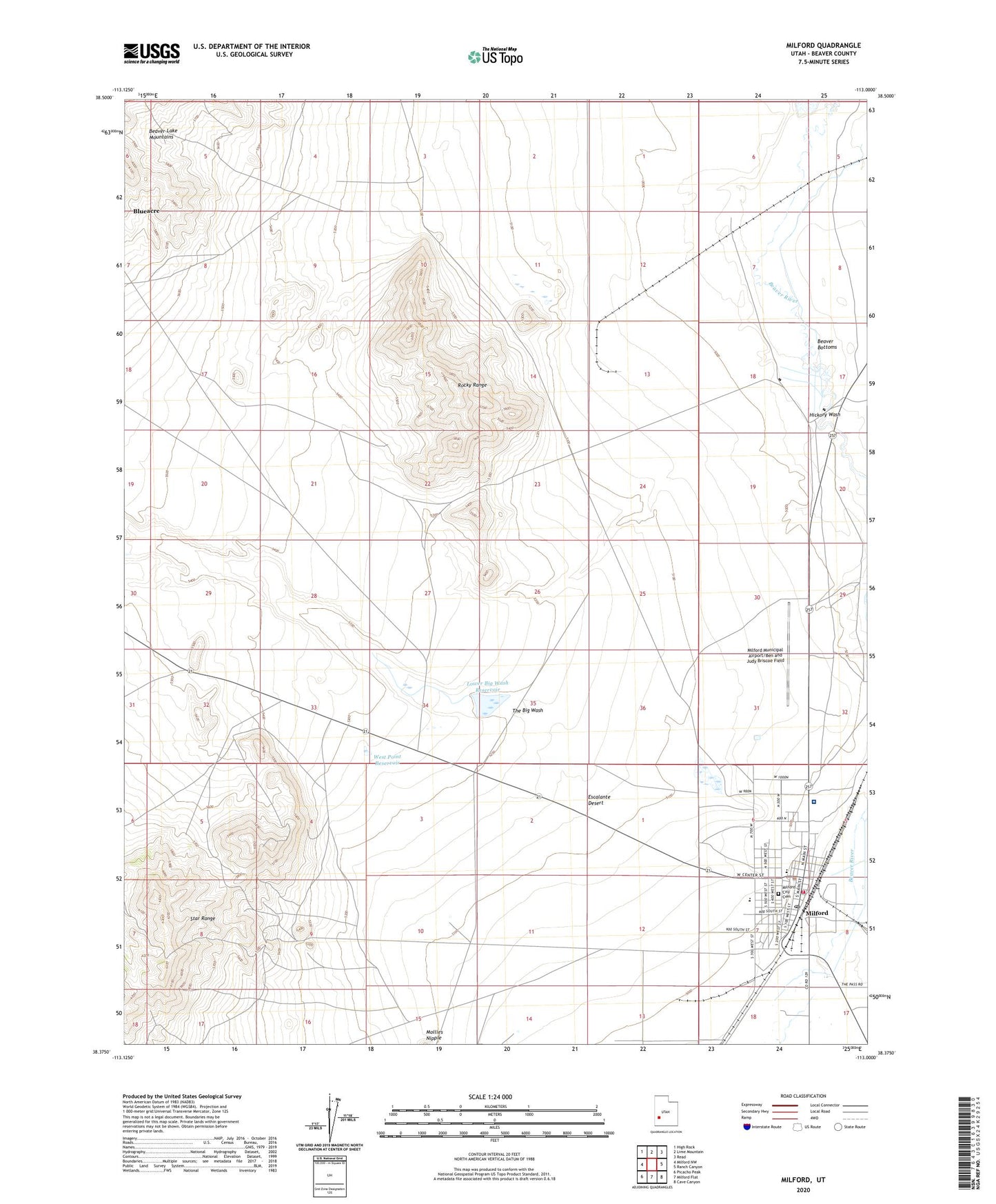
2023 topographic map quadrangle Milford in the state of Utah. Scale: 1:24000. Based on the newly updated USGS 7.5' US Topo map series, this map is in the following counties: Beaver. The map contains contour data, water features, and other items you are used to seeing on USGS maps, but also has updated roads and other features. This is the next generation of topographic maps. Printed on high-quality waterproof paper with UV fade-resistant inks.
Quads adjacent to this one:
West: Milford NW
Northwest: High Rock
North: Lime Mountain
Northeast: Read
East: Ranch Canyon
Southeast: Cave Canyon
South: Milford Flat
Southwest: Picacho Peak
This map covers the same area as the classic USGS quad with code o38113d1.
Contains the following named places: Beaver County Fire District - Milford, Beaver County Sheriff's Office Milford, Beaver-Harrison Mine, Big Wash Dam, Big Wash Reservoir, City of Milford, Copper King Mine, Copper Ranch Mine, First Baptist Church, Harrington-Hickory Mine, Hickory Wash, Little May Lilly Mine, Lower Big Wash Dam, Lower Big Wash Reservoir, Milford, Milford Catholic Church, Milford City Cemetery, Milford Community Methodist Church, Milford Elementary School, Milford High School, Milford Municipal Airport/Ben and Judy Briscoe Field, Milford Post Office, Milford Valley Memorial Hospital, Mollies Nipple Well, Montreal Mine, Old Hickory Mine, Rebel Mine, Rocky Range, The Big Wash, The Church of Jesus Christ of Latter Day Saints, West Point Reservoir