MyTopo
Crows Nest Spring Utah US Topo Map
Couldn't load pickup availability
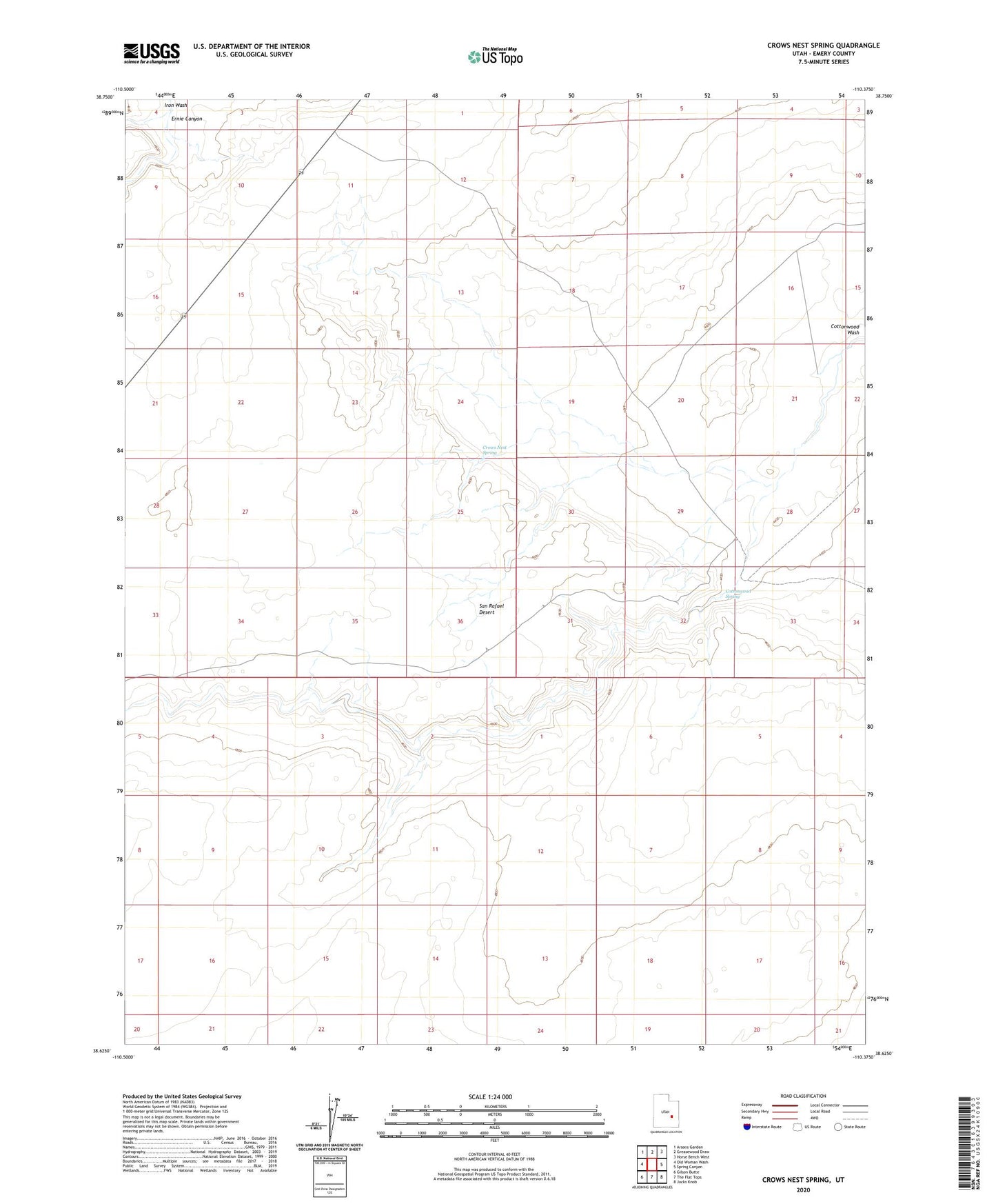
2023 topographic map quadrangle Crows Nest Spring in the state of Utah. Scale: 1:24000. Based on the newly updated USGS 7.5' US Topo map series, this map is in the following counties: Emery. The map contains contour data, water features, and other items you are used to seeing on USGS maps, but also has updated roads and other features. This is the next generation of topographic maps. Printed on high-quality waterproof paper with UV fade-resistant inks.
Quads adjacent to this one:
West: Old Woman Wash
Northwest: Arsons Garden
North: Greasewood Draw
Northeast: Horse Bench West
East: Spring Canyon
Southeast: Jacks Knob
South: The Flat Tops
Southwest: Gilson Butte
This map covers the same area as the classic USGS quad with code o38110f4.
Contains the following named places: Cottonwood Spring, Crows Nest Spring, Ernie Canyon, San Rafael Desert