MyTopo
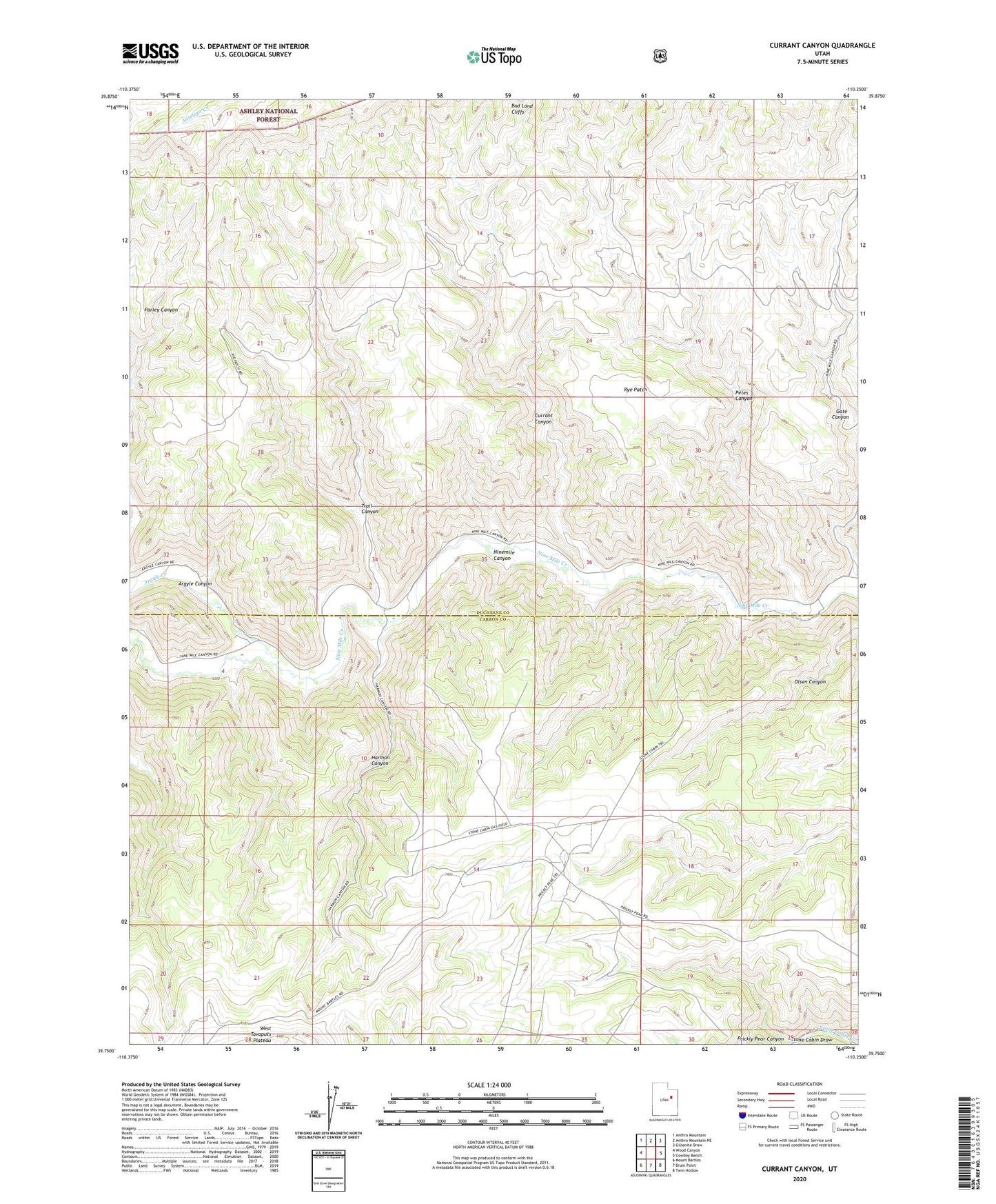
Currant Canyon Utah US Topo Map
Couldn't load pickup availability
Also explore the Currant Canyon Forest Service Topo of this same quad for updated USFS data
2023 topographic map quadrangle Currant Canyon in the state of Utah. Scale: 1:24000. Based on the newly updated USGS 7.5' US Topo map series, this map is in the following counties: Duchesne, Carbon. The map contains contour data, water features, and other items you are used to seeing on USGS maps, but also has updated roads and other features. This is the next generation of topographic maps. Printed on high-quality waterproof paper with UV fade-resistant inks.
Quads adjacent to this one:
West: Wood Canyon
Northwest: Anthro Mountain
North: Anthro Mountain NE
Northeast: Gilsonite Draw
East: Cowboy Bench
Southeast: Twin Hollow
South: Bruin Point
Southwest: Mount Bartles
This map covers the same area as the classic USGS quad with code o39110g3.
Contains the following named places: Argyle Canyon, Argyle Creek, Currant Canyon, Harmon Canyon, Interplanetary Airstrip, Petes Canyon, Prickly Pear Canyon, Rye Patch, South Duchesne Division, Stone Cabin Gas Field, Trail Canyon