MyTopo
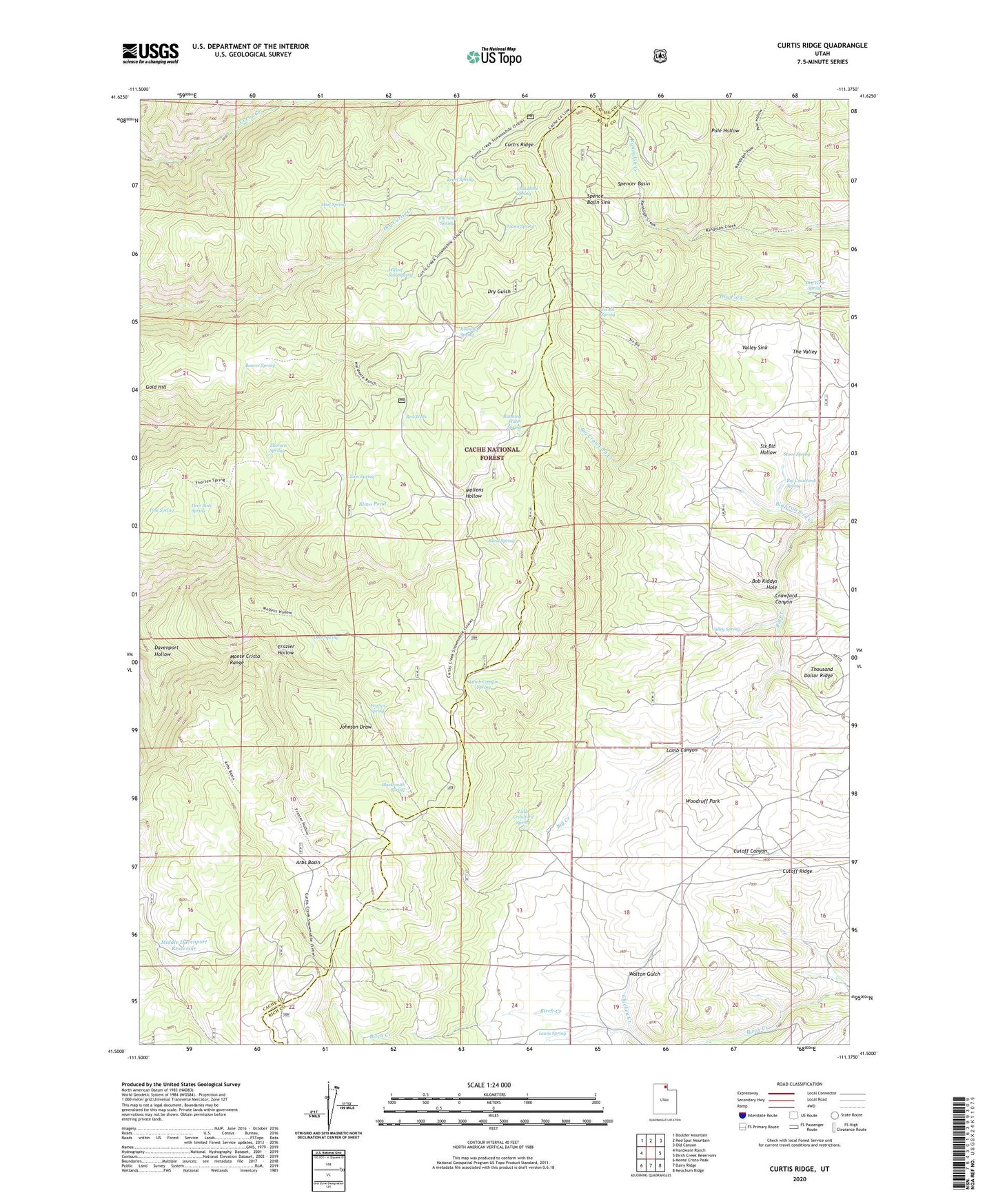
Curtis Ridge Utah US Topo Map
Couldn't load pickup availability
2020 topographic map quadrangle Curtis Ridge in the state of Utah. Scale: 1:24000. Based on the newly updated USGS 7.5' US Topo map series, this map is in the following counties: Cache, Rich. The map contains contour data, water features, and other items you are used to seeing on USGS maps, but also has updated roads and other features. This is the next generation of topographic maps. Printed on high-quality waterproof paper with UV fade-resistant inks.
Quads adjacent to this one:
West: Hardware Ranch
Northwest: Boulder Mountain
North: Red Spur Mountain
Northeast: Old Canyon
East: Birch Creek Reservoirs
Southeast: Meachum Ridge
South: Dairy Ridge
Southwest: Monte Cristo Peak
Contains the following named places: Arbs Basin, Beaver Spring, Big Crawford Creek, Big Crawford Spring, Blacksmith Spring, Blind Spring, Bob Kiddys Hole, Chicken Creek, Chuckhole Spring, Curtis Ridge, Davenport Hollow, Deer Sink Spring, Deer Spring, Dry Fork Spring, Elk Sink Spring, Elmo Pond, Frazier Hollow, Frazier Spring, Hardware Ranch Trail, Joann Spring, Kearl Spring, Lamb Canyon, Lamb Canyon Spring, Lewis Spring, Little Crawford Spring, Middle Davenport Reservoir, Mud Spring, Pine Spring, Red Wells, Roundup Spring, Running Water Spring, Six Bit Hollow, Six Bit Spring, Spence Basin Sink, Spencer Basin, Stove Spring, The Valley, Thorsen Spring, Thousand Dollar Ridge, Valley Sink, Valley Spring, Walton Gulch, Willow Sink Spring, Woodruff Park, Zion Spring