MyTopo
Meachum Ridge Utah US Topo Map
Couldn't load pickup availability
Also explore the Meachum Ridge Forest Service Topo of this same quad for updated USFS data
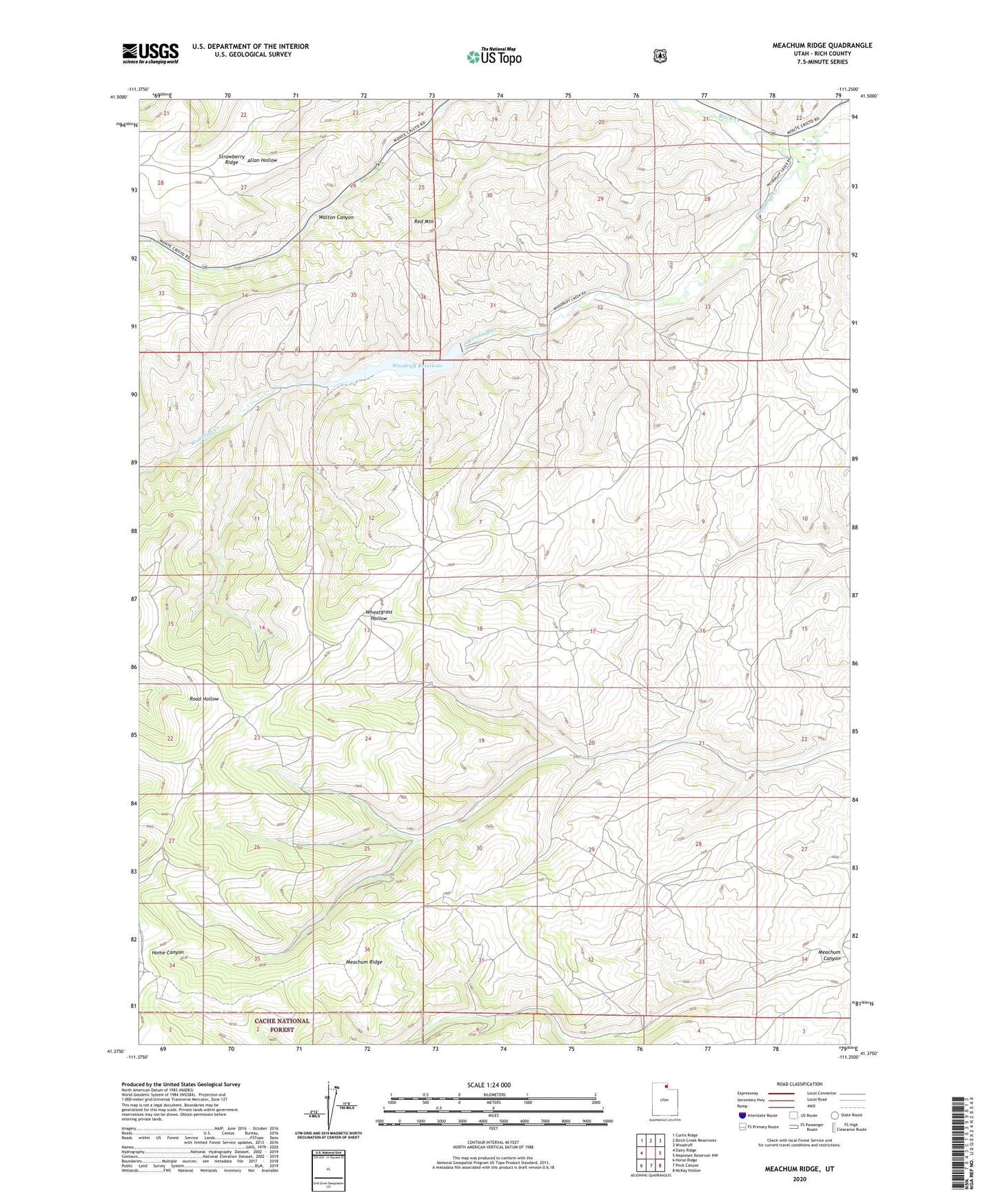
2023 topographic map quadrangle Meachum Ridge in the state of Utah. Scale: 1:24000. Based on the newly updated USGS 7.5' US Topo map series, this map is in the following counties: Rich. The map contains contour data, water features, and other items you are used to seeing on USGS maps, but also has updated roads and other features. This is the next generation of topographic maps. Printed on high-quality waterproof paper with UV fade-resistant inks.
Quads adjacent to this one:
West: Dairy Ridge
Northwest: Curtis Ridge
North: Birch Creek Reservoirs
Northeast: Woodruff
East: Neponset Reservoir NW
Southeast: McKay Hollow
South: Peck Canyon
Southwest: Horse Ridge
This map covers the same area as the classic USGS quad with code o41111d3.
Contains the following named places: Birch Creek, Meachum Ridge, Red Mountain, Woodruff Creek Dam, Woodruff Reservoir