
MyTopo
Deseret Peak West Utah US Topo Map
Couldn't load pickup availability
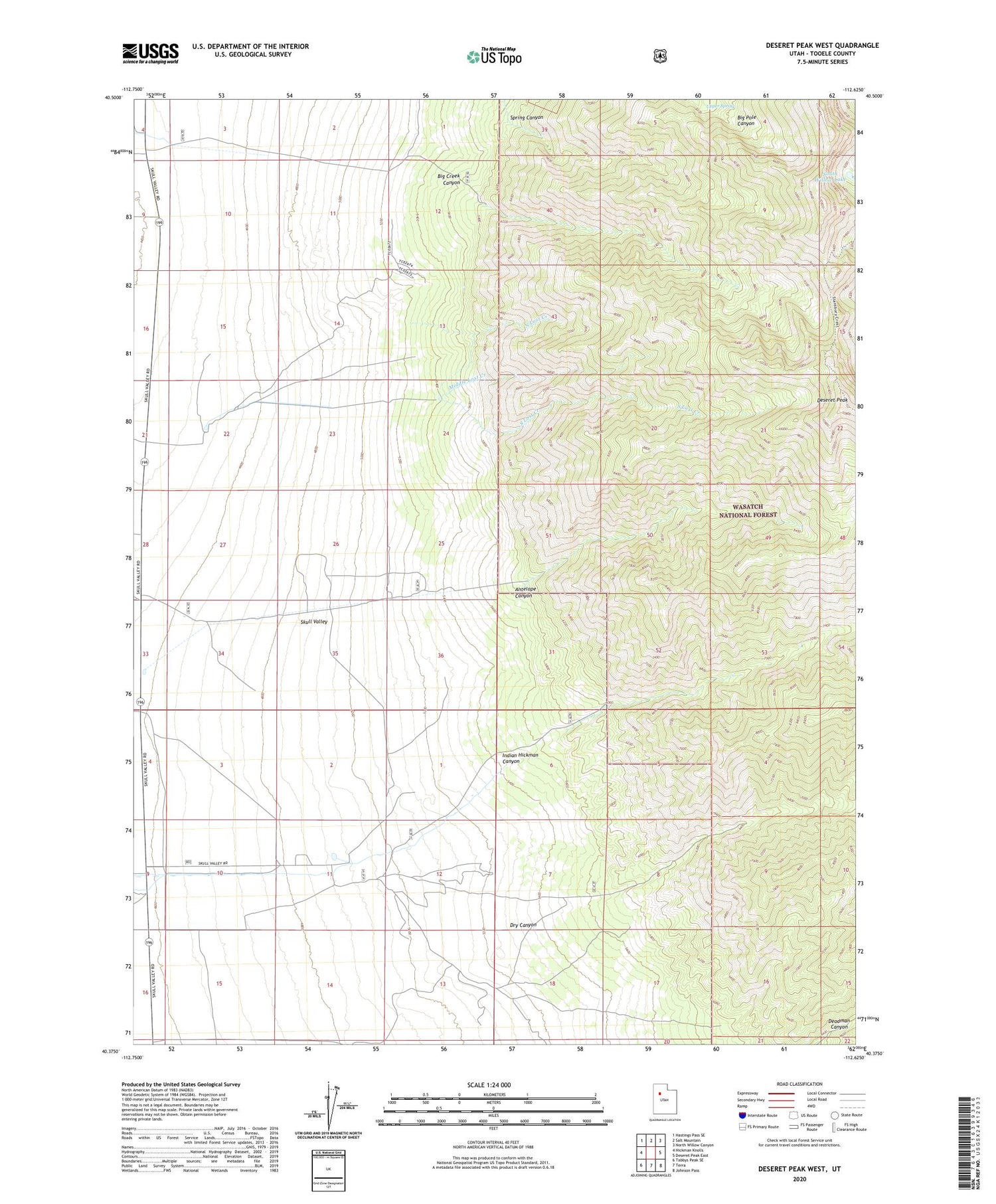
2020 topographic map quadrangle Deseret Peak West in the state of Utah. Scale: 1:24000. Based on the newly updated USGS 7.5' US Topo map series, this map is in the following counties: Tooele. The map contains contour data, water features, and other items you are used to seeing on USGS maps, but also has updated roads and other features. This is the next generation of topographic maps. Printed on high-quality waterproof paper with UV fade-resistant inks.
Quads adjacent to this one:
West: Hickman Knolls
Northwest: Hastings Pass SE
North: Salt Mountain
Northeast: North Willow Canyon
East: Deseret Peak East
Southeast: Johnson Pass
South: Terra
Southwest: Tabbys Peak SE
Contains the following named places: Antelope Canyon, Big Creek Canyon, Deseret Peak, Deseret Peak Wilderness, Deseret Ranch, Dry Canyon, Hatch Ranch, Indian Hickman Canyon, Island Ranch, Middle Lost Creek, Skull Valley Reservation, South Lost Creek, South Willow Lake, Spring Canyon, Upper Spring, ZIP Code: 84022


