MyTopo
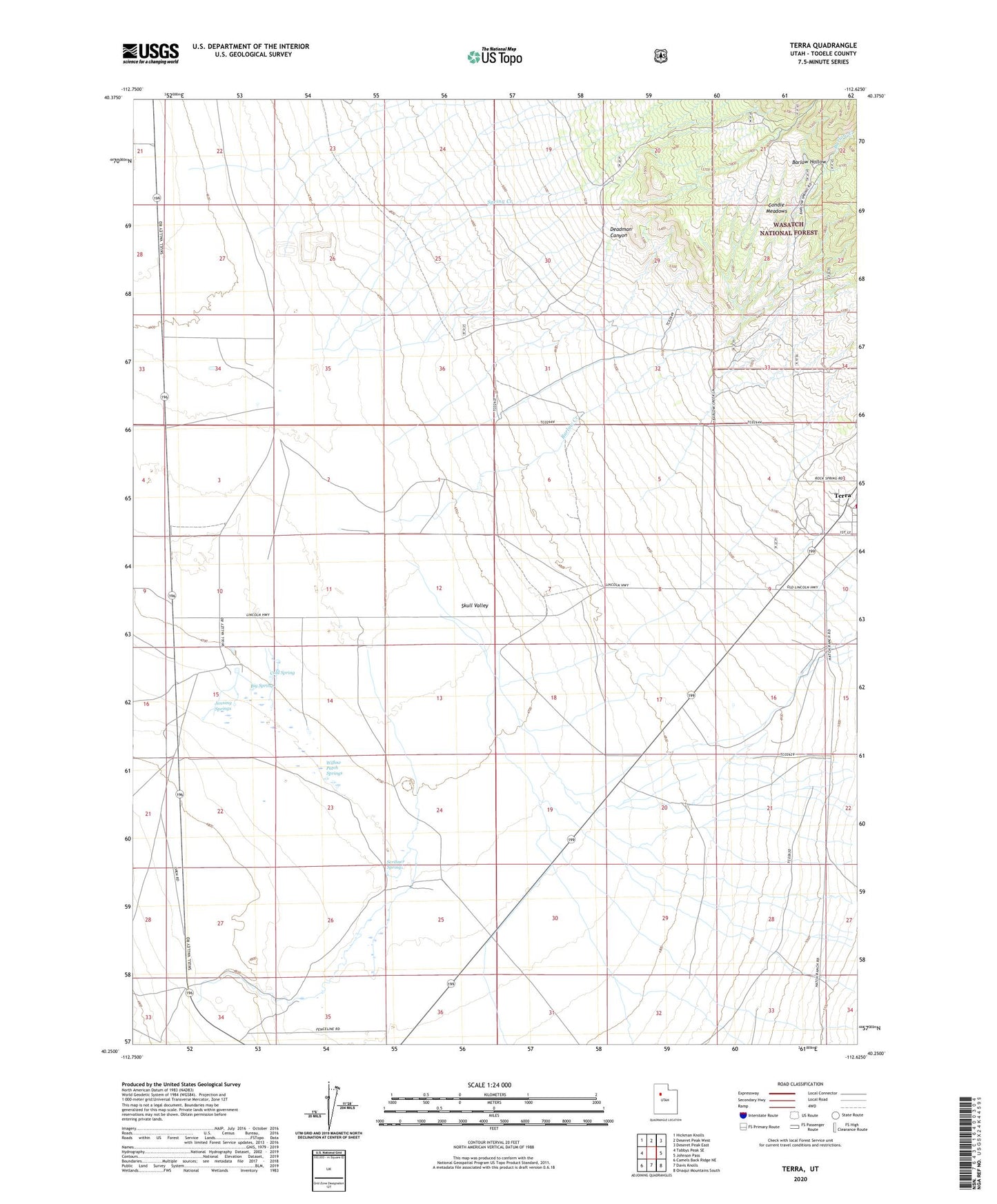
Terra Utah US Topo Map
Couldn't load pickup availability
Also explore the Terra Forest Service Topo of this same quad for updated USFS data
2023 topographic map quadrangle Terra in the state of Utah. Scale: 1:24000. Based on the newly updated USGS 7.5' US Topo map series, this map is in the following counties: Tooele. The map contains contour data, water features, and other items you are used to seeing on USGS maps, but also has updated roads and other features. This is the next generation of topographic maps. Printed on high-quality waterproof paper with UV fade-resistant inks.
Quads adjacent to this one:
West: Tabbys Peak SE
Northwest: Hickman Knolls
North: Deseret Peak West
Northeast: Deseret Peak East
East: Johnson Pass
Southeast: Onaqui Mountains South
South: Davis Knolls
Southwest: Camels Back Ridge NE
This map covers the same area as the classic USGS quad with code o40112c6.
Contains the following named places: Barlow Creek, Barlow Hollow, Big Spring, Cold Spring, Condie Meadows, Condie Ranch, Deadman Canyon, Hatch Ranch, Jenning Springs, Orr Ranch, Scribner Spring, Spring Creek, Terra, Willow Patch Springs