MyTopo
Dewey Utah US Topo Map
Couldn't load pickup availability
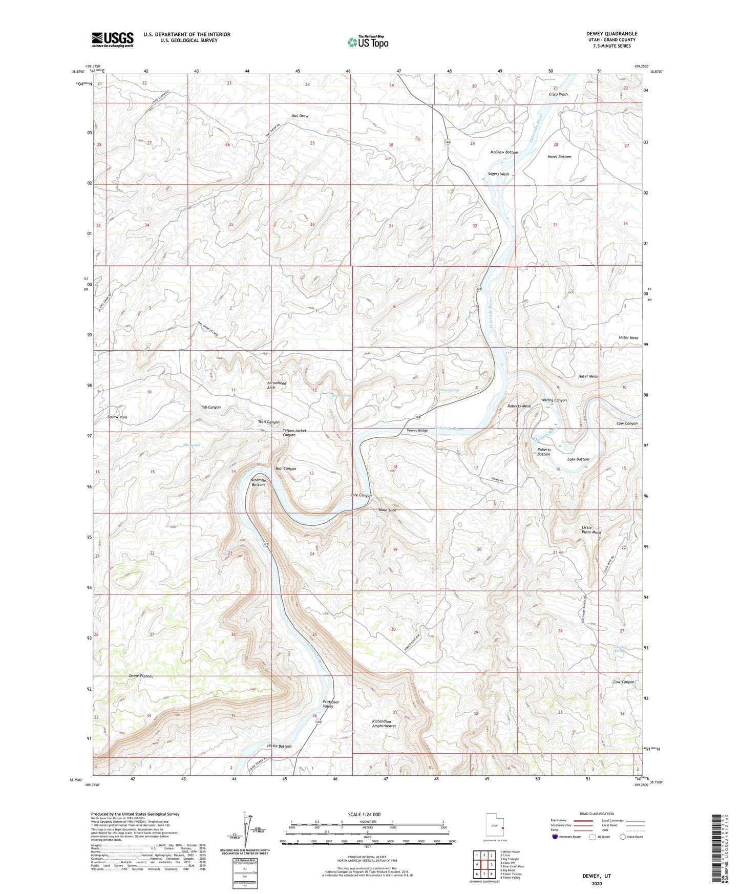
2020 topographic map quadrangle Dewey in the state of Utah. Scale: 1:24000. Based on the newly updated USGS 7.5' US Topo map series, this map is in the following counties: Grand. The map contains contour data, water features, and other items you are used to seeing on USGS maps, but also has updated roads and other features. This is the next generation of topographic maps. Printed on high-quality waterproof paper with UV fade-resistant inks.
Quads adjacent to this one:
West: Cisco SW
Northwest: White House
North: Cisco
Northeast: Big Triangle
East: Blue Chief Mesa
Southeast: Fisher Valley
South: Fisher Towers
Southwest: Big Bend
Contains the following named places: Arrowhead Arch, Buck Spring, Bull Canyon, Cato Ranch, Cisco Wash, Cow Canyon, Cowskin Spring, Dewey, Dewey Bridge, Dewey Spring, Dolores River, Gordon Ranch, Hittle Bottom, Hotel Bottom, Hotel Mesa, Lake Bottom, Little Pinto Mesa, McGraw Bottom, Mule Shoe, Ninemile Bottom, Owl Draw, Pole Canyon, Roberts Bottom, Roberts Mesa, Sagers Wash, Tar Bucket, Trail Canyon, Tub Canyon, Waring Canyon, Wolverton Ranch, Yellow Jacket Canyon