MyTopo
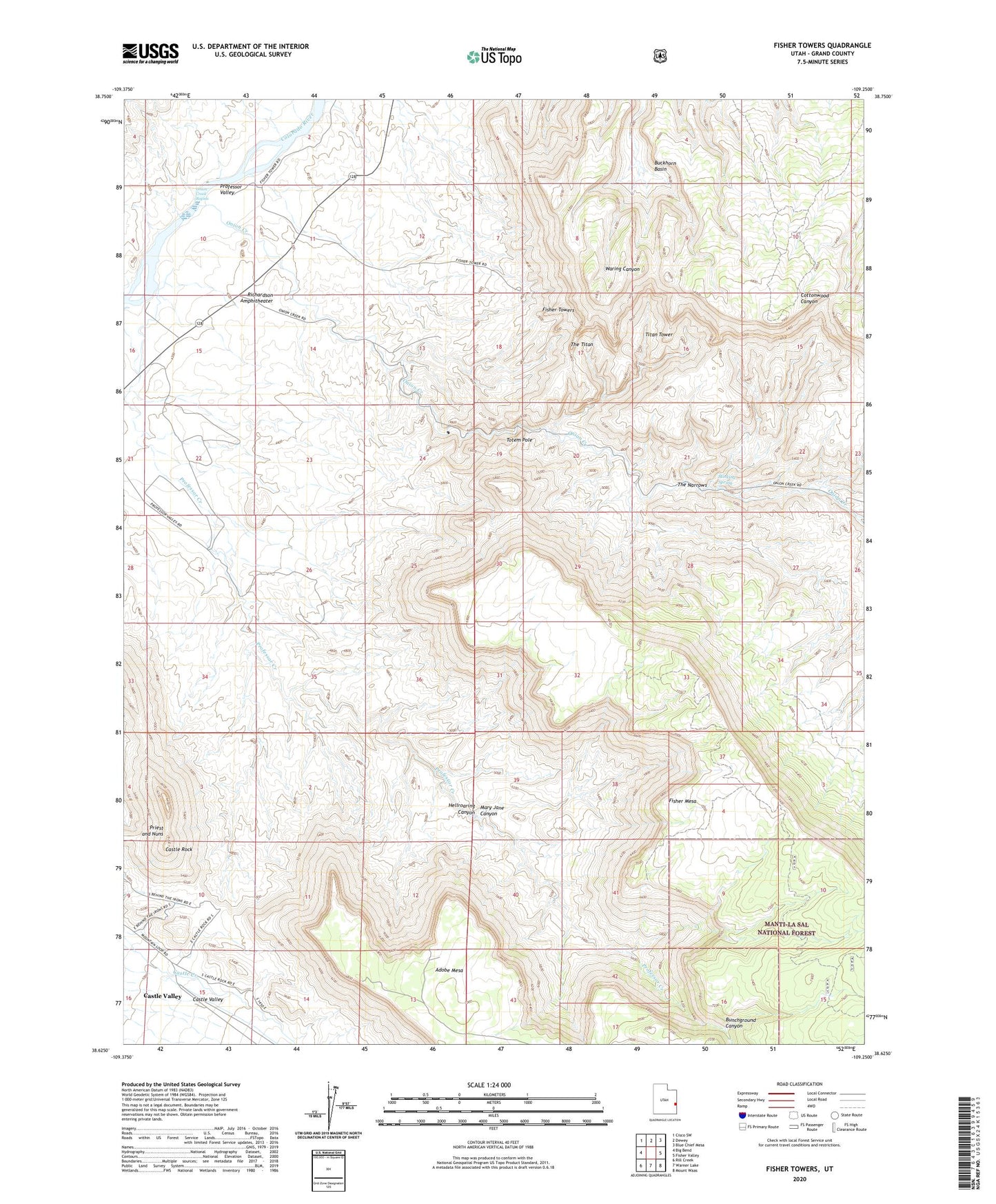
Fisher Towers Utah US Topo Map
Couldn't load pickup availability
Also explore the Fisher Towers Forest Service Topo of this same quad for updated USFS data
2023 topographic map quadrangle Fisher Towers in the state of Utah. Scale: 1:24000. Based on the newly updated USGS 7.5' US Topo map series, this map is in the following counties: Grand. The map contains contour data, water features, and other items you are used to seeing on USGS maps, but also has updated roads and other features. This is the next generation of topographic maps. Printed on high-quality waterproof paper with UV fade-resistant inks.
Quads adjacent to this one:
West: Big Bend
Northwest: Cisco SW
North: Dewey
Northeast: Blue Chief Mesa
East: Fisher Valley
Southeast: Mount Waas
South: Warner Lake
Southwest: Rill Creek
This map covers the same area as the classic USGS quad with code o38109f3.
Contains the following named places: Buckhorn Basin, Bunchground Canyon, Castle Rock, Castle Rock/Priest and Nuns Point of Interest, Fisher Towers, Fisher Towers Picnic Area, Hellroaring Canyon, Mary Jane Canyon, Moab Division, Onion Creek, Onion Creek Rapids, Priest and Nuns, Richardson, Richardson Amphitheater, Stinking Spring, The Narrows, The Titan, Titan Tower, Titus Ranch, Totem Pole