MyTopo
Big Triangle Utah US Topo Map
Couldn't load pickup availability
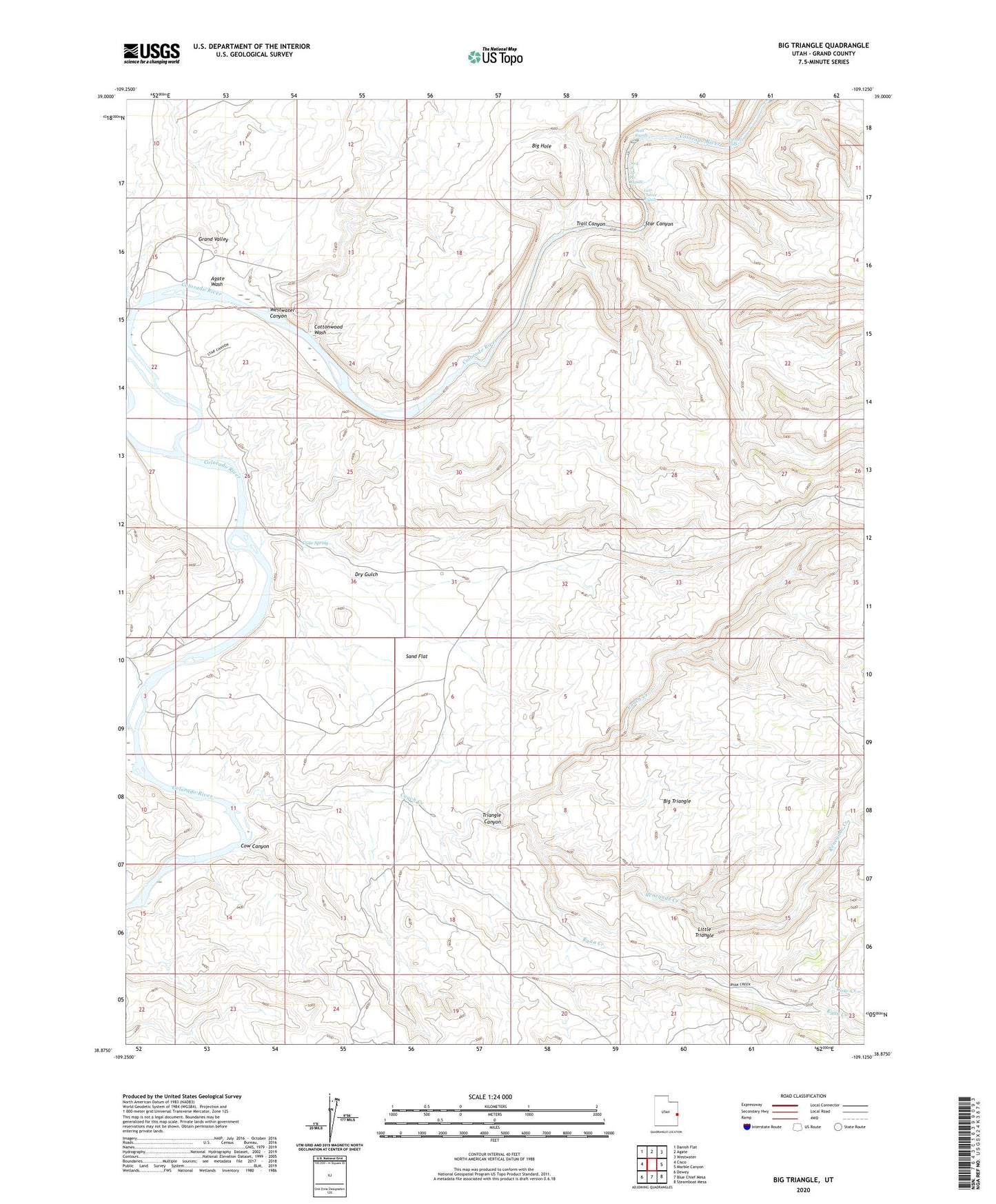
2023 topographic map quadrangle Big Triangle in the state of Utah. Scale: 1:24000. Based on the newly updated USGS 7.5' US Topo map series, this map is in the following counties: Grand. The map contains contour data, water features, and other items you are used to seeing on USGS maps, but also has updated roads and other features. This is the next generation of topographic maps. Printed on high-quality waterproof paper with UV fade-resistant inks.
Quads adjacent to this one:
West: Cisco
Northwest: Danish Flat
North: Agate
Northeast: Westwater
East: Marble Canyon
Southeast: Steamboat Mesa
South: Blue Chief Mesa
Southwest: Dewey
This map covers the same area as the classic USGS quad with code o38109h2.
Contains the following named places: Agate Wash, Big Hole, Big Triangle, Cane Spring, Cisco Landing, Coach Creek, Coates Creek, Cottonwood Wash, Cow Canyon, Cow Creek, Dry Gulch, Funnel Falls, Gavin Ranch, Hallet Ranch, Knowles Ranch, Last Chance Rapids, Little Triangle, Renegade Creek, Revoir Ranch, Ryan Creek, Sand Flat, Skull Rapids, Sock-It-To-Me Rapids, Star Canyon, Trail Canyon, Triangle Canyon, Westwater Canyon, ZIP Code: 84515