MyTopo
Dragon Utah US Topo Map
Couldn't load pickup availability
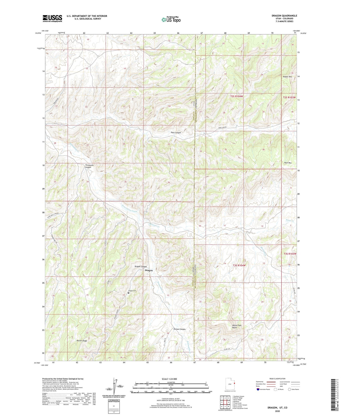
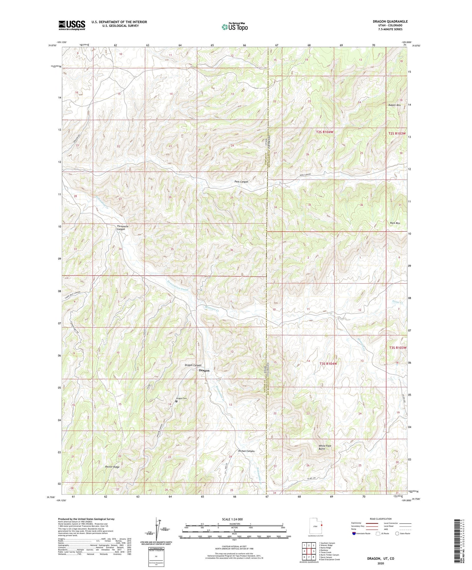
2020 topographic map quadrangle Dragon in the states of Utah, Colorado. Scale: 1:24000. Based on the newly updated USGS 7.5' US Topo map series, this map is in the following counties: Uintah, Rio Blanco. The map contains contour data, water features, and other items you are used to seeing on USGS maps, but also has updated roads and other features. This is the next generation of topographic maps. Printed on high-quality waterproof paper with UV fade-resistant inks.
Quads adjacent to this one:
West: Rainbow
Northwest: Southam Canyon
North: Weaver Ridge
Northeast: Banta Ridge
East: Texas Creek
Southeast: East Evacuation Creek
South: Davis Canyon
Southwest: Burnt Timber Canyon
Contains the following named places: Atchee Canyon, Berkeley School, Dragon, Dragon Canyon, Dragon Cemetery, Evacuation Creek, Evacuation Creek Gas Field, Missouri Creek, Rector Ridge, Texas Creek, Threemile Canyon, White Face Butte