MyTopo
Rainbow Utah US Topo Map
Couldn't load pickup availability
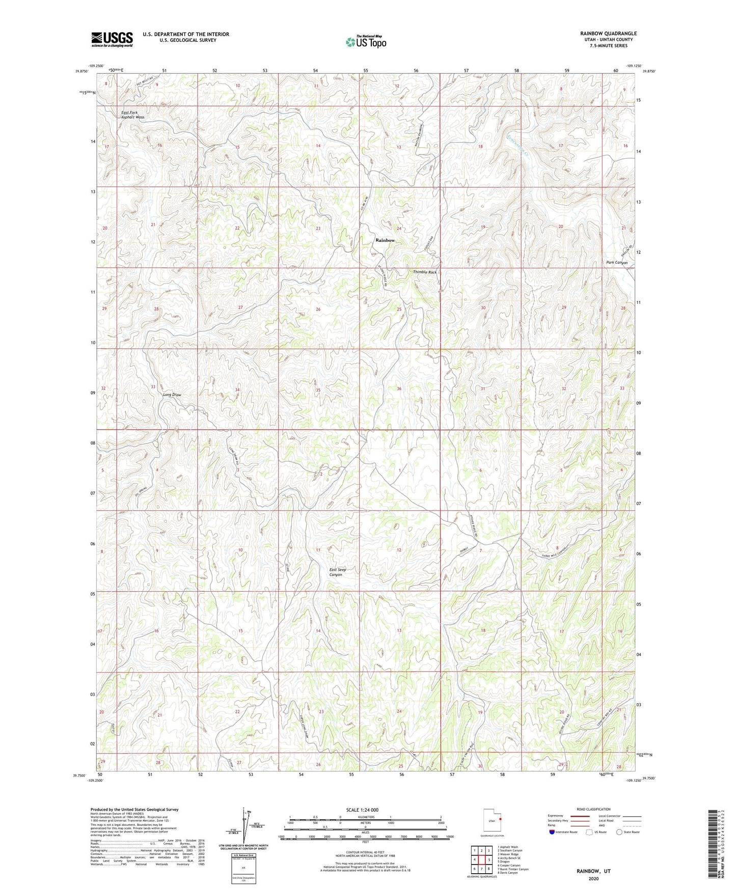
2023 topographic map quadrangle Rainbow in the state of Utah. Scale: 1:24000. Based on the newly updated USGS 7.5' US Topo map series, this map is in the following counties: Uintah. The map contains contour data, water features, and other items you are used to seeing on USGS maps, but also has updated roads and other features. This is the next generation of topographic maps. Printed on high-quality waterproof paper with UV fade-resistant inks.
Quads adjacent to this one:
West: Archy Bench SE
Northwest: Asphalt Wash
North: Southam Canyon
Northeast: Weaver Ridge
East: Dragon
Southeast: Davis Canyon
South: Burnt Timber Canyon
Southwest: Cooper Canyon
This map covers the same area as the classic USGS quad with code o39109g2.
Contains the following named places: East Fork Asphalt Wash, East Seep Canyon, Kings Well, Long Draw, Oil Springs Oil and Gas Field, Park Canyon, Rainbow, Thimble Rock