MyTopo
Banta Ridge Colorado US Topo Map
Couldn't load pickup availability
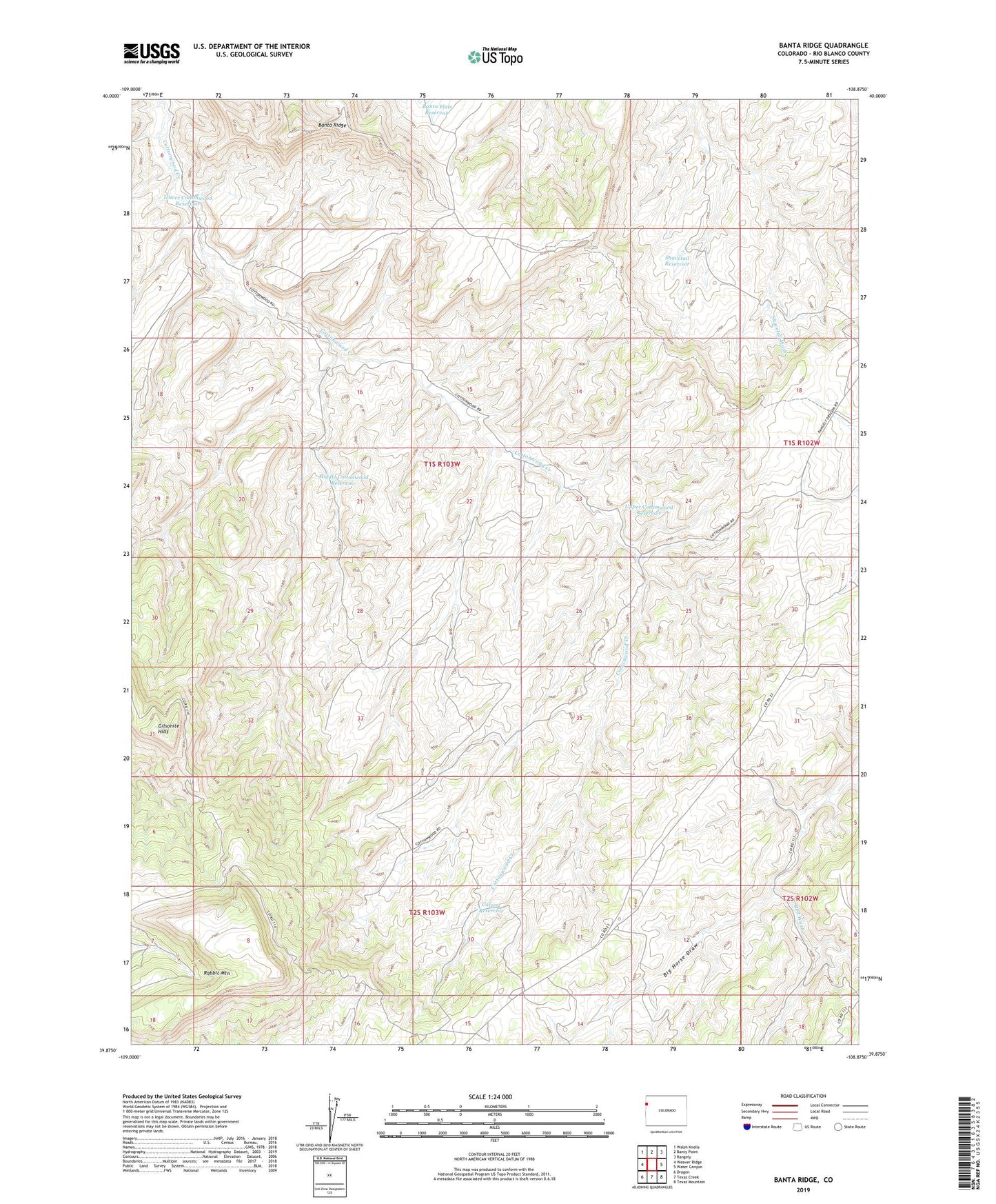
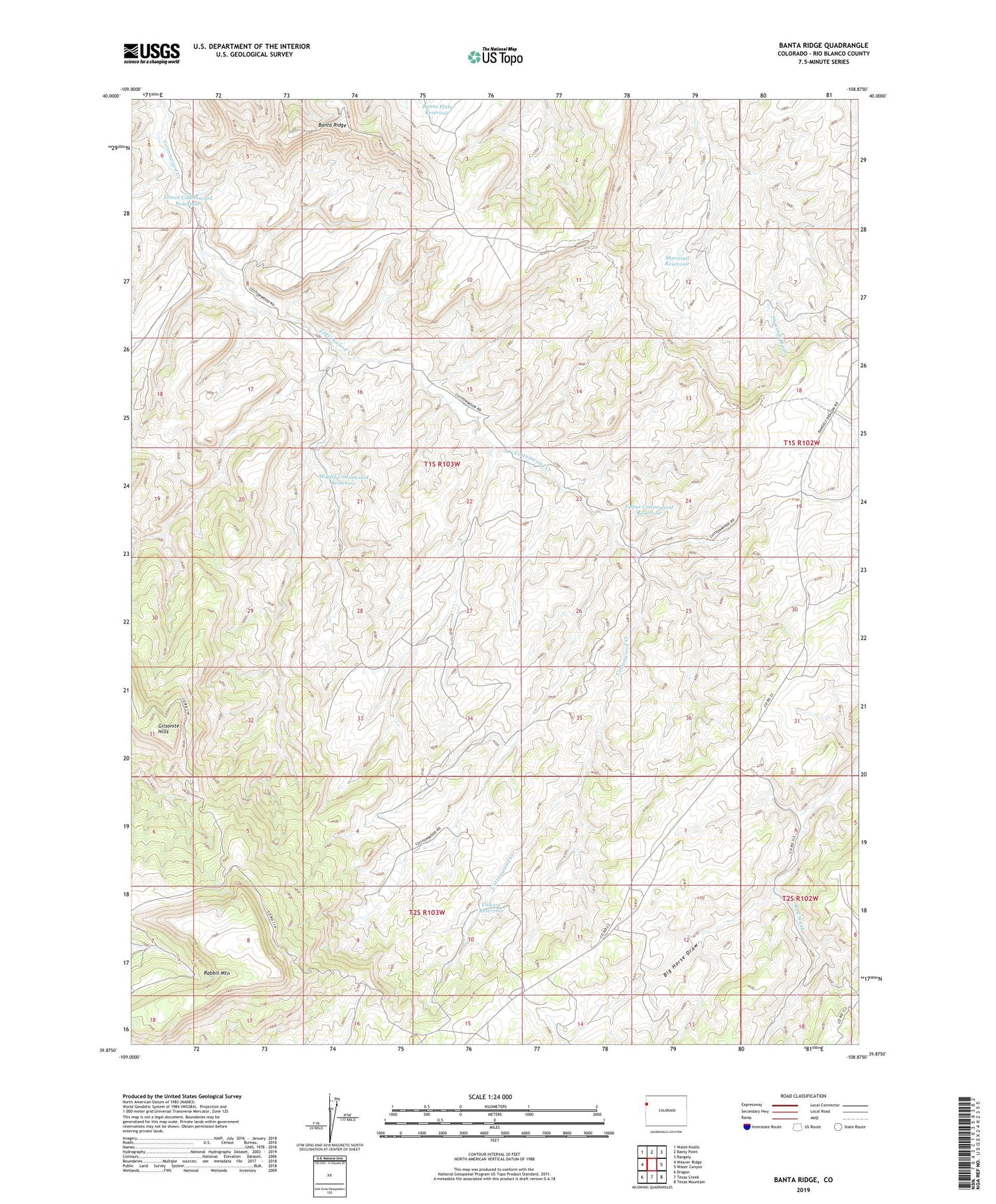
2022 topographic map quadrangle Banta Ridge in the state of Colorado. Scale: 1:24000. Based on the newly updated USGS 7.5' US Topo map series, this map is in the following counties: Rio Blanco. The map contains contour data, water features, and other items you are used to seeing on USGS maps, but also has updated roads and other features. This is the next generation of topographic maps. Printed on high-quality waterproof paper with UV fade-resistant inks.
Quads adjacent to this one:
West: Weaver Ridge
Northwest: Walsh Knolls
North: Banty Point
Northeast: Rangely
East: Water Canyon
Southeast: Texas Mountain
South: Texas Creek
Southwest: Dragon
This map covers the same area as the classic USGS quad with code o39108h8.
Contains the following named places: Banta Flats Reservoir, Banta Ridge, Calvert Reservoir, Gilsonite Hills, Lower Cottonwood Reservoir, Middle Cottonwood Reservoir, Rabbit Mountain, Red Wash, Shavetail Reservoir, Upper Cottonwood Reservoir