MyTopo
East of the Navajo Utah US Topo Map
Couldn't load pickup availability
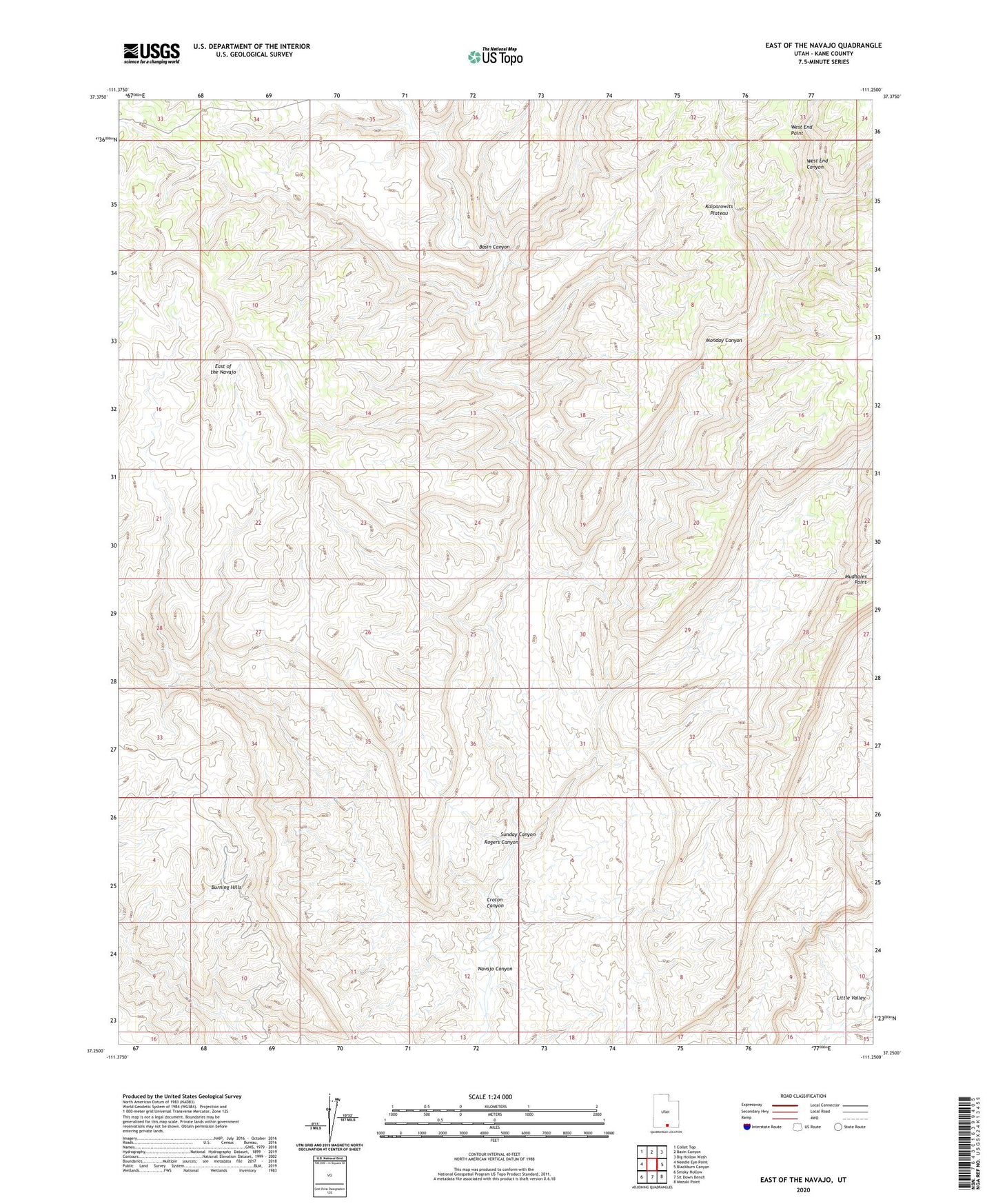
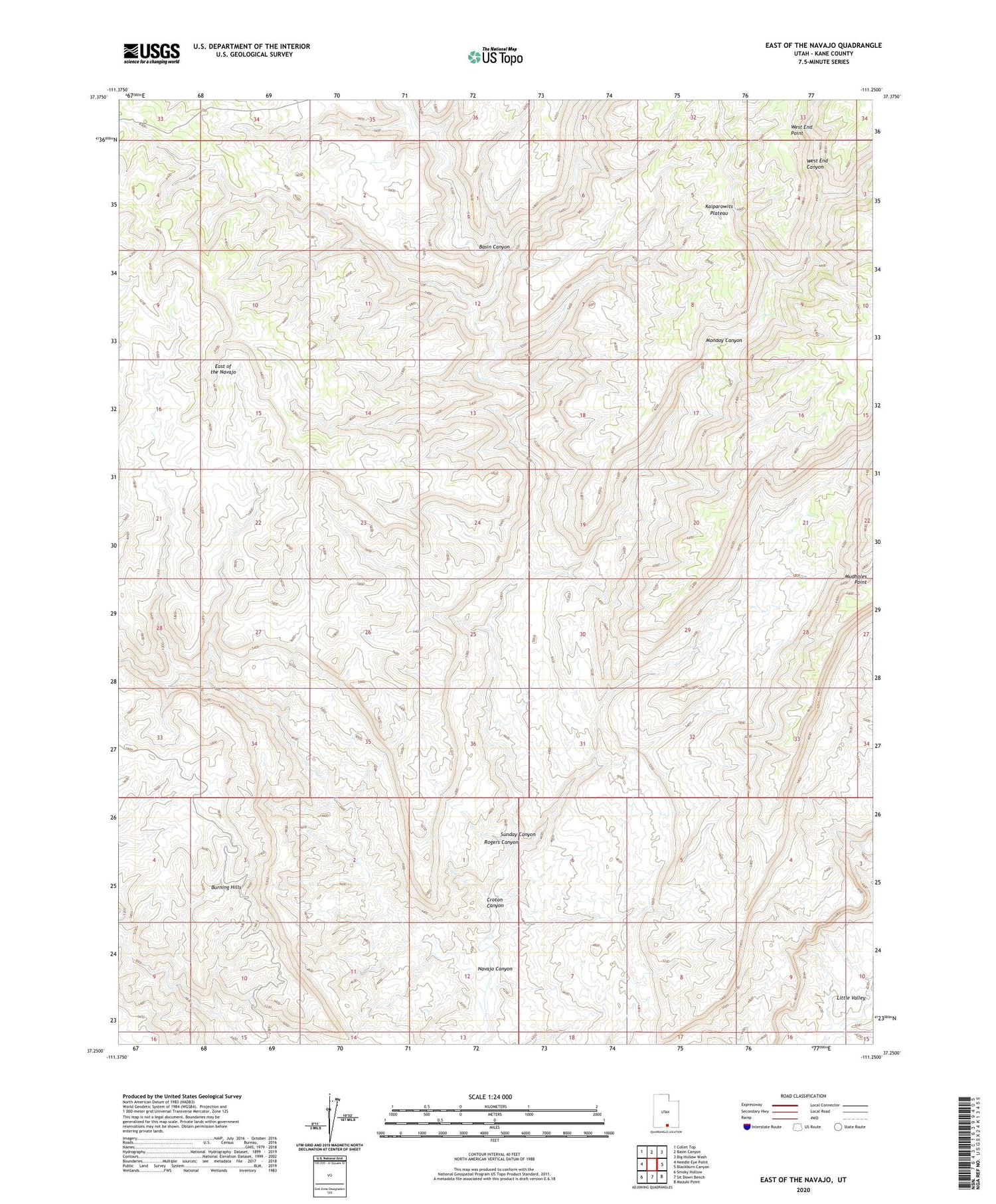
2020 topographic map quadrangle East of the Navajo in the state of Utah. Scale: 1:24000. Based on the newly updated USGS 7.5' US Topo map series, this map is in the following counties: Kane. The map contains contour data, water features, and other items you are used to seeing on USGS maps, but also has updated roads and other features. This is the next generation of topographic maps. Printed on high-quality waterproof paper with UV fade-resistant inks.
Quads adjacent to this one:
West: Needle Eye Point
Northwest: Collet Top
North: Basin Canyon
Northeast: Big Hollow Wash
East: Blackburn Canyon
Southeast: Mazuki Point
South: Sit Down Bench
Southwest: Smoky Hollow
Contains the following named places: Basin Canyon, East of the Navajo, Monday Canyon, Navajo Canyon, Rogers Canyon, Sunday Canyon, West End Canyon