MyTopo
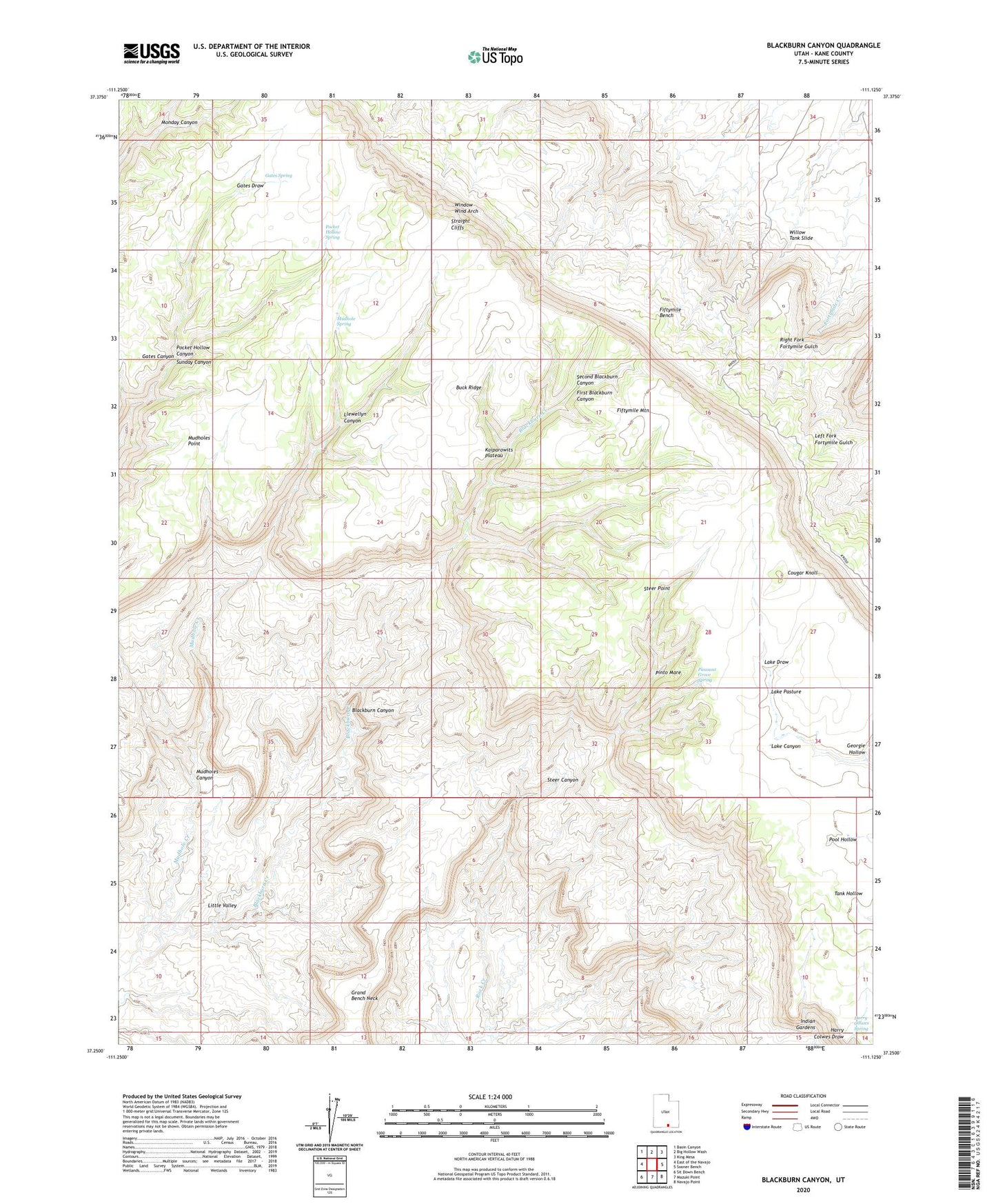
Blackburn Canyon Utah US Topo Map
Couldn't load pickup availability
2023 topographic map quadrangle Blackburn Canyon in the state of Utah. Scale: 1:24000. Based on the newly updated USGS 7.5' US Topo map series, this map is in the following counties: Kane. The map contains contour data, water features, and other items you are used to seeing on USGS maps, but also has updated roads and other features. This is the next generation of topographic maps. Printed on high-quality waterproof paper with UV fade-resistant inks.
Quads adjacent to this one:
West: East of the Navajo
Northwest: Basin Canyon
North: Big Hollow Wash
Northeast: King Mesa
East: Sooner Bench
Southeast: Navajo Point
South: Mazuki Point
Southwest: Sit Down Bench
This map covers the same area as the classic USGS quad with code o37111c2.
Contains the following named places: Aspen Patch, Blackburn Canyon, Blackburn Creek, Buck Ridge, Cougar Knoll, Fiftymile Bench, Fiftymile Mountain, First Blackburn Canyon, Gates Canyon, Gates Draw, Gates Spring, Georgie Hollow, Grand Bench Neck, Harry Colwes Draw, Harry Colwes Spring, Indian Gardens, Lake Draw, Lake Pasture, Little Valley, Llewellyn Canyon, Middle Trail, Mudhole Creek, Mudhole Spring, Mudholes Canyon, Mudholes Point, Pinto Mare, Pleasant Grove, Pleasant Grove Spring, Pocket Hollow Canyon, Pocket Hollow Spring, Second Blackburn Canyon, Steer Canyon, Steer Point, Straight Cliffs, Willow Tank Slide, Window Wind Arch