MyTopo
Needle Eye Point Utah US Topo Map
Couldn't load pickup availability
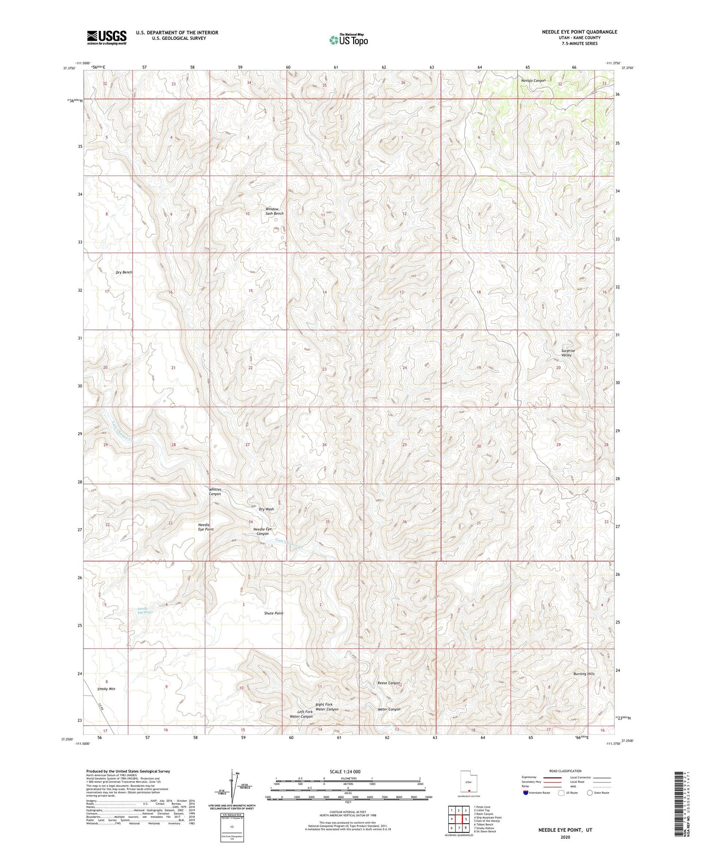
2023 topographic map quadrangle Needle Eye Point in the state of Utah. Scale: 1:24000. Based on the newly updated USGS 7.5' US Topo map series, this map is in the following counties: Kane. The map contains contour data, water features, and other items you are used to seeing on USGS maps, but also has updated roads and other features. This is the next generation of topographic maps. Printed on high-quality waterproof paper with UV fade-resistant inks.
Quads adjacent to this one:
West: Ship Mountain Point
Northwest: Petes Cove
North: Collet Top
Northeast: Basin Canyon
East: East of the Navajo
Southeast: Sit Down Bench
South: Smoky Hollow
Southwest: Tibbet Bench
This map covers the same area as the classic USGS quad with code o37111c4.
Contains the following named places: Bullberry Creek, Burning Hills, Dry Wash, Left Fork Water Canyon, Needle Eye Canyon, Needle Eye Point, Needle Eye Water, Reese Canyon, Right Fork Water Canyon, Shute Point, Surprise Valley, Water Canyon, Whities Canyon