MyTopo
Farnsworth Peak Utah US Topo Map
Couldn't load pickup availability
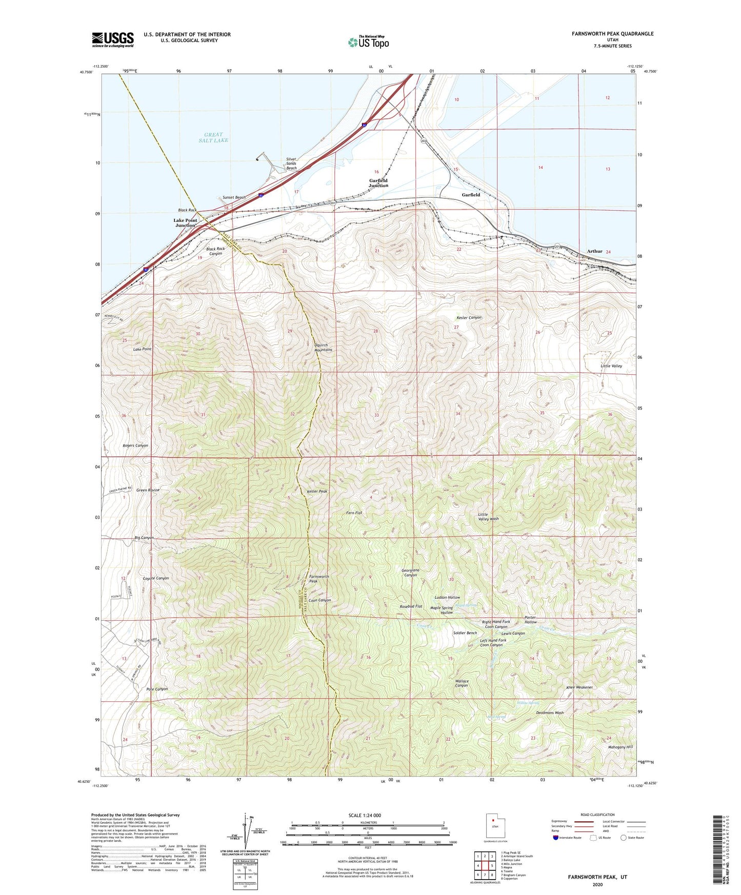
2020 topographic map quadrangle Farnsworth Peak in the state of Utah. Scale: 1:24000. Based on the newly updated USGS 7.5' US Topo map series, this map is in the following counties: Salt Lake, Tooele. The map contains contour data, water features, and other items you are used to seeing on USGS maps, but also has updated roads and other features. This is the next generation of topographic maps. Printed on high-quality waterproof paper with UV fade-resistant inks.
Quads adjacent to this one:
West: Mills Junction
Northwest: Plug Peak SE
North: Antelope Island South
Northeast: Baileys Lake
East: Magna
Southeast: Copperton
South: Bingham Canyon
Southwest: Tooele
Contains the following named places: Arthur, Big Canyon, Black Rock, Black Rock Beach, Black Rock Canyon, BP Minerals-Garfield Heliport, Coyote Canyon, Farnsworth Peak, Fern Flat, Garfield, Garfield Junction, Georgiana Canyon, Green Ravine, KDAB-FM (Ogden), Kennecott Tailings Pond Number One Dam, Kennecott Tailings Pond Number Two, Kennecott Tailings Pond Number Two Dam, Kesler Canyon, Kesler Peak, KISN-FM (Salt Lake City), Knee Weakener, KQPD-FM (Ogden), KRCL-FM (Salt Lake City), KRSP-FM (Salt Lake City), KSFI-FM (Salt Lake City), KSLT-TV (Salt Lake City), KSOP-FM (Salt Lake City), KSTU-TV (Salt Lake City), KWHO-FM (Salt Lake City), KZAN-FM (Ogden), Lake Point, Lake Point Junction, Left Hand Fork Coon Canyon, Lewis Canyon, Little Farnsworth Peak Heliport, Little Valley, Ludson Hollow, Mahogany Hill, Maple Spring, Maple Spring Hollow, Mud Spring, Pole Canyon, Porter Hollow, Right Hand Fork Coon Canyon, Rogers Canyon, Rosebud Flat, Silver Sands Beach, Soldier Bench, Sunset Beach, Viewpoint, Wallace Canyon, Willow Creek, Willow Spring, ZIP Code: 84044