MyTopo
Baileys Lake Utah US Topo Map
Couldn't load pickup availability
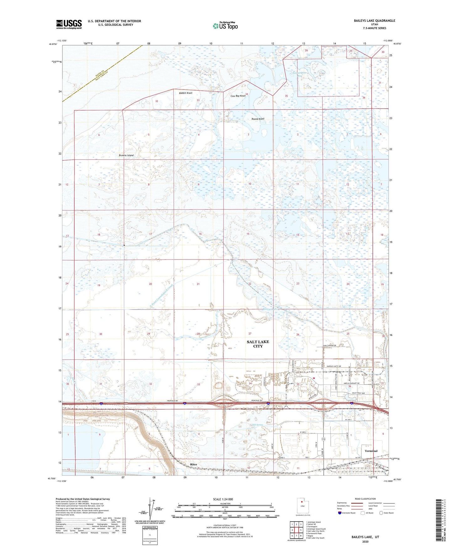
2023 topographic map quadrangle Baileys Lake in the state of Utah. Scale: 1:24000. Based on the newly updated USGS 7.5' US Topo map series, this map is in the following counties: Salt Lake, Davis. The map contains contour data, water features, and other items you are used to seeing on USGS maps, but also has updated roads and other features. This is the next generation of topographic maps. Printed on high-quality waterproof paper with UV fade-resistant inks.
Quads adjacent to this one:
West: Antelope Island South
Northwest: Antelope Island
North: Saltair NE
Northeast: Farmington
East: Salt Lake City North
Southeast: Salt Lake City South
South: Magna
Southwest: Farnsworth Peak
This map covers the same area as the classic USGS quad with code o40112g1.
Contains the following named places: Baileys Lake, Bonneville Center, Brighton Drain, Browns Island, Cow Bay Knoll, Goggin Drain, Harrison Duck Club, KSL-AM (Salt Lake City), Lake Front Duck Club, Magna Division, Maplewood Addition, North Point Consolidated Canal, Rabbit Knoll, Riter, Riter Drain, Round Knoll, Rudy Duck Club, Salt Lake City Fire Department Fire Station 9, Salt Lake City Fire Station Number 9, Salt Lake International Center, Salt Spring, Saltair, Terminal, Utah Duck Club, West Branch Brighton Canal