MyTopo
Gordon Flats Utah US Topo Map
Couldn't load pickup availability
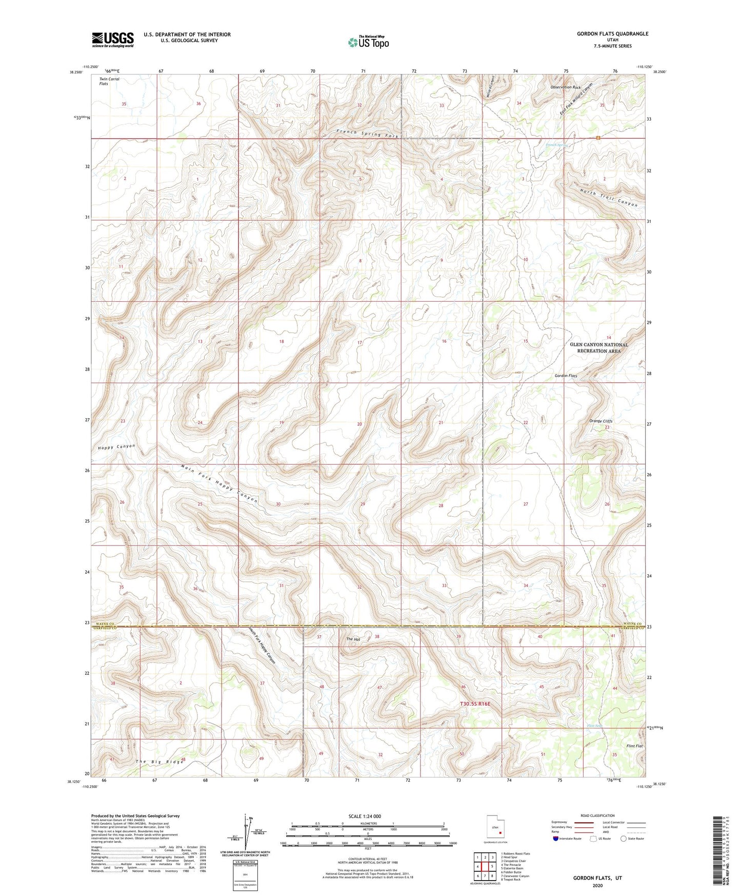
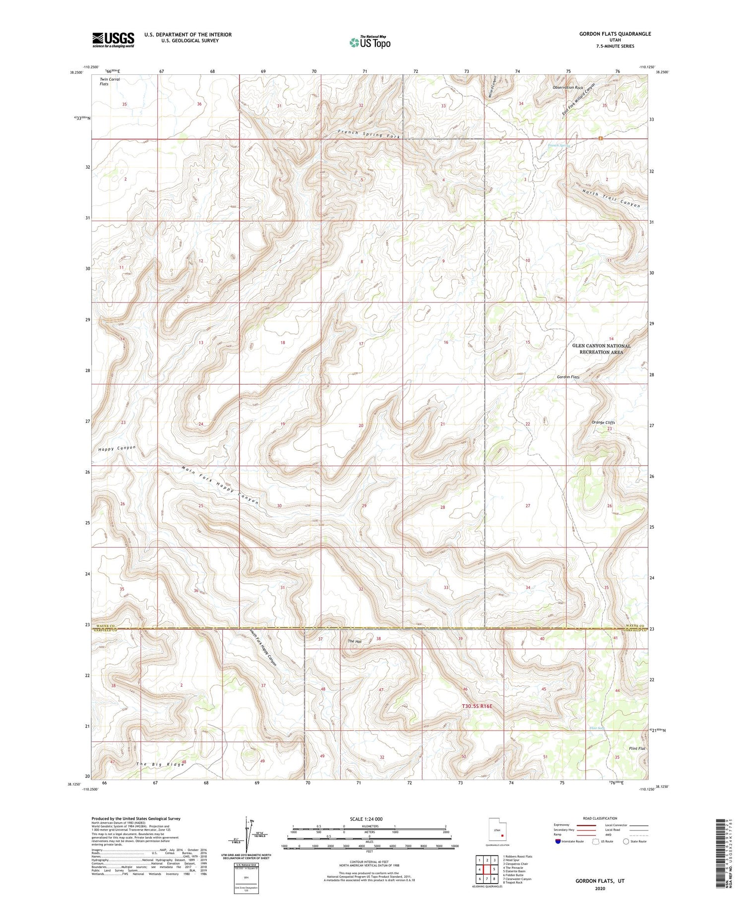
2020 topographic map quadrangle Gordon Flats in the state of Utah. Scale: 1:24000. Based on the newly updated USGS 7.5' US Topo map series, this map is in the following counties: Wayne, Garfield. The map contains contour data, water features, and other items you are used to seeing on USGS maps, but also has updated roads and other features. This is the next generation of topographic maps. Printed on high-quality waterproof paper with UV fade-resistant inks.
Quads adjacent to this one:
West: The Pinnacle
Northwest: Robbers Roost Flats
North: Head Spur
Northeast: Cleopatras Chair
East: Elaterite Basin
Southeast: Teapot Rock
South: Clearwater Canyon
Southwest: Fiddler Butte
Contains the following named places: Bagpipe Butte Overlook, Flint Flat, Flint Seep, French Spring, French Spring Fork, Gordon Flats, Gordon Flats Airport, Main Fork Happy Canyon, North Point, Observation Rock, South Fork Happy Canyon, The Hat