MyTopo
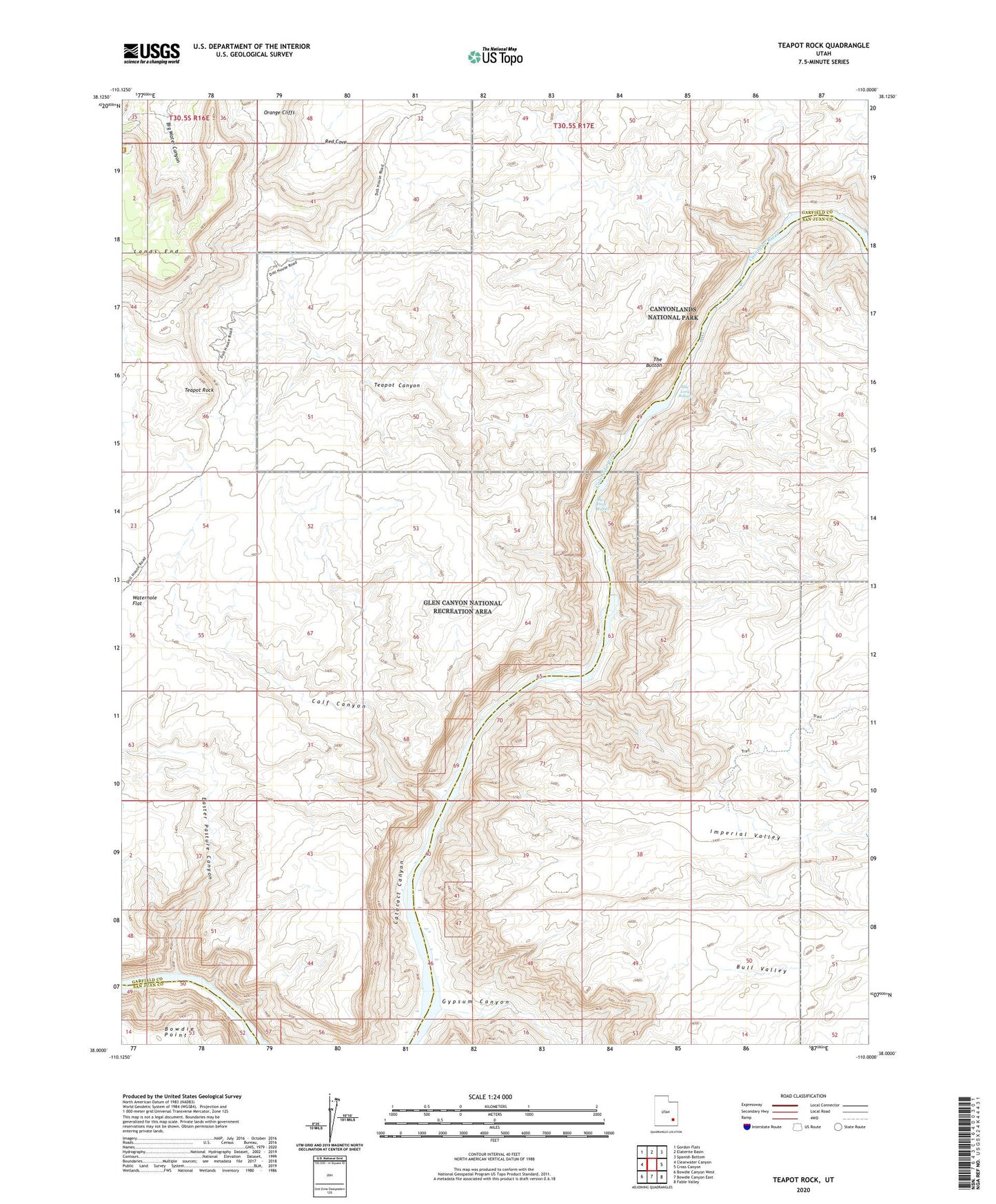
Teapot Rock Utah US Topo Map
Couldn't load pickup availability
2023 topographic map quadrangle Teapot Rock in the state of Utah. Scale: 1:24000. Based on the newly updated USGS 7.5' US Topo map series, this map is in the following counties: Garfield, San Juan. The map contains contour data, water features, and other items you are used to seeing on USGS maps, but also has updated roads and other features. This is the next generation of topographic maps. Printed on high-quality waterproof paper with UV fade-resistant inks.
Quads adjacent to this one:
West: Clearwater Canyon
Northwest: Gordon Flats
North: Elaterite Basin
Northeast: Spanish Bottom
East: Cross Canyon
Southeast: Fable Valley
South: Bowdie Canyon East
Southwest: Bowdie Canyon West
This map covers the same area as the classic USGS quad with code o38110a1.
Contains the following named places: Best Inscription-1891, Big Drop Rapids, Bull Valley, Calf Canyon, Easter Pasture Canyon, Eddy Inscription-1927, Flint Cove, Flint Trail, Gypsum Canyon, Imperial Valley, Kolb Inscription-1911, Mile Long Rapids, Nevills Inscription, Ocean Point, Range Canyon, Red Cove, Teapot Canyon, Teapot Rock, The Button, Waterhole Flat