MyTopo
Grass Lakes Utah US Topo Map
Couldn't load pickup availability
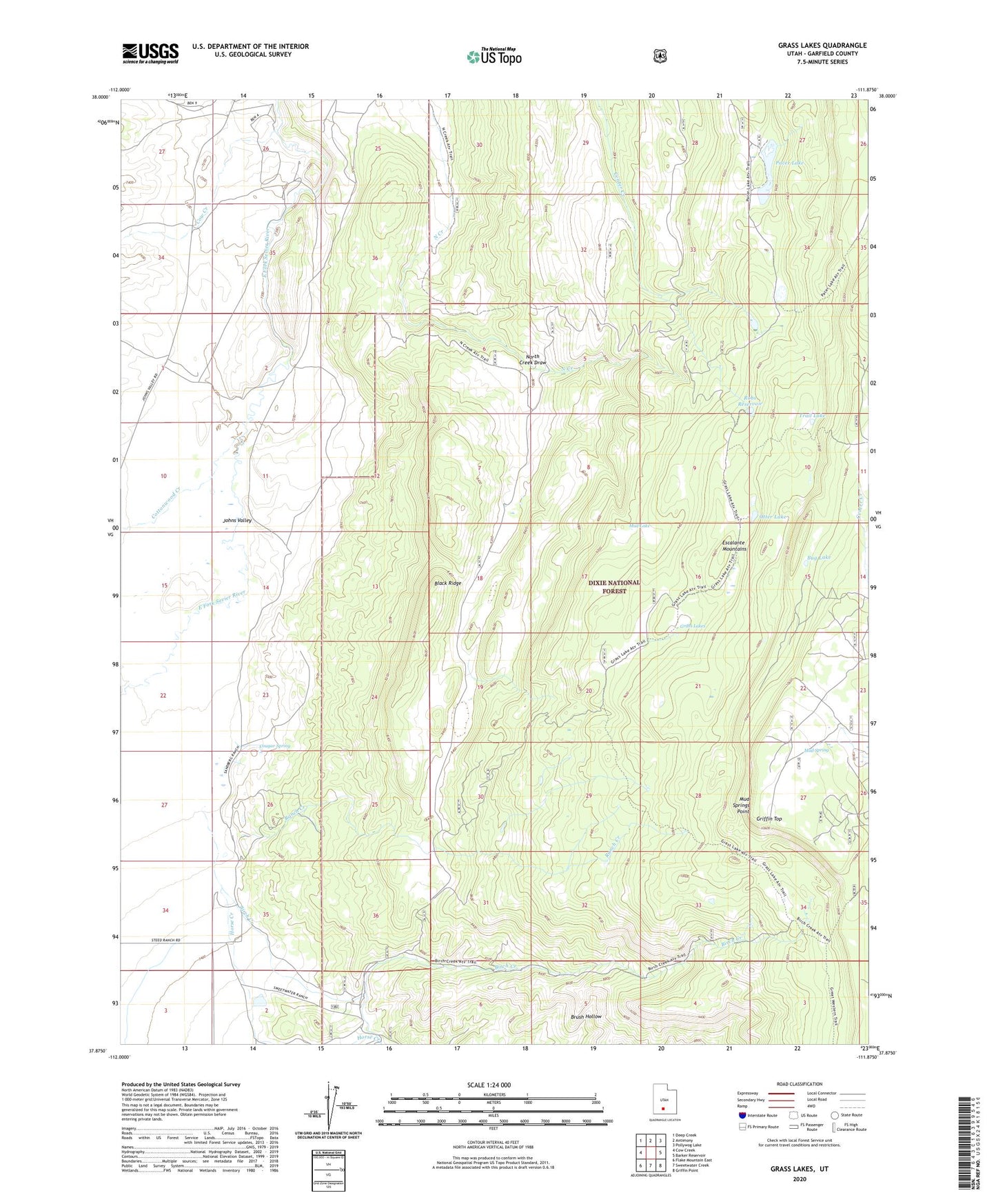
2020 topographic map quadrangle Grass Lakes in the state of Utah. Scale: 1:24000. Based on the newly updated USGS 7.5' US Topo map series, this map is in the following counties: Garfield. The map contains contour data, water features, and other items you are used to seeing on USGS maps, but also has updated roads and other features. This is the next generation of topographic maps. Printed on high-quality waterproof paper with UV fade-resistant inks.
Quads adjacent to this one:
West: Cow Creek
Northwest: Deep Creek
North: Antimony
Northeast: Pollywog Lake
East: Barker Reservoir
Southeast: Griffin Point
South: Sweetwater Creek
Southwest: Flake Mountain East
Contains the following named places: Birch Creek, Black Ridge, Bug Lake, Cottonwood Creek, Cougar Spring, Cow Creek, Grass Lakes, Griffin Top, Horse Creek, Mud Lake, Mud Spring, Mud Springs Point, North Creek Draw, Otter Lake, Pacer Lake, Pacer Lake Reservoir Dam, Ranch Creek, Riddle Lake, Robs Reservoir, Round Willow Bottom Dam, Round Willow Bottom Reservoir, Trail Lake, Twin Lakes, ZIP Code: 84712