MyTopo
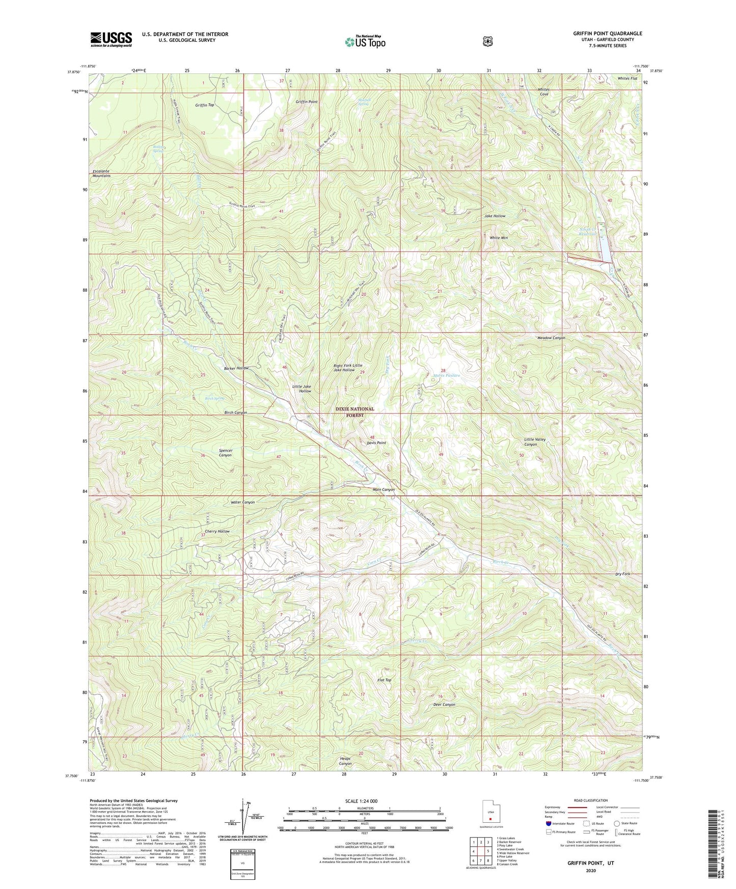
Griffin Point Utah US Topo Map
Couldn't load pickup availability
Also explore the Griffin Point Forest Service Topo of this same quad for updated USFS data
2023 topographic map quadrangle Griffin Point in the state of Utah. Scale: 1:24000. Based on the newly updated USGS 7.5' US Topo map series, this map is in the following counties: Garfield. The map contains contour data, water features, and other items you are used to seeing on USGS maps, but also has updated roads and other features. This is the next generation of topographic maps. Printed on high-quality waterproof paper with UV fade-resistant inks.
Quads adjacent to this one:
West: Sweetwater Creek
Northwest: Grass Lakes
North: Barker Reservoir
Northeast: Posy Lake
East: Wide Hollow Reservoir
Southeast: Canaan Creek
South: Upper Valley
Southwest: Pine Lake
This map covers the same area as the classic USGS quad with code o37111g7.
Contains the following named places: Barker Hollow, Barney Top, Birch Canyon, Birch Spring, Boiling Spring, Cherry Creek, Cherry Creek Mine, Cherry Hollow, Corn Creek, Corn Creek Mine, Davis Point, Dry Fork, Flat Top, Griffin Point, Hall Creek, Jake Hollow, Little Jake Hollow, Marts Pasture, Mitchell Spring, North Creek Dam, North Creek Reservoir, Right Fork Little Jake Hollow, Spencer Canyon, Twin Trees, Twin Trees Campground, Water Canyon, West Fork North Creek, White Mountain, Whites Cove, Whites Flat