MyTopo
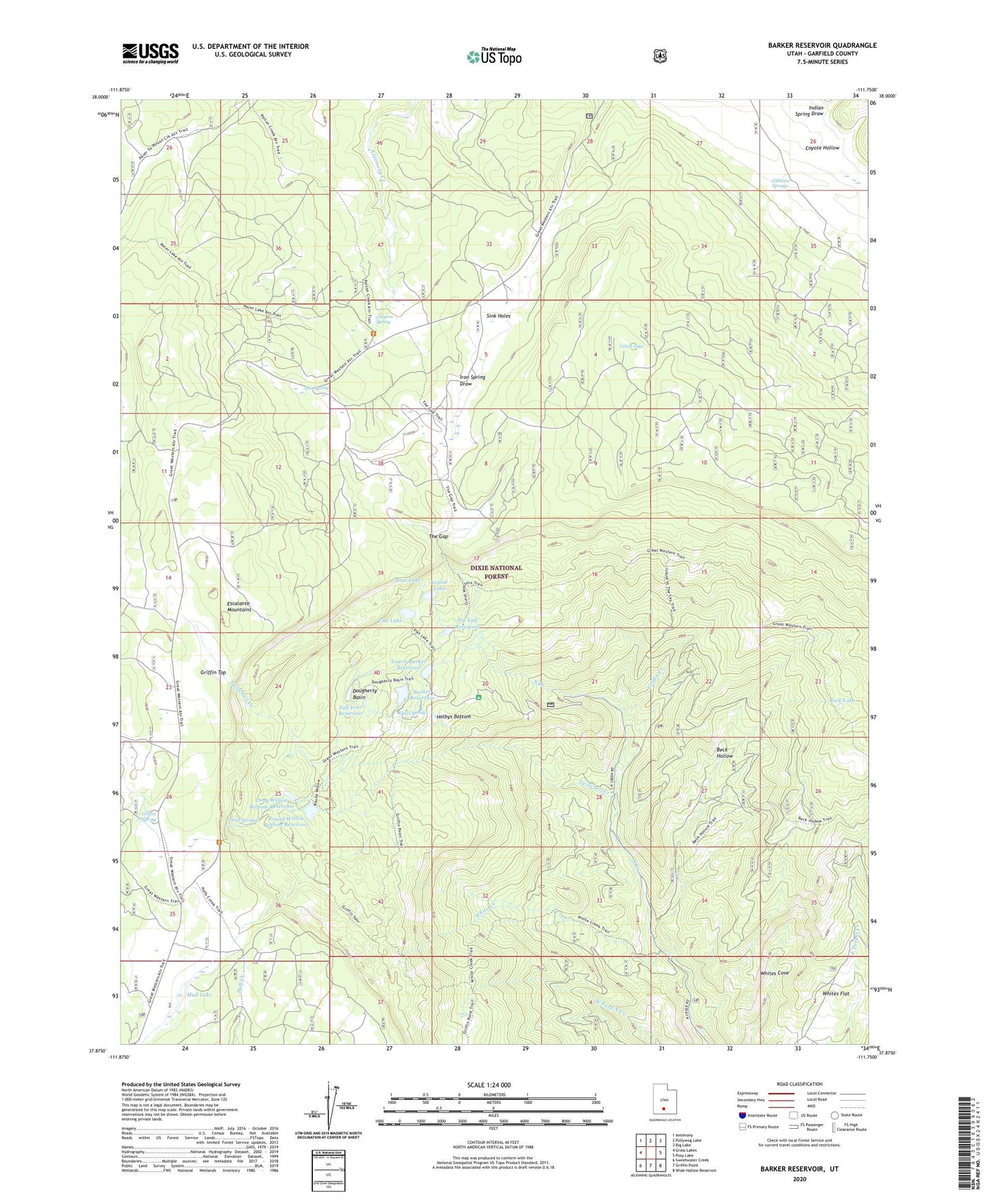
Barker Reservoir Utah US Topo Map
Couldn't load pickup availability
Also explore the Barker Reservoir Forest Service Topo of this same quad for updated USFS data
2023 topographic map quadrangle Barker Reservoir in the state of Utah. Scale: 1:24000. Based on the newly updated USGS 7.5' US Topo map series, this map is in the following counties: Garfield. The map contains contour data, water features, and other items you are used to seeing on USGS maps, but also has updated roads and other features. This is the next generation of topographic maps. Printed on high-quality waterproof paper with UV fade-resistant inks.
Quads adjacent to this one:
West: Grass Lakes
Northwest: Antimony
North: Pollywog Lake
Northeast: Big Lake
East: Posy Lake
Southeast: Wide Hollow Reservoir
South: Griffin Point
Southwest: Sweetwater Creek
This map covers the same area as the classic USGS quad with code o37111h7.
Contains the following named places: Barker Dam, Barker Reservoir, Barker Reservoir Campground, Beck Hollow, Blue Lake, Clayton Spring, Dougherty Basin, Escalante Mountains, Flat Lake, Gates Spring, Gibbons Springs, Griffin Creek, Griffin Spring, Holbys Bottom, Indian Spring Draw, Iron Spring, Joe Lay Reservoir, Long Willow Bottom Dam, Long Willow Bottom Reservoir, Lower Barker Dam, Lower Barker Reservoir, Mud Lake, Rock Lake, Round Willow Bottom Reservoir, Sink Holes, Tall Four Reservoir, The Gap, Three Springs, Twitchell Creek, Velvet Lake, White Creek, White Ranch, Whites Flat, Yellow Lake