MyTopo
Green River SE Utah US Topo Map
Couldn't load pickup availability
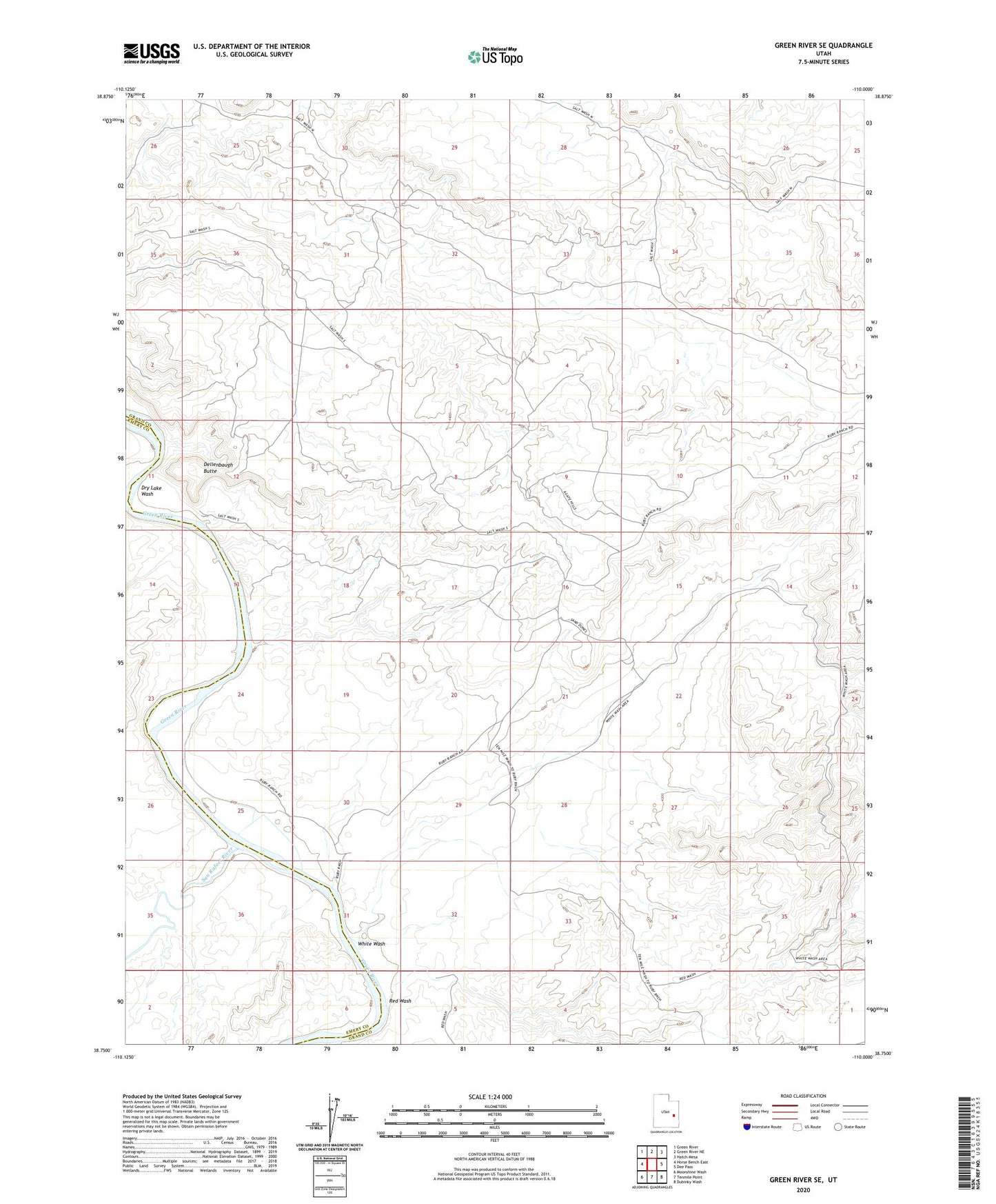
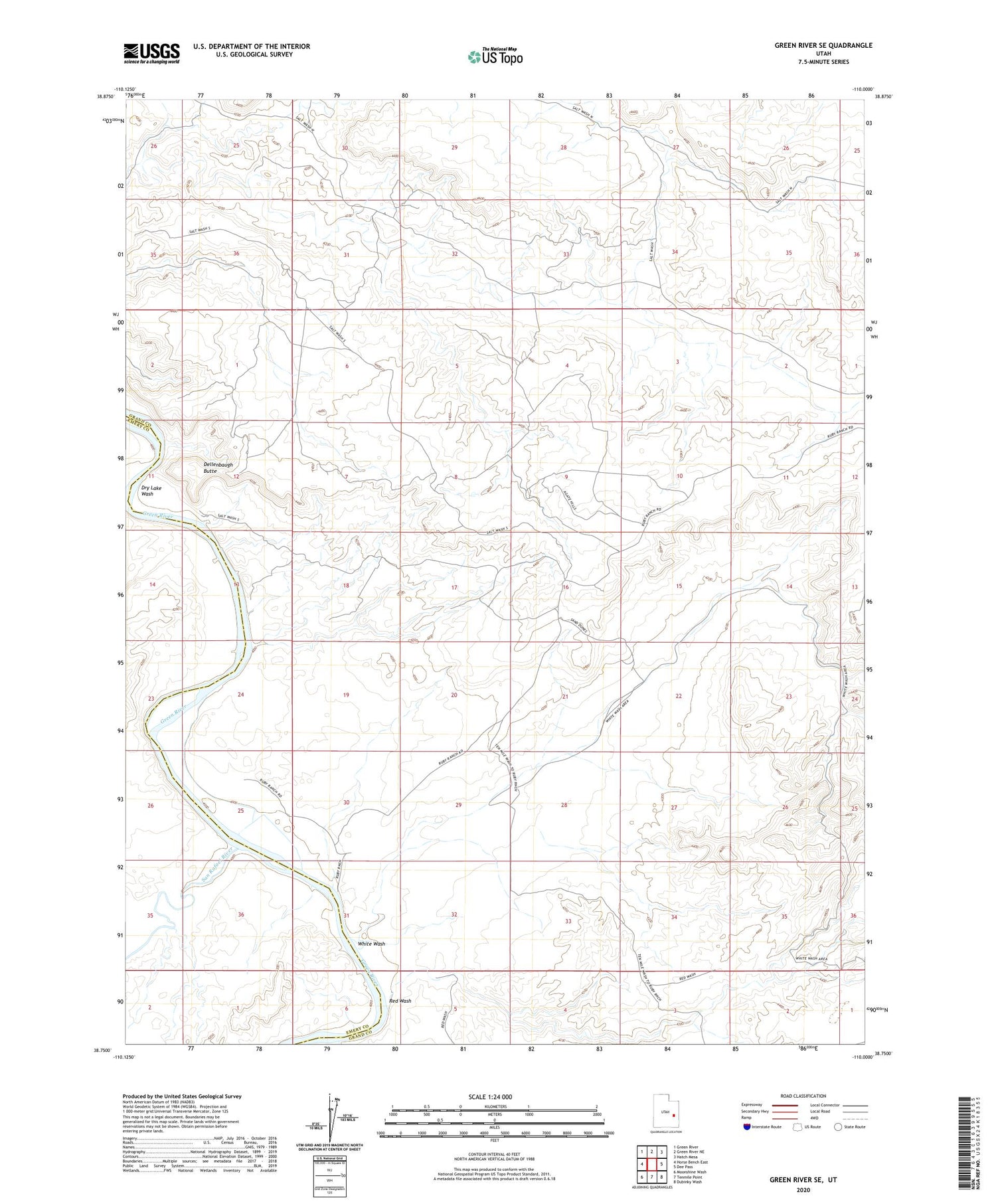
2020 topographic map quadrangle Green River SE in the state of Utah. Scale: 1:24000. Based on the newly updated USGS 7.5' US Topo map series, this map is in the following counties: Grand, Emery. The map contains contour data, water features, and other items you are used to seeing on USGS maps, but also has updated roads and other features. This is the next generation of topographic maps. Printed on high-quality waterproof paper with UV fade-resistant inks.
Quads adjacent to this one:
West: Horse Bench East
Northwest: Green River
North: Green River NE
Northeast: Hatch Mesa
East: Dee Pass
Southeast: Dubinky Wash
South: Tenmile Point
Southwest: Moonshine Wash
Contains the following named places: Dellenbaugh Butte, Red Wash, Ruby Ranch, San Rafael River, White Wash