MyTopo
Green River Utah US Topo Map
Couldn't load pickup availability
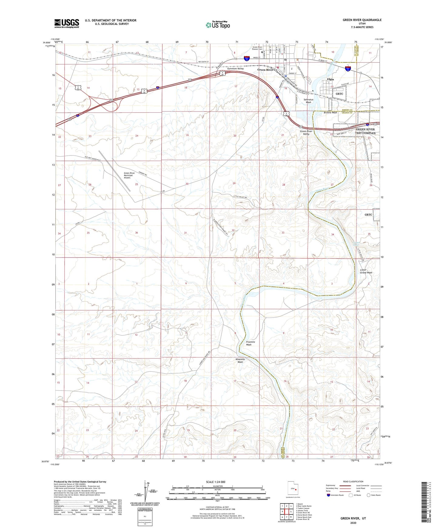
2023 topographic map quadrangle Green River in the state of Utah. Scale: 1:24000. Based on the newly updated USGS 7.5' US Topo map series, this map is in the following counties: Emery, Grand. The map contains contour data, water features, and other items you are used to seeing on USGS maps, but also has updated roads and other features. This is the next generation of topographic maps. Printed on high-quality waterproof paper with UV fade-resistant inks.
Quads adjacent to this one:
West: Jessies Twist
Northwest: Desert
North: Blue Castle Butte
Northeast: Tusher Canyon
East: Green River NE
Southeast: Green River SE
South: Horse Bench East
Southwest: Horse Bench West
This map covers the same area as the classic USGS quad with code o38110h2.
Contains the following named places: Book Cliff Elementary School, Browns Wash, City of Green River, Crystal Geyser, Elgin, Emery County Ambulance - Green River, Emery County Sheriffs Office Green River, First Baptist Church, Fivemile Wash, Green River Pioneer Cemetery, Green River, Green River Airport, Green River Bible Church, Green River Campground, Green River Fire Department, Green River Heliport, Green River Municipal Airport, Green River Post Office, Green River State Park, Green River State Recreation Area, Little Grand Wash, Ninemile Wash, Saleratus Wash, The Church of Jesus Christ of Latter Day Saints, Utah Highway Patrol Section 9 Green River Office