MyTopo
Hanksville Utah US Topo Map
Couldn't load pickup availability
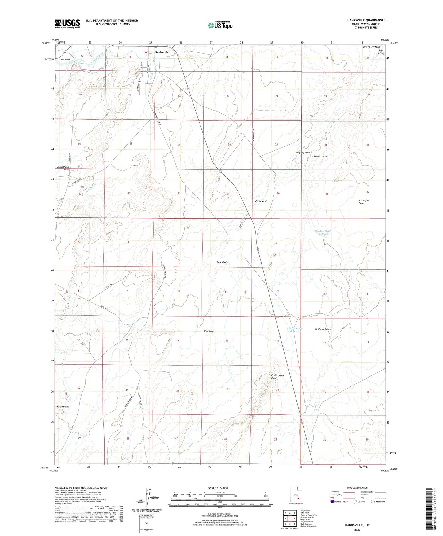
2023 topographic map quadrangle Hanksville in the state of Utah. Scale: 1:24000. Based on the newly updated USGS 7.5' US Topo map series, this map is in the following counties: Wayne. The map contains contour data, water features, and other items you are used to seeing on USGS maps, but also has updated roads and other features. This is the next generation of topographic maps. Printed on high-quality waterproof paper with UV fade-resistant inks.
Quads adjacent to this one:
West: Steamboat Point
Northwest: Skyline Rim
North: The Notch
Northeast: Point of Rocks West
East: Angel Cove
Southeast: Baking Skillet Knoll
South: Bull Mountain
Southwest: Dry Lakes Peak
This map covers the same area as the classic USGS quad with code o38110c6.
Contains the following named places: Beef Hollow Reservoir, BLM Office-Hanksville, Blue Knoll, Collie Wash, Cow Wash, Dry Valley, Halfway Bench, Halfway Wash, Hanksville, Hanksville Division, Hanksville Elementary School, Hanksville Fire Department, Hanksville Post Office, Meadow Gulch, Meadow Gulch Reservoir, Penitentiary Point, Sand Wash, South Hanksville Airport, The Church of Jesus Christ of Latter Day Saints, Town of Hanksville, Wayne County Ambulance - Hanksville, White Point, ZIP Code: 84734