
MyTopo
Horse Pasture Mesa Utah US Topo Map
Couldn't load pickup availability
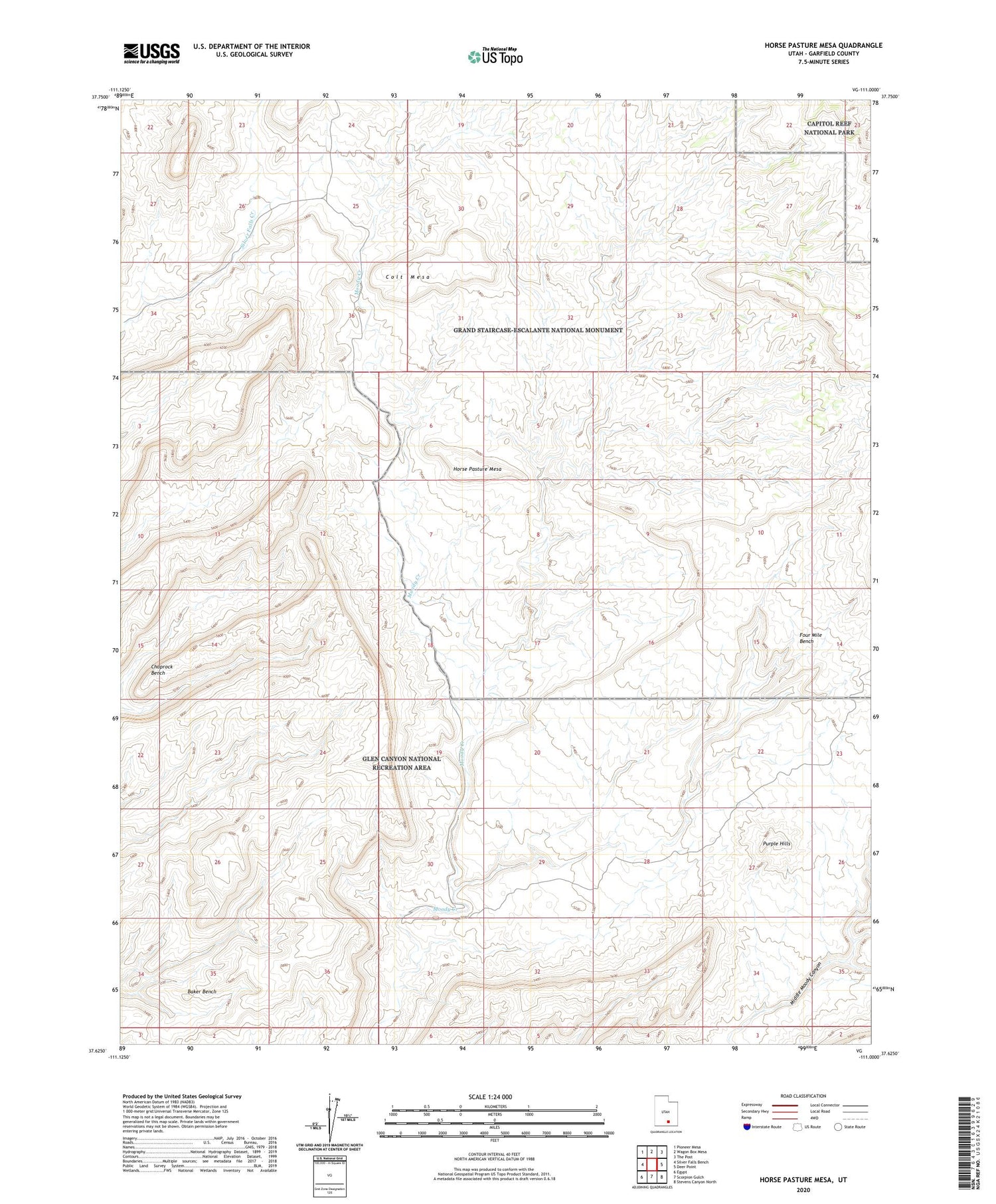
2020 topographic map quadrangle Horse Pasture Mesa in the state of Utah. Scale: 1:24000. Based on the newly updated USGS 7.5' US Topo map series, this map is in the following counties: Garfield. The map contains contour data, water features, and other items you are used to seeing on USGS maps, but also has updated roads and other features. This is the next generation of topographic maps. Printed on high-quality waterproof paper with UV fade-resistant inks.
Quads adjacent to this one:
West: Silver Falls Bench
Northwest: Pioneer Mesa
North: Wagon Box Mesa
Northeast: The Post
East: Deer Point
Southeast: Stevens Canyon North
South: Scorpion Gulch
Southwest: Egypt
Contains the following named places: Colt Mesa, Four Mile Bench, Horse Pasture Mesa, Hotshot Prospect, Purple Hills, Sneaky Prospect


