MyTopo
Hoyt Peak Utah US Topo Map
Couldn't load pickup availability
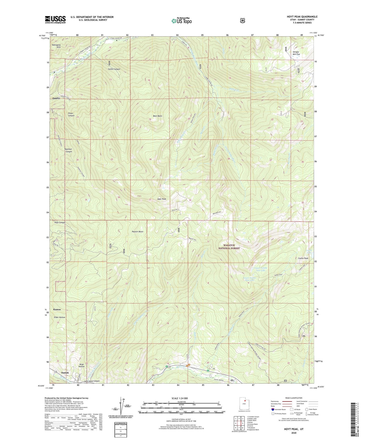
2020 topographic map quadrangle Hoyt Peak in the state of Utah. Scale: 1:24000. Based on the newly updated USGS 7.5' US Topo map series, this map is in the following counties: Summit. The map contains contour data, water features, and other items you are used to seeing on USGS maps, but also has updated roads and other features. This is the next generation of topographic maps. Printed on high-quality waterproof paper with UV fade-resistant inks.
Quads adjacent to this one:
West: Kamas
Northwest: Crandall Canyon
North: Hidden Lake
Northeast: Slader Basin
East: Erickson Basin
Southeast: Soapstone Basin
South: Woodland
Southwest: Francis
Contains the following named places: Bear Basin, Castle Lake, Castle Peak, Cedar Fork, Hoyt Peak, Kamas Wildlife Management Area, Left-hand Canyon, Lower Yellow Pine Lake, Maxwells Creek, Nobletts Creek, Paulsin Basin, Pullem Creek, Samak Census Designated Place, Shingle Mill Flat, Slate Creek, South Fork Weber River, Swifts Canyon, Upper Yellow Pine Lake, Wasatch National Forest, Weber Cottonwood Recreation Site, Welch Creek, White Pine Creek, Wide Hollow, Yellow Pine Campground, Yellow Pine Creek, ZIP Code: 84055