MyTopo
Kings Peak Utah US Topo Map
Couldn't load pickup availability
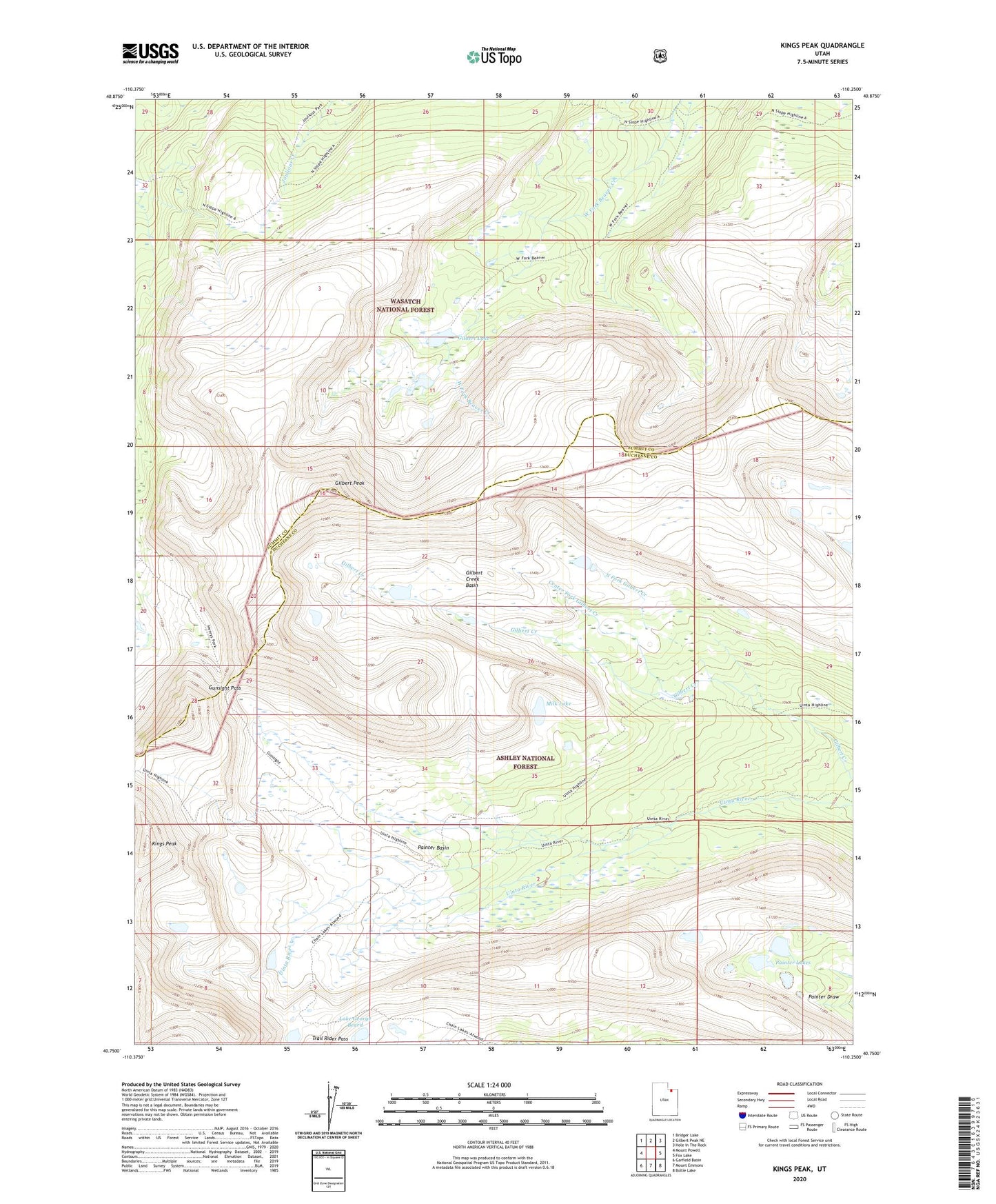
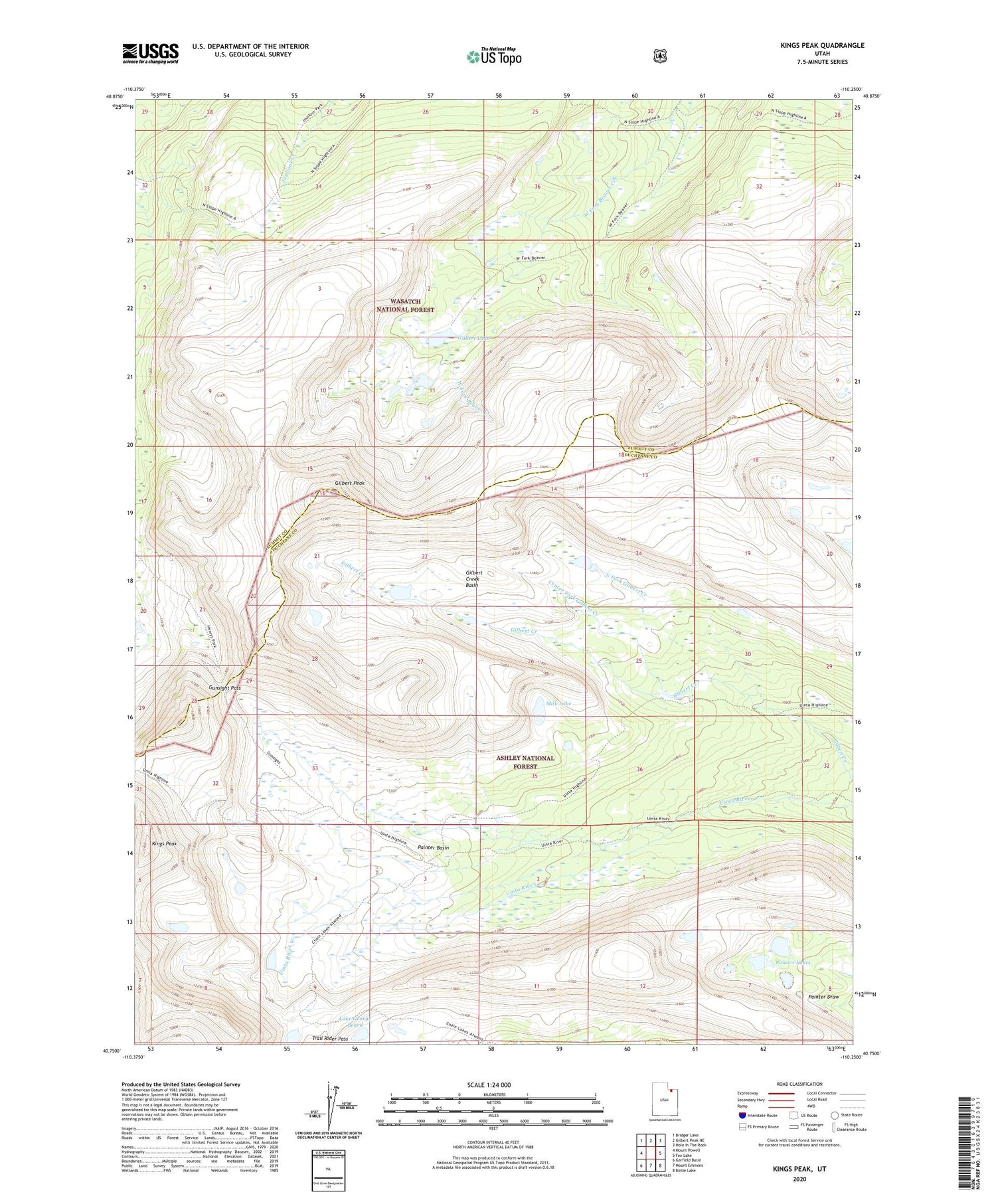
2020 topographic map quadrangle Kings Peak in the state of Utah. Scale: 1:24000. Based on the newly updated USGS 7.5' US Topo map series, this map is in the following counties: Duchesne, Summit. The map contains contour data, water features, and other items you are used to seeing on USGS maps, but also has updated roads and other features. This is the next generation of topographic maps. Printed on high-quality waterproof paper with UV fade-resistant inks.
Quads adjacent to this one:
West: Mount Powell
Northwest: Bridger Lake
North: Gilbert Peak NE
Northeast: Hole In The Rock
East: Fox Lake
Southeast: Bollie Lake
South: Mount Emmons
Southwest: Garfield Basin
Contains the following named places: Center Fork Gilbert Creek, Gilbert Creek Basin, Gilbert Lake, Gilbert Peak, Gunsight Pass, Kings Peak, Lake George Beard, Milk Lake, North Fork Gilbert Creek, Painter Basin, Painter Lakes, Trail Rider Pass