MyTopo
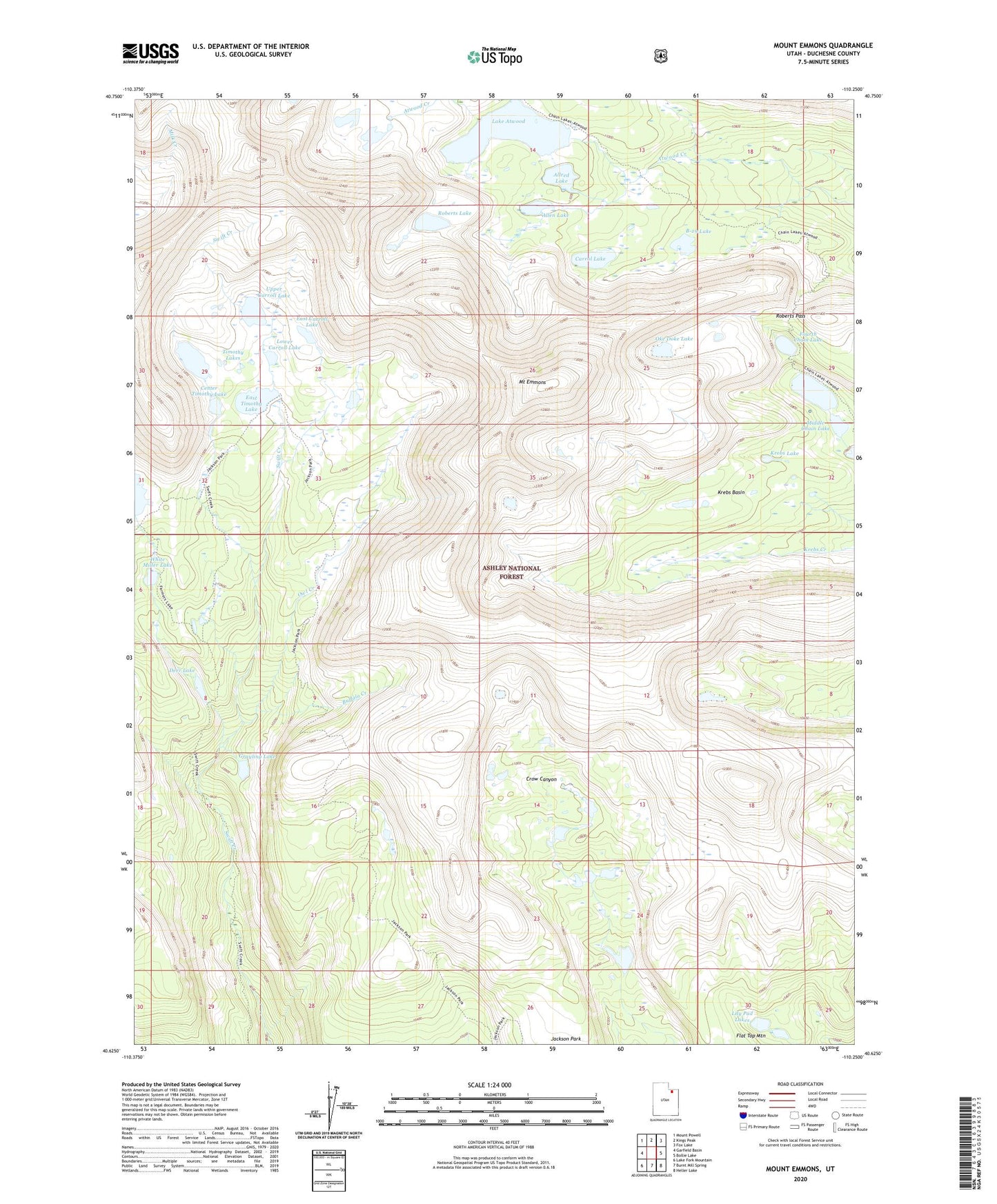
Mount Emmons Utah US Topo Map
Couldn't load pickup availability
Also explore the Mount Emmons Forest Service Topo of this same quad for updated USFS data
2023 topographic map quadrangle Mount Emmons in the state of Utah. Scale: 1:24000. Based on the newly updated USGS 7.5' US Topo map series, this map is in the following counties: Duchesne. The map contains contour data, water features, and other items you are used to seeing on USGS maps, but also has updated roads and other features. This is the next generation of topographic maps. Printed on high-quality waterproof paper with UV fade-resistant inks.
Quads adjacent to this one:
West: Garfield Basin
Northwest: Mount Powell
North: Kings Peak
Northeast: Fox Lake
East: Bollie Lake
Southeast: Heller Lake
South: Burnt Mill Spring
Southwest: Lake Fork Mountain
This map covers the same area as the classic USGS quad with code o40110f3.
Contains the following named places: Allen Lake, Allred Lake, B-29 Lake, Buffalo Creek, Carrol Lake, Center Timothy Lake, Chain Lakes, Deer Lake, Deer Lake Dam, East Carroll Lake, East Timothy Dam, East Timothy Lake, Fourth Chain Lake, Grayling Lake, Jackson Park, Krebs Basin, Krebs Lake, Lake Atwood, Lake Atwood Dam, Lily Pad Lakes, Lower Carroll Lake, Middle Chain Lake, Mount Emmons, Oke Doke Lake, Owl Creek, Roberts Lake, Roberts Pass, Timothy Lakes, Upper Carroll Lake, Upper Chain Lake, Upper Chain Lake Dam, West Timothy Lake, White Miller Lake