MyTopo
Locomotive Springs Utah US Topo Map
Couldn't load pickup availability
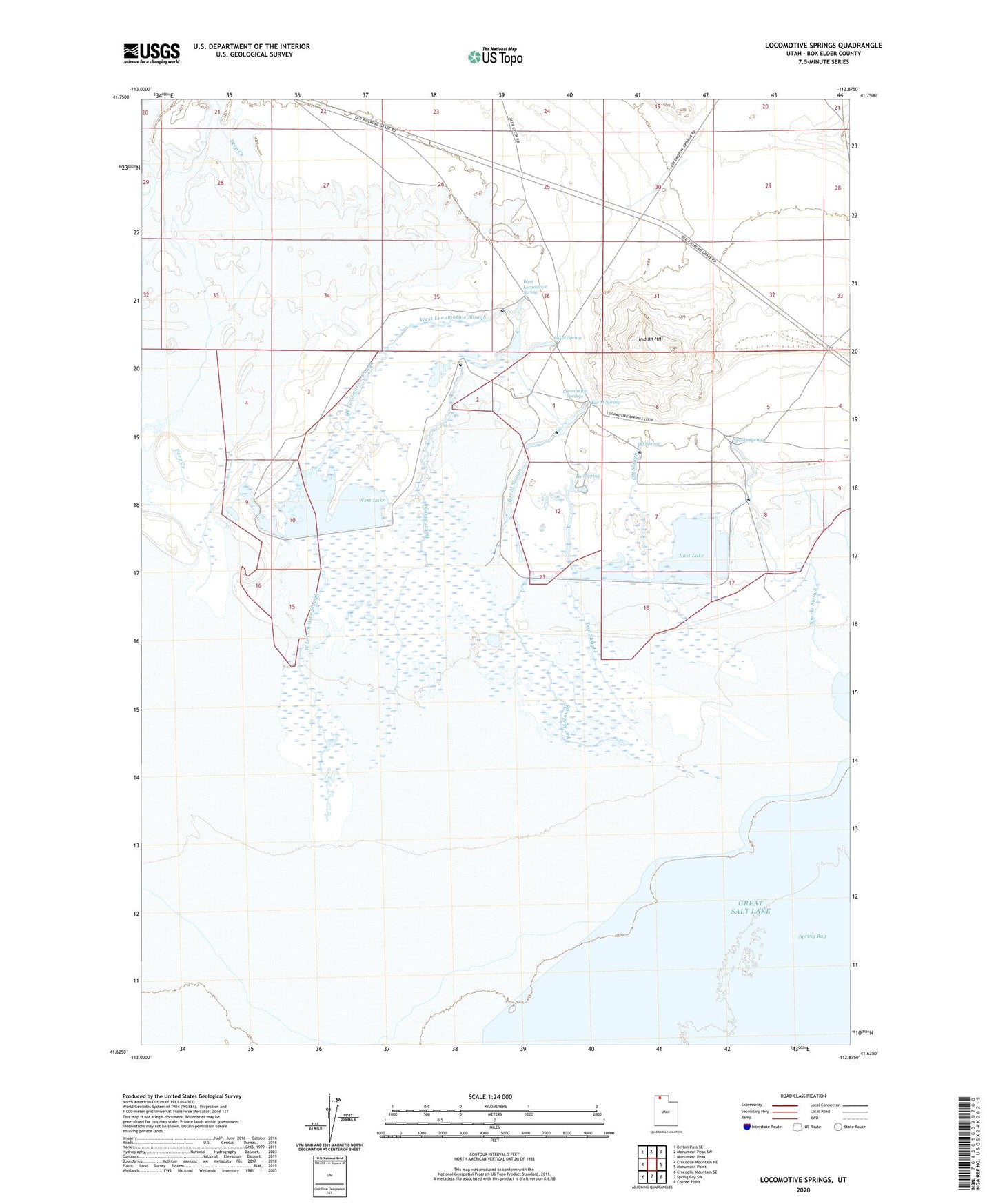
2023 topographic map quadrangle Locomotive Springs in the state of Utah. Scale: 1:24000. Based on the newly updated USGS 7.5' US Topo map series, this map is in the following counties: Box Elder. The map contains contour data, water features, and other items you are used to seeing on USGS maps, but also has updated roads and other features. This is the next generation of topographic maps. Printed on high-quality waterproof paper with UV fade-resistant inks.
Quads adjacent to this one:
West: Crocodile Mountain NE
Northwest: Kelton Pass SE
North: Monument Peak SW
Northeast: Monument Peak
East: Monument Point
Southeast: Coyote Point
South: Spring Bay SW
Southwest: Crocodile Mountain SE
This map covers the same area as the classic USGS quad with code o41112f8.
Contains the following named places: Baker Slough, Baker Spring, Bar M Slough, Bar M Spring, East Lake, Indian Hill, Locomotive Springs, Locomotive Springs Waterfowl Management Area, Off Slough, Off Spring, Sparks Slough, Sparks Spring, Teal Slough, Teal Spring, West Lake, West Locomotive Slough, West Locomotive Spring