MyTopo
Lopers Spring Utah US Topo Map
Couldn't load pickup availability
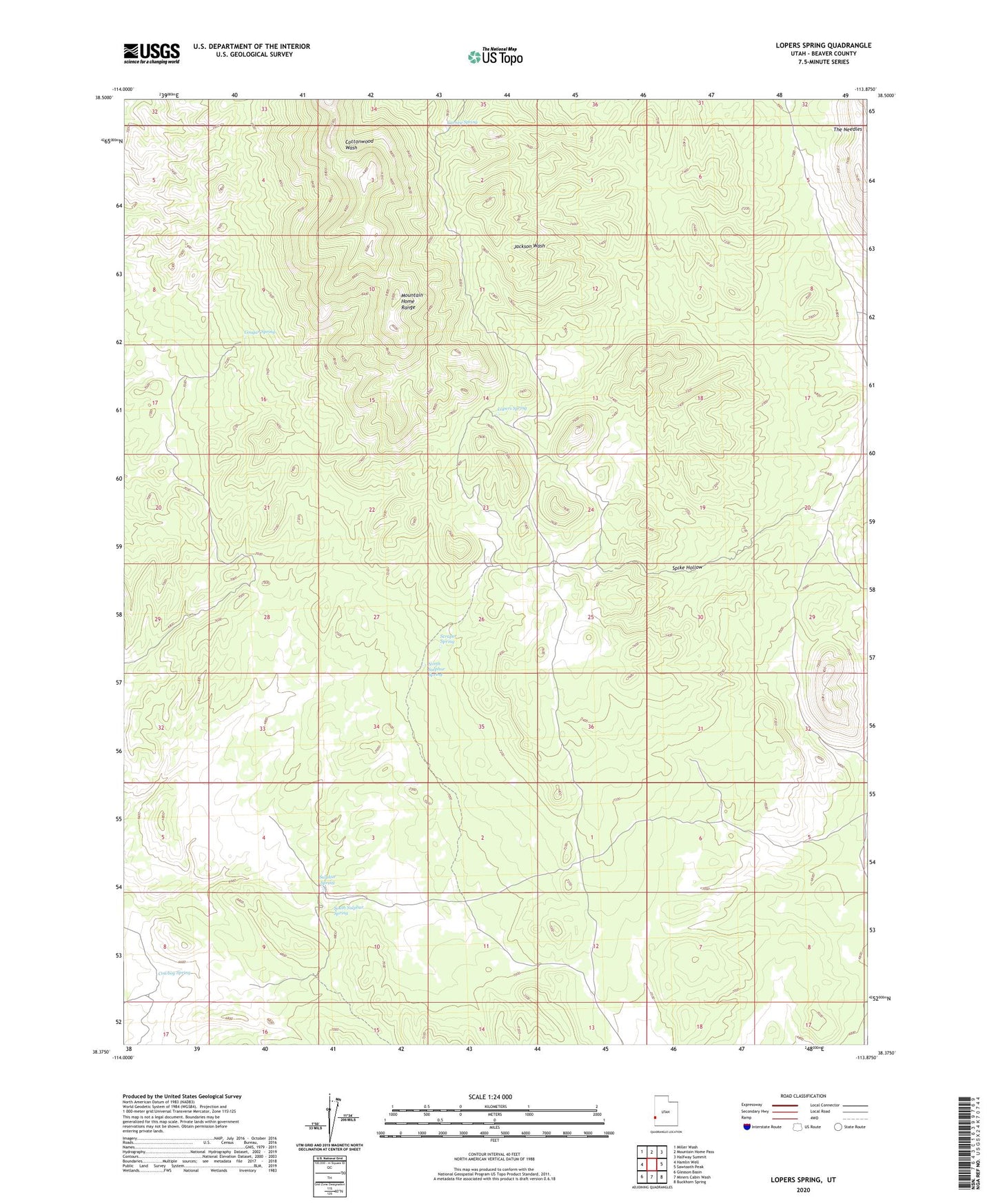
2020 topographic map quadrangle Lopers Spring in the state of Utah. Scale: 1:24000. Based on the newly updated USGS 7.5' US Topo map series, this map is in the following counties: Beaver. The map contains contour data, water features, and other items you are used to seeing on USGS maps, but also has updated roads and other features. This is the next generation of topographic maps. Printed on high-quality waterproof paper with UV fade-resistant inks.
Quads adjacent to this one:
West: Hamlin Well
Northwest: Miller Wash
North: Mountain Home Pass
Northeast: Halfway Summit
East: Sawtooth Peak
Southeast: Buckhorn Spring
South: Miners Cabin Wash
Southwest: Gleason Basin
Contains the following named places: Carney Spring, Cougar Spring, Cowboy Spring, Lopers Cabin, Lopers Spring, North Sulphur Spring, Scraper Spring, South Sulphur Spring, Spike Hollow, Sulphur Spring, The Needles