MyTopo
McKay Hollow Utah US Topo Map
Couldn't load pickup availability
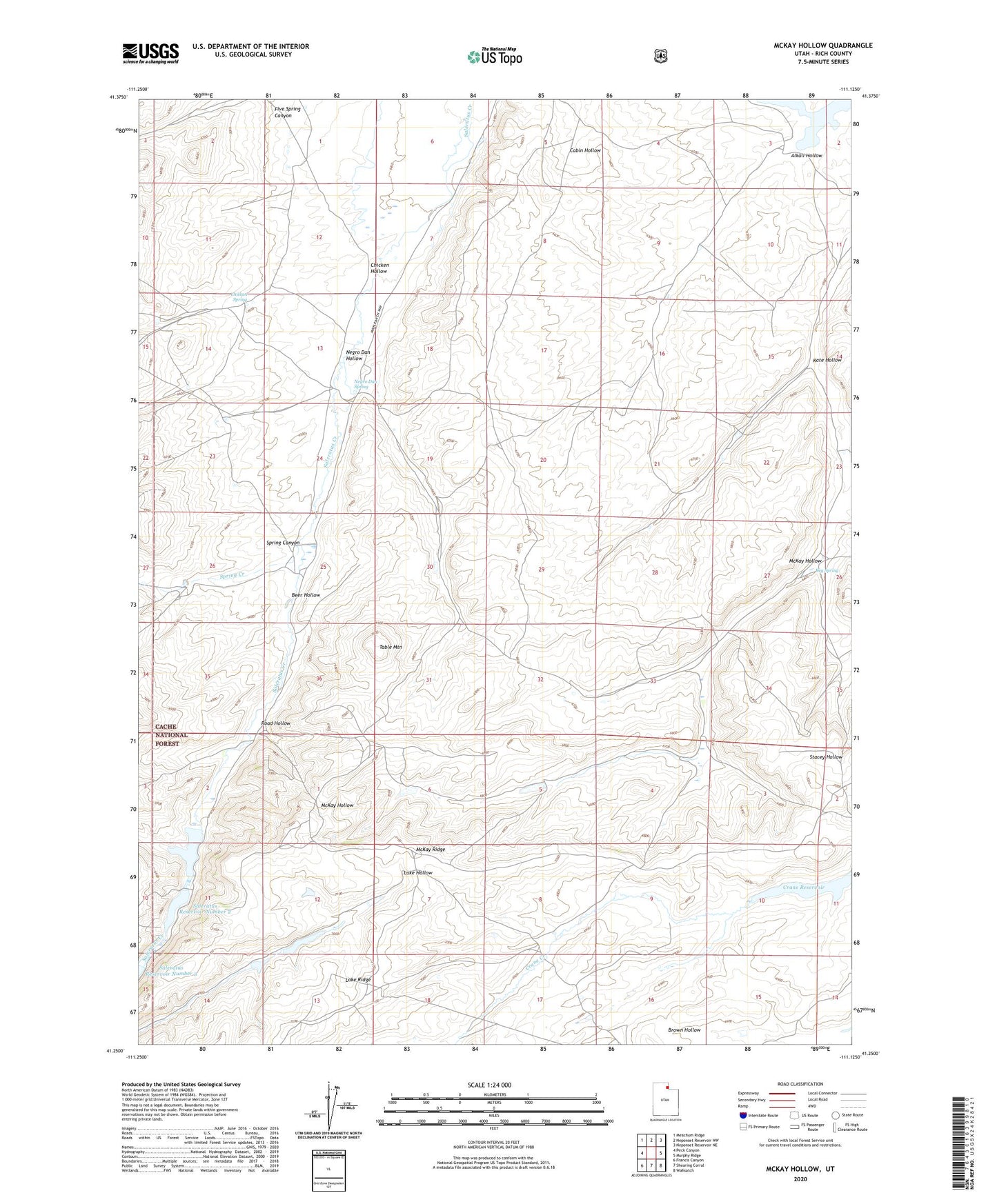
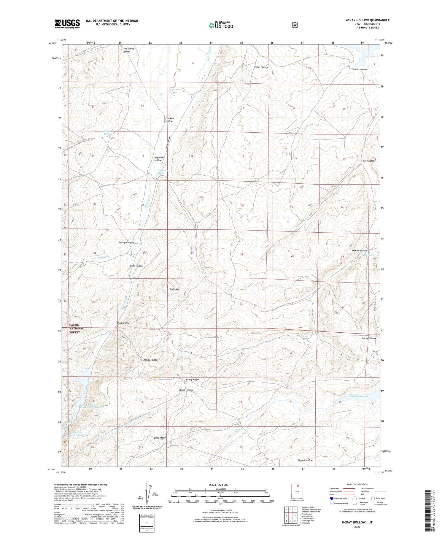
2020 topographic map quadrangle McKay Hollow in the state of Utah. Scale: 1:24000. Based on the newly updated USGS 7.5' US Topo map series, this map is in the following counties: Rich. The map contains contour data, water features, and other items you are used to seeing on USGS maps, but also has updated roads and other features. This is the next generation of topographic maps. Printed on high-quality waterproof paper with UV fade-resistant inks.
Quads adjacent to this one:
West: Peck Canyon
Northwest: Meachum Ridge
North: Neponset Reservoir NW
Northeast: Neponset Reservoir NE
East: Murphy Ridge
Southeast: Wahsatch
South: Shearing Corral
Southwest: Francis Canyon
Contains the following named places: Alkali Hollow, Beer Hollow, Chicken Hollow, Chicken Spring, Five Spring Canyon, Kate Hollow, Keg Spring, McKay Hollow, McKay Ridge, Negro Dan Hollow, Negro Dan Spring, Road Hollow, Saleratus Reservoir Number 1, Saleratus Reservoir Number 2, Spring Canyon, Spring Creek, Table Mountain