MyTopo
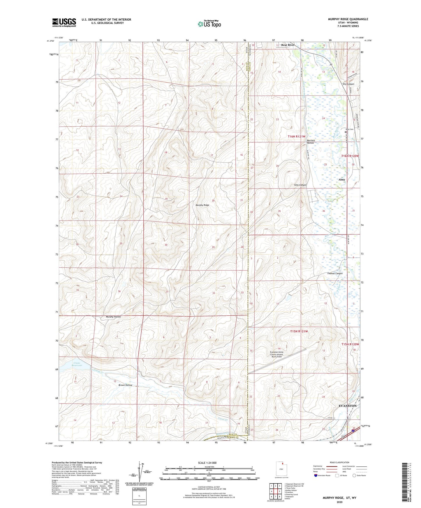
Murphy Ridge Utah US Topo Map
Couldn't load pickup availability
2023 topographic map quadrangle Murphy Ridge in the states of Utah, Wyoming. Scale: 1:24000. Based on the newly updated USGS 7.5' US Topo map series, this map is in the following counties: Rich, Uinta, Summit. The map contains contour data, water features, and other items you are used to seeing on USGS maps, but also has updated roads and other features. This is the next generation of topographic maps. Printed on high-quality waterproof paper with UV fade-resistant inks.
Quads adjacent to this one:
West: McKay Hollow
Northwest: Neponset Reservoir NW
North: Neponset Reservoir NE
Northeast: Three Forks
East: Evanston
Southeast: Millis
South: Wahsatch
Southwest: Shearing Corral
Contains the following named places: Adin Brown Ditch, Almy, Almy Cemetery, Almy Number Seven Mine, Almy Number Six Mine, Bartlett Hollow, Brown Hollow, Chesney Dam, Chesney Reservoir, Crane Creek, Crane Reservoir, Dry Canyon, Evanston-Uinta County Airport Burns Field, KEVA-AM (Evanston), Morris Ditch, Murphy Ridge, Red Canyon Creek, Sims Canyon, Thomas Canyon, Wasatch Creek, Wyuta, Yellow Creek