MyTopo
Meadowville Utah US Topo Map
Couldn't load pickup availability
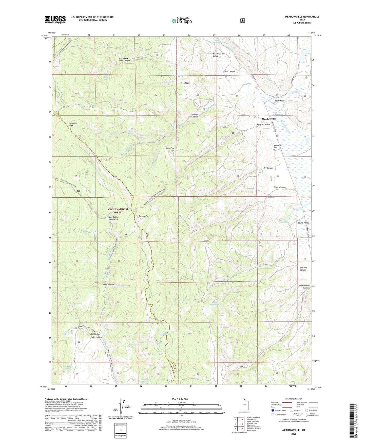
2020 topographic map quadrangle Meadowville in the state of Utah. Scale: 1:24000. Based on the newly updated USGS 7.5' US Topo map series, this map is in the following counties: Rich, Cache. The map contains contour data, water features, and other items you are used to seeing on USGS maps, but also has updated roads and other features. This is the next generation of topographic maps. Printed on high-quality waterproof paper with UV fade-resistant inks.
Quads adjacent to this one:
West: Temple Peak
Northwest: Tony Grove Creek
North: Garden City
Northeast: Bear Lake South
East: Laketown
Southeast: Old Canyon
South: Red Spur Mountain
Southwest: Boulder Mountain
Contains the following named places: Baker Knoll, Bear Wallow, Big Spring, Birch Creek, Clay Seep, Cook Ranch, Cook Reservoir, Dry Canyon, Dugway Spring, Edgar Canyon, Government Spring, Hells Hollow, Hump Pond, Jebo Canyon, Jebo Flats, Jebo Spring, Jebo Troughs Spring, Kearl Pond, Kearl Reservoir, Log Cabin Hollow, Log Cabin Ridge, Lone Pine Flat, Lower Tufts Spring, Mahogany Spring, Meadowville, Meadowville Cemetery, Middle Fork Tufts Creek, Mill Hollow, Mill Spring, Nebeker Spring, Red Bank Spring, Red Pine Canyon, Slideout Canyon, South Fork Jebo Canyon, South Fork Tufts Creek, Suck Spring, Temple Canyon, Temple Flat, Tufts Creek, Upper Tufts Spring, Willow Spring