MyTopo
Bear Lake South Utah US Topo Map
Couldn't load pickup availability
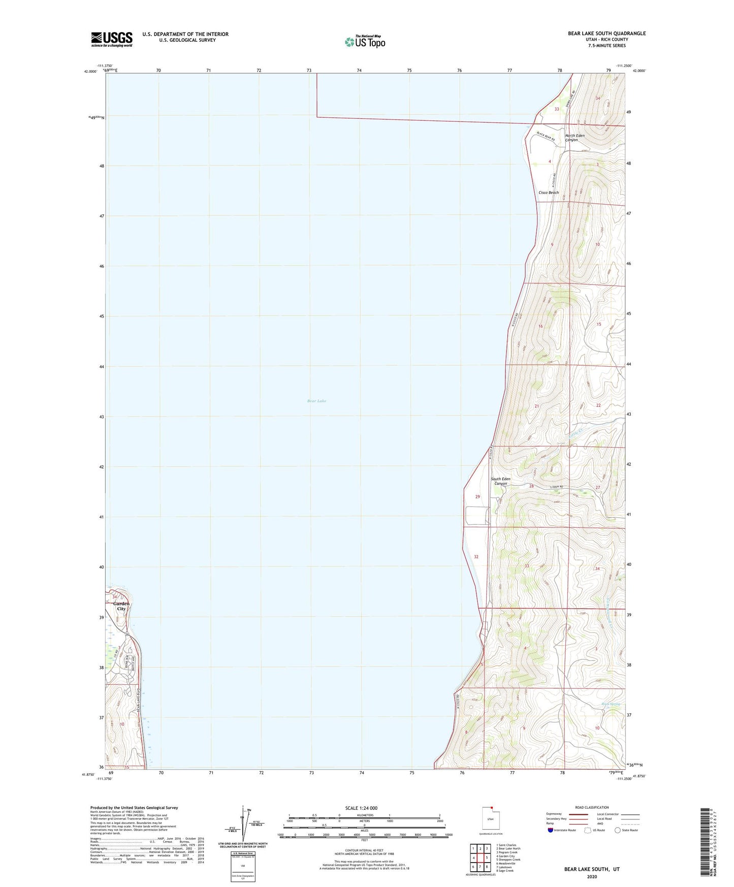
2023 topographic map quadrangle Bear Lake South in the state of Utah. Scale: 1:24000. Based on the newly updated USGS 7.5' US Topo map series, this map is in the following counties: Rich. The map contains contour data, water features, and other items you are used to seeing on USGS maps, but also has updated roads and other features. This is the next generation of topographic maps. Printed on high-quality waterproof paper with UV fade-resistant inks.
Quads adjacent to this one:
West: Garden City
Northwest: Saint Charles
North: Bear Lake North
Northeast: Pegram Creek
East: Sheeppen Creek
Southeast: Sage Creek
South: Laketown
Southwest: Meadowville
This map covers the same area as the classic USGS quad with code o41111h3.
Contains the following named places: Bear Lake, Camp Bear Lake, Cisco Beach, Little Creek, Nebeker Ranch, North Eden Canyon, Rock Spring, South Eden Canyon, ZIP Code: 84038