MyTopo
Garden City Utah US Topo Map
Couldn't load pickup availability
Also explore the Garden City Forest Service Topo of this same quad for updated USFS data
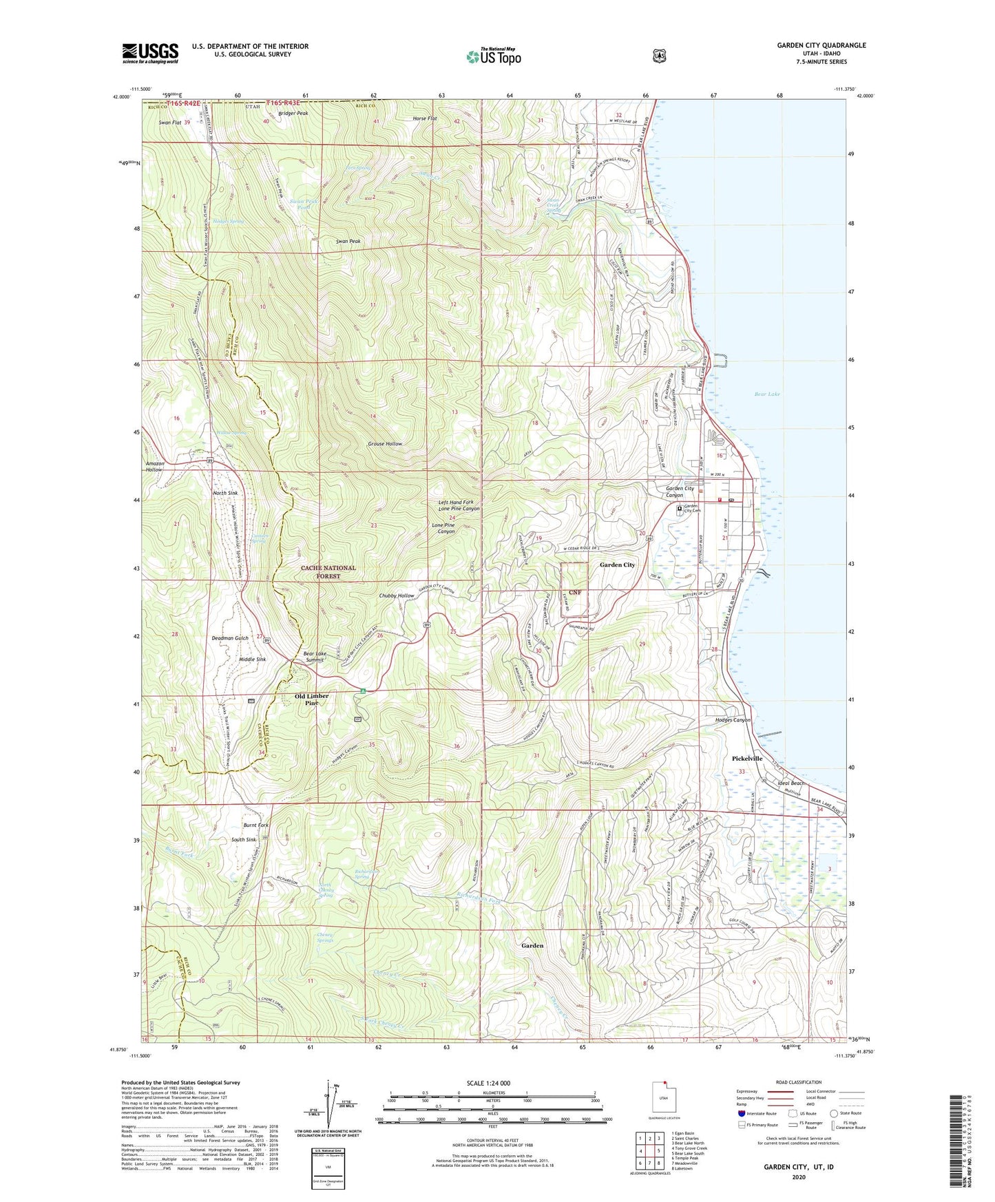
2023 topographic map quadrangle Garden City in the state of Utah. Scale: 1:24000. Based on the newly updated USGS 7.5' US Topo map series, this map is in the following counties: Rich, Cache, Bear Lake. The map contains contour data, water features, and other items you are used to seeing on USGS maps, but also has updated roads and other features. This is the next generation of topographic maps. Printed on high-quality waterproof paper with UV fade-resistant inks.
Quads adjacent to this one:
West: Tony Grove Creek
Northwest: Egan Basin
North: Saint Charles
Northeast: Bear Lake North
East: Bear Lake South
Southeast: Laketown
South: Meadowville
Southwest: Temple Peak
This map covers the same area as the classic USGS quad with code o41111h4.
Contains the following named places: Bear Lake Marina Campground, Bear Lake Overlook, Bear Lake State Park, Bear Lake Summit, Bridger Peak, Burnt Fork, Camp Hunt, Canteen Spring, Cheney Springs, Chubby Hollow, Deadman Gulch, Fays Trailer Park, Fern Spring, Garden, Garden Census Designated Place, Garden City, Garden City Canyon, Garden City Cemetery, Garden City Fire Department, Garden City Post Office, Grouse Hollow, Hodges Canyon, Hodges Spring, Horse Flat, Ideal Beach, Lake-Air Airport, Lakota, Left Hand Fork Lone Pine Canyon, Limber Pine Trail, Limber Pine Trail Head, Lone Pine Canyon, Middle Sink, North Cheney Spring, North Sink, Old Limber Pine, Pickelville, Rich County Ambulance Mobile Unit - Garden City, Richardson Fork, Richardson Spring, South Fork Cheney Creek, South Sink, Sunrise Campground, Swan Creek, Swan Creek Spring, Swan Flat, Swan Peak, Swan Peak Pond, The Church of Jesus Christ of Latter Day Saints, Town of Garden City, Willow Spring, ZIP Code: 84028