MyTopo
Navajo Begay Utah US Topo Map
Couldn't load pickup availability
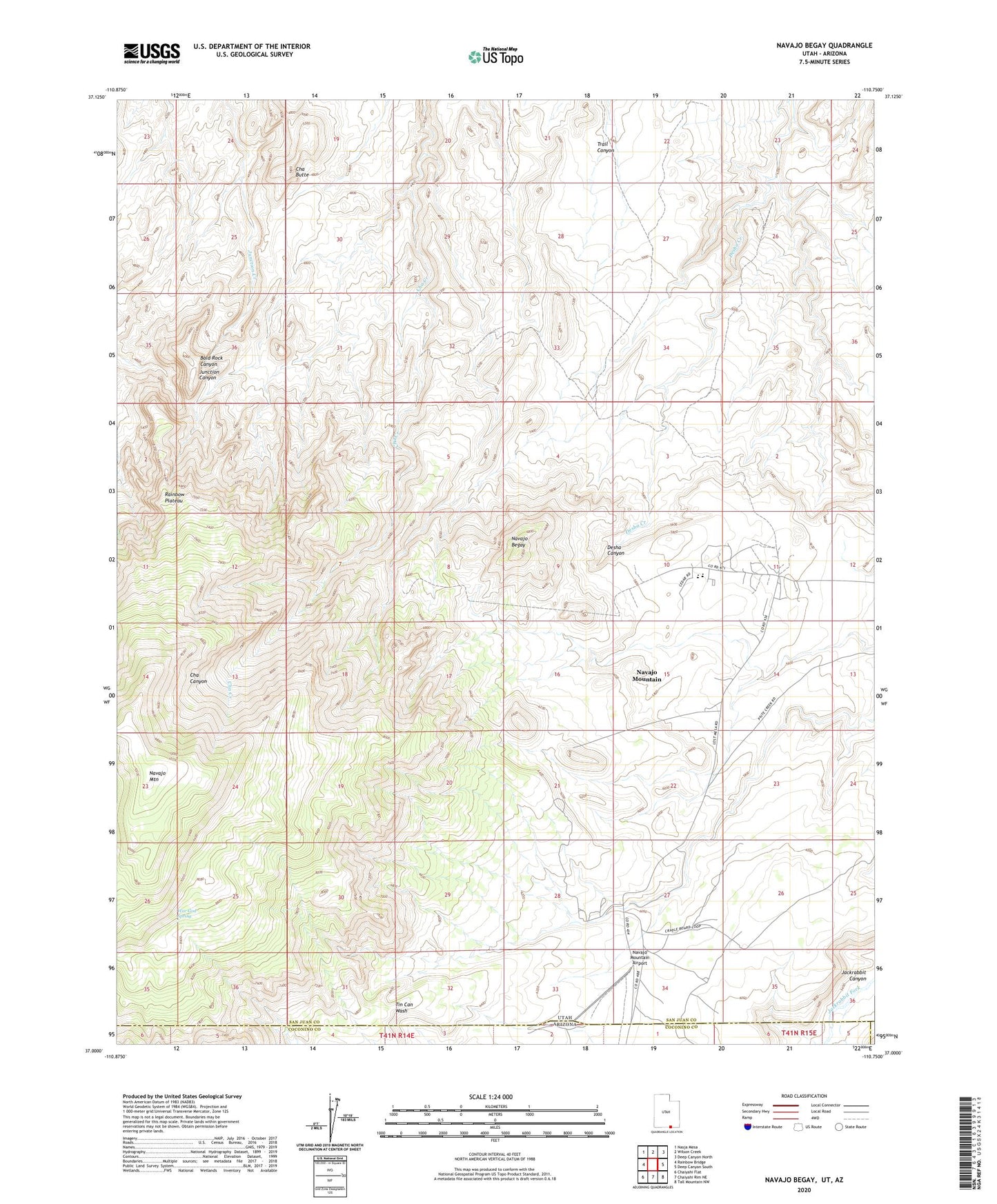
2020 topographic map quadrangle Navajo Begay in the state of Utah. Scale: 1:24000. Based on the newly updated USGS 7.5' US Topo map series, this map is in the following counties: San Juan, Coconino, Navajo. The map contains contour data, water features, and other items you are used to seeing on USGS maps, but also has updated roads and other features. This is the next generation of topographic maps. Printed on high-quality waterproof paper with UV fade-resistant inks.
Quads adjacent to this one:
West: Rainbow Bridge
Northwest: Nasja Mesa
North: Wilson Creek
Northeast: Deep Canyon North
East: Deep Canyon South
Southeast: Tall Mountain NW
South: Chaiyahi Rim NE
Southwest: Chaiyahi Flat
Contains the following named places: Cha Butte, Navajo Begay, Navajo Mountain, Navajo Mountain Airport, Navajo Mountain Census Designated Place, Navajo Mountain Chapter, Navajo Mountain School, Navajo Mountain Trailhead, Rainbow City, San Juan Southern Paiute Northern Area, War God Spring